Category:SVG labeled maps of administrative divisions of England (location map scheme)
Jump to navigation
Jump to search
Constituent countries of the United Kingdom: England · Northern Ireland · Scotland · Wales – British Crown dependencies: Bailiwick of Guernsey · Isle of Man · Jersey


.svg)


_(Paris_zoom).svg)
.svg)
,_administrative_divisions_-_de_-_colored_(multizoom).svg)
_-_colored.svg)
.svg)
,_administrative_divisions_-_Nmbrs_(multizoom).svg)
,_administrative_divisions_-_de_-_colored.svg)
_-_de_-_colored.svg)

.svg)

.svg)
Subcategories
This category has the following 2 subcategories, out of 2 total.
Media in category "SVG labeled maps of administrative divisions of England (location map scheme)"
The following 28 files are in this category, out of 28 total.
-
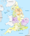
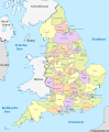 England, administrative divisions (admin counties) - de - colored.svg 816 × 991; 1.48 MB
-
 England, administrative divisions (admin counties) - de - monochrome.svg 816 × 991; 1.49 MB
-
 England, administrative divisions (admin counties) - Nmbrs - colored.svg 816 × 991; 1.48 MB
-
 England, administrative divisions (admin counties) - Nmbrs - monochrome.svg 816 × 991; 1.49 MB
-
-

-

-

-
-

-
-

-
-

-

-

-

-

-

-

-

-

-

-

-
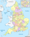
 England, administrative divisions - de - colored.svg 816 × 991; 715 KB
-
 England, administrative divisions - de - monochrome.svg 816 × 991; 722 KB
-
 England, administrative divisions - Nmbrs - colored.svg 816 × 991; 716 KB
-
 England, administrative divisions - Nmbrs - monochrome.svg 816 × 991; 722 KB
_-_de_-_colored.svg)
_-_de_-_monochrome.svg)
_-_Nmbrs_-_colored.svg)
_-_Nmbrs_-_monochrome.svg)
_-_de_-_colored_(%2BLondon_zoom).svg)
_-_de_-_colored.svg)
_-_de_-_monochrome_(%2BLondon_zoom).svg)
_-_de_-_monochrome.svg)
_-_Nmbrs_-_colored_(%2BLondon_zoom).svg)
_-_Nmbrs_-_colored.svg)
_-_Nmbrs_-_monochrome_(%2BLondon_zoom).svg)
_-_Nmbrs_-_monochrome.svg)
_-_de_-_colored.svg)
_-_de_-_monochrome.svg)
_-_Nmbrs_-_colored.svg)
_-_Nmbrs_-_monochrome.svg)
_-_de_-_colored_(%2BLondon_zoom).svg)
_-_de_-_colored_(-London_zoom).svg)
_-_de_-_monochrome_(%2BLondon_zoom).svg)
_-_de_-_monochrome_(-London_zoom).svg)
_-_Nmbrs_-_colored_(%2BLondon_zoom).svg)
_-_Nmbrs_-_colored_(-London_zoom).svg)
_-_Nmbrs_-_monochrome_(%2BLondon_zoom).svg)
_-_Nmbrs_-_monochrome_(-London_zoom).svg)


