Category:SVG labeled maps of administrative divisions of the Philippines (location map scheme)
Jump to navigation
Jump to search


.svg)


_(Paris_zoom).svg)
.svg)
,_administrative_divisions_-_de_-_colored_(multizoom).svg)
_-_colored.svg)
.svg)
,_administrative_divisions_-_Nmbrs_(multizoom).svg)
,_administrative_divisions_-_de_-_colored.svg)
_-_de_-_colored.svg)

.svg)

.svg)
Subcategories
This category has the following 2 subcategories, out of 2 total.
Media in category "SVG labeled maps of administrative divisions of the Philippines (location map scheme)"
The following 7 files are in this category, out of 7 total.
-
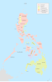 Administrative Divisions of the Philippines (1880).svg 512 × 792; 1.47 MB
-
 Administrative Divisions of the Philippines (1899).svg 512 × 792; 1.45 MB
-
 Administrative Divisions of the Philippines (1908).svg 512 × 792; 1.51 MB
-
 Administrative Divisions of the Philippines (1918).svg 512 × 792; 1.53 MB
-
 Administrative Divisions of the Philippines (1935).svg 512 × 792; 1.52 MB
-
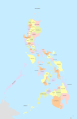
 Administrative Divisions of the Philippines (1942-1945).svg 512 × 792; 1.49 MB
-
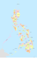 Administrative Divisions of the Philippines (1986).svg 512 × 792; 1.86 MB
.svg)
.svg)
.svg)
.svg)
.svg)
.svg)
.svg)