Category:SVG labeled maps of administrative divisions of the Democratic Republic of the Congo (location map scheme)
Jump to navigation
Jump to search


.svg)


_(Paris_zoom).svg)
.svg)
,_administrative_divisions_-_de_-_colored_(multizoom).svg)
_-_colored.svg)
.svg)
,_administrative_divisions_-_Nmbrs_(multizoom).svg)
,_administrative_divisions_-_de_-_colored.svg)
_-_de_-_colored.svg)

.svg)

.svg)
Subcategories
This category has only the following subcategory.
Media in category "SVG labeled maps of administrative divisions of the Democratic Republic of the Congo (location map scheme)"
The following 7 files are in this category, out of 7 total.
-
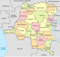
 Congo DemRep, administrative divisions - de - colored.svg 1,150 × 1,095; 534 KB
-
 Congo DemRep, administrative divisions - de - monochrome.svg 1,150 × 1,095; 534 KB
-
 Congo DemRep, administrative divisions - es - colored (2015).svg 1,150 × 1,095; 907 KB
-
 Congo DemRep, administrative divisions - et - colored.svg 1,150 × 1,095; 1.07 MB
-
 Congo DemRep, administrative divisions - Nmbrs - colored.svg 1,150 × 1,095; 534 KB
-
 Congo DemRep, administrative divisions - Nmbrs - monochrome.svg 1,150 × 1,095; 534 KB
-
 Congo DemRep, administrative divisions - th - colored (2015).svg 1,150 × 1,095; 961 KB


.svg)


.svg)