Category:SVG labeled maps of administrative divisions of Poland (location map scheme)
Jump to navigation
Jump to search


.svg)


_(Paris_zoom).svg)
.svg)
,_administrative_divisions_-_de_-_colored_(multizoom).svg)
_-_colored.svg)
.svg)
,_administrative_divisions_-_Nmbrs_(multizoom).svg)
,_administrative_divisions_-_de_-_colored.svg)
_-_de_-_colored.svg)

.svg)

.svg)
Subcategories
This category has only the following subcategory.
Media in category "SVG labeled maps of administrative divisions of Poland (location map scheme)"
The following 7 files are in this category, out of 7 total.
-
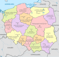
 Poland, administrative divisions - de - colored.svg 861 × 837; 587 KB
-
 Poland, administrative divisions - de.svg 861 × 837; 574 KB
-
 Poland, administrative divisions - ka - colored.svg 861 × 837; 1.33 MB
-
 Poland, administrative divisions - Nmbrs - colored.svg 861 × 837; 636 KB
-
 Poland, administrative divisions - Nmbrs.svg 861 × 837; 476 KB
-
 Poland, administrative divisions - pl - colored.svg 860 × 836; 911 KB
-
 Poland, administrative divisions - th - colored.svg 861 × 837; 1.07 MB


