Category:SVG labeled maps of administrative divisions of East Timor (location map scheme)
Jump to navigation
Jump to search


.svg)


_(Paris_zoom).svg)
.svg)
,_administrative_divisions_-_de_-_colored_(multizoom).svg)
_-_colored.svg)
.svg)
,_administrative_divisions_-_Nmbrs_(multizoom).svg)
,_administrative_divisions_-_de_-_colored.svg)
_-_de_-_colored.svg)

.svg)

.svg)
Media in category "SVG labeled maps of administrative divisions of East Timor (location map scheme)"
The following 8 files are in this category, out of 8 total.
-
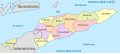 East Timor administrative divisions-de-colored 2003-2015.svg 1,607 × 710; 190 KB
-
 East Timor administrative divisions-de-monochrome 2003-2015.svg 1,607 × 710; 190 KB
-
 East Timor administrative divisions-mk-colored 2003-2015.svg 1,607 × 710; 314 KB
-
 East Timor administrative divisions-Nmbrs-colored 2003-2015.svg 1,607 × 710; 190 KB
-
 East Timor administrative divisions-Nmbrs-monochrome 2003-2015.svg 1,607 × 710; 191 KB
-
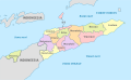
 East Timor administrative divisions-th-colored 2003-2015.svg 1,714 × 757; 350 KB
-
 East Timor, administrative divisions (since 2015) - th - colored.svg 1,714 × 757; 865 KB
-
 East Timor, administrative divisions - et - colored.svg 1,701 × 1,051; 192 KB


_-_th_-_colored.svg)
