Category:SVG labeled maps of administrative divisions of Mauritius (location map scheme)
Jump to navigation
Jump to search


.svg)


_(Paris_zoom).svg)
.svg)
,_administrative_divisions_-_de_-_colored_(multizoom).svg)
_-_colored.svg)
.svg)
,_administrative_divisions_-_Nmbrs_(multizoom).svg)
,_administrative_divisions_-_de_-_colored.svg)
_-_de_-_colored.svg)

.svg)

.svg)
Media in category "SVG labeled maps of administrative divisions of Mauritius (location map scheme)"
The following 15 files are in this category, out of 15 total.
-
 Mauritius, administrative divisions - de - colored (full).svg 1,063 × 1,150; 362 KB
-
 Mauritius, administrative divisions - de - colored (full+details).svg 1,063 × 1,150; 413 KB
-
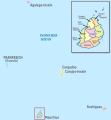
 Mauritius, administrative divisions - de - colored.svg 1,400 × 1,908; 297 KB
-
 Mauritius, administrative divisions - de - monochrome (full).svg 1,063 × 1,150; 362 KB
-
 Mauritius, administrative divisions - de - monochrome (full+details).svg 1,063 × 1,150; 414 KB
-
 Mauritius, administrative divisions - de - monochrome.svg 1,400 × 1,908; 298 KB
-
 Mauritius, administrative divisions - et - colored.svg 1,400 × 1,908; 162 KB
-
 Mauritius, administrative divisions - Nmbrs - colored (full).svg 1,063 × 1,150; 362 KB
-
 Mauritius, administrative divisions - Nmbrs - colored (full+details).svg 1,063 × 1,150; 414 KB
-
 Mauritius, administrative divisions - Nmbrs - colored.svg 1,400 × 1,908; 296 KB
-
 Mauritius, administrative divisions - Nmbrs - monochrome (full).svg 1,063 × 1,150; 362 KB
-
 Mauritius, administrative divisions - Nmbrs - monochrome (full+details).svg 1,063 × 1,150; 415 KB
-
 Mauritius, administrative divisions - Nmbrs - monochrome.svg 1,400 × 1,908; 296 KB
-
 Mauritius, administrative divisions - th - colored (full+details).svg 1,063 × 1,150; 570 KB
-
 Mauritius, administrative divisions - th - colored.svg 1,400 × 1,908; 300 KB
.svg)
.svg)

.svg)
.svg)


.svg)
.svg)

.svg)
.svg)

.svg)
