Category:SVG labeled maps of administrative divisions of the Faroe Islands (location map scheme)
Jump to navigation
Jump to search


.svg)


_(Paris_zoom).svg)
.svg)
,_administrative_divisions_-_de_-_colored_(multizoom).svg)
_-_colored.svg)
.svg)
,_administrative_divisions_-_Nmbrs_(multizoom).svg)
,_administrative_divisions_-_de_-_colored.svg)
_-_de_-_colored.svg)

.svg)

.svg)
Media in category "SVG labeled maps of administrative divisions of the Faroe Islands (location map scheme)"
The following 12 files are in this category, out of 12 total.
-
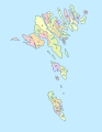
 Faroe Islands, administrative divisions - de (municipalities) - colored.svg 775 × 1,000; 223 KB
-
 Faroe Islands, administrative divisions - de (municipalities).svg 775 × 1,000; 251 KB
-
 Faroe Islands, administrative divisions - de (regions) - colored.svg 775 × 1,000; 179 KB
-
 Faroe Islands, administrative divisions - de (regions).svg 775 × 1,000; 136 KB
-

-

-
 Faroe Islands, administrative divisions - Nmbrs (municipalities) - colored.svg 775 × 1,000; 196 KB
-
 Faroe Islands, administrative divisions - Nmbrs (municipalities).svg 775 × 1,000; 153 KB
-
 Faroe Islands, administrative divisions - Nmbrs (regions) - colored.svg 775 × 1,000; 113 KB
-
 Faroe Islands, administrative divisions - Nmbrs (regions).svg 775 × 1,000; 112 KB
-

-

_-_colored.svg)
.svg)
_-_colored.svg)
.svg)
_-_colored.svg)
_-_monochrome.svg)
_-_colored.svg)
.svg)
_-_colored.svg)
.svg)
_-_colored.svg)
_-_monochrome.svg)