Category:SVG labeled maps of administrative divisions of Estonia (location map scheme)
Jump to navigation
Jump to search


.svg)


_(Paris_zoom).svg)
.svg)
,_administrative_divisions_-_de_-_colored_(multizoom).svg)
_-_colored.svg)
.svg)
,_administrative_divisions_-_Nmbrs_(multizoom).svg)
,_administrative_divisions_-_de_-_colored.svg)
_-_de_-_colored.svg)

.svg)

.svg)
Media in category "SVG labeled maps of administrative divisions of Estonia (location map scheme)"
The following 10 files are in this category, out of 10 total.
-
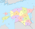
 Estonia, administrative divisions - de - colored 2017.svg 1,666 × 1,391; 508 KB
-
 Estonia, administrative divisions - de - colored.svg 1,668 × 1,393; 631 KB
-
 Estonia, administrative divisions - de.svg 1,668 × 1,393; 532 KB
-
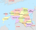
 Estonia, administrative divisions - et - colored.svg 1,666 × 1,391; 539 KB
-
 Estonia, administrative divisions - it - colored 2017.png 1,666 × 1,391; 420 KB
-
 Estonia, administrative divisions - Nmbrs - colored.svg 1,668 × 1,393; 552 KB
-
 Estonia, administrative divisions - Nmbrs.svg 1,668 × 1,393; 451 KB
-
 Estonia, administrative divisions - ru - colored.svg 1,666 × 1,391; 404 KB
-
 Estonia, administrative divisions - th - colored 2017.svg 1,666 × 1,391; 746 KB
-
 Окрузи во Естонија.svg 1,668 × 1,393; 679 KB


