Category:SVG labeled maps of administrative divisions of Malaysia (location map scheme)
Jump to navigation
Jump to search


.svg)


_(Paris_zoom).svg)
.svg)
,_administrative_divisions_-_de_-_colored_(multizoom).svg)
_-_colored.svg)
.svg)
,_administrative_divisions_-_Nmbrs_(multizoom).svg)
,_administrative_divisions_-_de_-_colored.svg)
_-_de_-_colored.svg)

.svg)

.svg)
Media in category "SVG labeled maps of administrative divisions of Malaysia (location map scheme)"
The following 9 files are in this category, out of 9 total.
-
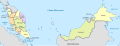
 Malaysia, administrative divisions - de - colored.svg 1,200 × 457; 532 KB
-
 Malaysia, administrative divisions - de - monochrome.svg 1,200 × 457; 532 KB
-
 Malaysia, administrative divisions - es - colored.svg 1,200 × 457; 444 KB
-
 Malaysia, administrative divisions - et - colored.svg 1,200 × 457; 360 KB
-
 Malaysia, administrative divisions - Nmbrs - colored.svg 1,200 × 457; 532 KB
-
 Malaysia, administrative divisions - Nmbrs - monochrome.svg 1,200 × 457; 533 KB
-
 Malaysia, administrative divisions - th - colored.svg 1,200 × 457; 731 KB
-
 Malaysia, administrative divisions - zh hans - colored.svg 1,200 × 457; 463 KB
-
 Malaysia, administrative divisions - zh hant - colored.svg 1,200 × 457; 463 KB