Category:SVG labeled maps of administrative divisions of São Tomé and Príncipe (location map scheme)
Jump to navigation
Jump to search


.svg)


_(Paris_zoom).svg)
.svg)
,_administrative_divisions_-_de_-_colored_(multizoom).svg)
_-_colored.svg)
.svg)
,_administrative_divisions_-_Nmbrs_(multizoom).svg)
,_administrative_divisions_-_de_-_colored.svg)
_-_de_-_colored.svg)

.svg)

.svg)
Media in category "SVG labeled maps of administrative divisions of São Tomé and Príncipe (location map scheme)"
The following 16 files are in this category, out of 16 total.
-
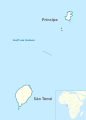 São Tomé and Príncipe administrative divisions+location in Africa.svg 496 × 694; 614 KB
-

-

-
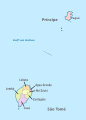 São Tomé and Príncipe, administrative divisions - de - colored.svg 496 × 694; 77 KB
-

-

-

-
 São Tomé and Príncipe, administrative divisions - et - colored.svg 496 × 694; 58 KB
-

-

-

-

-
-

-
 São Tomé and Príncipe, administrative divisions - oc - colored.svg 496 × 694; 50 KB
-
 São Tomé and Príncipe, administrative divisions - th - colored.svg 496 × 694; 97 KB

.svg)
.svg)

.svg)
.svg)


.svg)
.svg)

.svg)
.svg)


