Category:SVG labeled maps of administrative divisions of the Isle of Man (location map scheme)
Jump to navigation
Jump to search


.svg)


_(Paris_zoom).svg)
.svg)
,_administrative_divisions_-_de_-_colored_(multizoom).svg)
_-_colored.svg)
.svg)
,_administrative_divisions_-_Nmbrs_(multizoom).svg)
,_administrative_divisions_-_de_-_colored.svg)
_-_de_-_colored.svg)

.svg)

.svg)
Media in category "SVG labeled maps of administrative divisions of the Isle of Man (location map scheme)"
The following 13 files are in this category, out of 13 total.
-
 Isle of Man, administrative divisions (1st+2nd-tier) - de - colored.svg 1,200 × 1,100; 269 KB
-
 Isle of Man, administrative divisions (1st+2nd-tier) - de - monochrome.svg 1,200 × 1,100; 270 KB
-
 Isle of Man, administrative divisions (1st+2nd-tier) - en - colored.svg 870 × 1,054; 312 KB
-
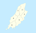
 Isle of Man, administrative divisions (1st+2nd-tier) - Nmbrs - colored.svg 1,200 × 1,100; 270 KB
-
 Isle of Man, administrative divisions (1st+2nd-tier) - Nmbrs - monochrome.svg 1,200 × 1,100; 270 KB
-
 Isle of Man, administrative divisions (sheadings) - de - colored.svg 1,200 × 1,100; 116 KB
-
 Isle of Man, administrative divisions (sheadings) - de.svg 1,200 × 1,100; 115 KB
-
 Isle of Man, administrative divisions (sheadings) - Nmbrs - colored.svg 1,200 × 1,100; 127 KB
-
 Isle of Man, administrative divisions (sheadings) - Nmbrs.svg 1,200 × 1,100; 86 KB
-
 Isle of Man, administrative divisions - de - colored.svg 1,200 × 1,100; 221 KB
-
 Isle of Man, administrative divisions - de.svg 1,200 × 1,100; 178 KB
-
 Isle of Man, administrative divisions - Nmbrs - colored.svg 1,200 × 1,100; 108 KB
-
 Isle of Man, administrative divisions - Nmbrs.svg 1,200 × 1,100; 105 KB
_-_de_-_colored.svg)
_-_de_-_monochrome.svg)
_-_en_-_colored.svg)
_-_Nmbrs_-_colored.svg)
_-_Nmbrs_-_monochrome.svg)
_-_de_-_colored.svg)
_-_de.svg)
_-_Nmbrs_-_colored.svg)
_-_Nmbrs.svg)


