Category:SVG labeled maps of administrative divisions of Zambia (location map scheme)
Jump to navigation
Jump to search


.svg)


_(Paris_zoom).svg)
.svg)
,_administrative_divisions_-_de_-_colored_(multizoom).svg)
_-_colored.svg)
.svg)
,_administrative_divisions_-_Nmbrs_(multizoom).svg)
,_administrative_divisions_-_de_-_colored.svg)
_-_de_-_colored.svg)

.svg)

.svg)
Media in category "SVG labeled maps of administrative divisions of Zambia (location map scheme)"
The following 10 files are in this category, out of 10 total.
-
 Zambia, administrative divisions - de - colored.svg 1,181 × 1,022; 696 KB
-
 Zambia, administrative divisions - de - monochrome.svg 1,181 × 1,022; 673 KB
-
 Zambia, administrative divisions - en - colored.svg 1,363 × 1,130; 1.44 MB
-
 Zambia, administrative divisions - en - monochrome.svg 1,363 × 1,130; 1.16 MB
-
 Zambia, administrative divisions - eo - colored.svg 1,363 × 1,130; 1.36 MB
-
 Zambia, administrative divisions - es - colored.svg 952 × 919; 696 KB
-
 Zambia, administrative divisions - et - colored.svg 1,181 × 1,022; 521 KB
-
 Zambia, administrative divisions - Nmbrs - colored.svg 1,181 × 1,022; 665 KB
-
 Zambia, administrative divisions - Nmbrs - monochrome.svg 1,181 × 1,022; 665 KB
-
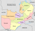 Zambia, administrative divisions - ru - colored.svg 1,181 × 1,022; 748 KB


