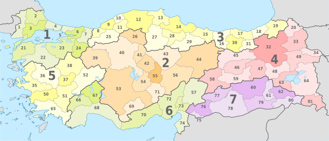
File:Turkey, administrative divisions (regions+provinces) - Nmbrs (geosort) - colored.svg
Jump to navigation
Jump to search

Size of this PNG preview of this SVG file: 800 × 343 pixels. Other resolutions: 320 × 137 pixels | 640 × 274 pixels | 1,024 × 439 pixels | 1,280 × 549 pixels | 2,560 × 1,098 pixels | 1,579 × 677 pixels.
Original file (SVG file, nominally 1,579 × 677 pixels, file size: 1.96 MB)
Captions
Captions
Add a one-line explanation of what this file represents
Summary
[edit]


.svg)


_(Paris_zoom).svg)
.svg)
,_administrative_divisions_-_de_-_colored_(multizoom).svg)
_-_colored.svg)
.svg)
,_administrative_divisions_-_Nmbrs_(multizoom).svg)
,_administrative_divisions_-_de_-_colored.svg)
_-_de_-_colored.svg)

.svg)

.svg)
_-_Nmbrs_(geosort)_-_colored.svg&action=edit§ion=1)
Licensing
[edit]_-_Nmbrs_(geosort)_-_colored.svg&action=edit§ion=2)
I, the copyright holder of this work, hereby publish it under the following licenses:
This file is licensed under the Creative Commons Attribution-Share Alike 3.0 Unported license.
- You are free:
- to share – to copy, distribute and transmit the work
- to remix – to adapt the work
- Under the following conditions:
- attribution – You must give appropriate credit, provide a link to the license, and indicate if changes were made. You may do so in any reasonable manner, but not in any way that suggests the licensor endorses you or your use.
- share alike – If you remix, transform, or build upon the material, you must distribute your contributions under the same or compatible license as the original.

|
Permission is granted to copy, distribute and/or modify this document under the terms of the GNU Free Documentation License, Version 1.2 or any later version published by the Free Software Foundation; with no Invariant Sections, no Front-Cover Texts, and no Back-Cover Texts. A copy of the license is included in the section entitled GNU Free Documentation License. |
You may select the license of your choice.

|
I'd greatly appreciate, that you attribute this media file to Wikimedia Commons, if used outside Wikipedia or Commons. For use in publications such as books, newspapers, blogs, websites, please insert here the following line:
|
_-_Nmbrs_(geosort)_-_colored.svg&action=edit&redlink=1)
File history
Click on a date/time to view the file as it appeared at that time.
| Date/Time | Thumbnail | Dimensions | User | Comment | |
|---|---|---|---|---|---|
| current | 07:52, 24 September 2014 | | 1,579 × 677 (1.96 MB) | RosssW (talk | contribs) | Нумерация илов: исправлено дублирование номера № 72. Fixed duplicate numbers 72. |
| 08:14, 23 July 2012 |  | 1,579 × 677 (1.92 MB) | TUBS (talk | contribs) | == {{int:filedesc}} == {{Information |Description={{de|Karte der politischen Gliederung von XY (siehe Dateiname)}} {{en|Map of administrative divisions of XY (see filename)}} |Source={{own}}{{Adobe Illustrator}}{{Commonist}}{{AttribSVG|Kirklareli in T... |
You cannot overwrite this file.
File usage on Commons
There are no pages that use this file.
File usage on other wikis
The following other wikis use this file:
- Usage on ba.wikipedia.org
- Usage on be.wikipedia.org
- Usage on fr.wikipedia.org
- Usage on it.wikipedia.org
- Usage on ja.wikibooks.org
- Usage on ky.wikipedia.org
- Usage on ru.wikipedia.org
- Usage on sah.wikipedia.org
- Usage on tt.wikipedia.org
Metadata
_-_Nmbrs_(geosort)_-_colored.svg&oldid=695301781)
Categories:
- SVG labeled maps of administrative divisions of Turkey (location map scheme)
- SVG labeled maps of administrative divisions of countries of Europe (location map scheme) (numbers only)
- SVG labeled maps of administrative divisions of countries of Asia (location map scheme) (numbers only)
- SVG labeled maps of administrative divisions of countries of Europe (location map scheme) (colored scheme)
- SVG labeled maps of administrative divisions of countries of Asia (location map scheme) (colored scheme)
- Maps of regions of Turkey
- SVG maps of Turkey
- Maps of provinces of Turkey