Category:Unspec SVG created with Adobe Illustrator
Jump to navigation
Jump to search
| Unchecked Adobe files |
This category contains files tagged with {{Adobe}} without any specification
Often the images are drawn with another tool, e.g. Inkscape
All these files should be checked with SVG check
Media in category "Unspec SVG created with Adobe Illustrator"
The following 200 files are in this category, out of 24,057 total.
(previous page) (next page)-
 Burgsinn in MSP.svg 662 × 754; 484 KB
-
 Flag of the Governor of Alabama (1868–1939).svg 744 × 496; 139 KB
-
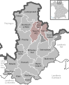
 Hamburg Mitte Kleiner Grasbrook.svg 311 × 187; 1.37 MB
-
 Martuni in Artsakh (claimed hatched) (dotted de-facto).svg 384 × 428; 110 KB
-
 Naukseni in Latvia.svg 1,305 × 822; 623 KB
-
 Schweindorf in WTM.svg 1,047 × 1,240; 375 KB
-
 Schürdt in AK.svg 285 × 277; 197 KB
-
 Altenberga in SHK.svg 1,124 × 988; 242 KB
-
 Balochistan in Pakistan (claims hatched).svg 2,365 × 1,890; 1.15 MB
-
 Dachsbach in NEA.svg 753 × 534; 1.46 MB
-
 European Council Exit Sign - Right.svg 400 × 200; 1 KB
-
 Lesser CoA of the empress Alexandra Feodorovna of Russia.svg 781 × 1,013; 4.49 MB
-
 Republic of China (Taiwan) (orthographic projection).svg 512 × 512; 1.23 MB
-
 Somalia in its region (claimed hatched).svg 481 × 305; 6.84 MB
-
 Amt Gnoien in LRO.svg 815 × 697; 386 KB
-
 Dolnoslaskie in Poland.svg 862 × 838; 719 KB
-
 Hoffeld in AW.svg 283 × 249; 362 KB
-
 Karaman in Turkey.svg 1,579 × 677; 1.67 MB
-
 Masally in Azerbaijan.svg 1,200 × 919; 268 KB
-
 MDS 53c Flottenarzt San ZM L.svg 131 × 327; 7.65 MB
-
 Mollakent Medresesi plan.svg 512 × 259; 41 KB
-
 Moores Island in Bahamas.svg 1,559 × 1,124; 696 KB
-
 North Central Coast in Vietnam.svg 1,200 × 2,349; 512 KB
-
 Nützen in SE.svg 1,164 × 1,048; 1.06 MB
-
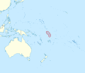
 Oceania UN Geoscheme - Map of Polynesia.svg 900 × 520; 520 KB
-
 PR secondary 246.svg 750 × 600; 4 KB
-
 Schwall in SIM.svg 889 × 903; 229 KB
-
 Teterow in LRO.svg 815 × 697; 386 KB
-
 Ämter in HW.svg 394 × 256; 170 KB
-
 Absberg in WUG.svg 611 × 532; 1.02 MB
-
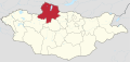
 Dundgovi in Mongolia.svg 1,777 × 842; 850 KB
-
 HA OS5 11 Panzergrenadier OA PzGren.svg 166 × 397; 1.53 MB
-
 HA OS5 Militärgeistlicher K.svg 170 × 397; 2.43 MB
-
 Haimhausen in DAH.svg 536 × 432; 962 KB
-
 Horka in GR.svg 1,908 × 1,938; 285 KB
-

-
 Jiading in Shanghai.svg 632 × 612; 1.69 MB
-
 Leese in NI.svg 1,591 × 1,602; 372 KB
-
 Mapa físico de localización Lambayeque.svg 512 × 558; 10.45 MB
-
 Mecklenburg-Vorpommern NWM 2011.svg 1,129 × 775; 1.55 MB
-
 Monaco, administrative divisions - Nmbrs - colored (quarters+wards).svg 822 × 1,026; 220 KB
-
 Myanmar on the globe (Southeast Asia centered).svg 897 × 897; 290 KB
-
 Navassa Island in North America.svg 1,181 × 1,185; 6.92 MB
-
 Peru in South America (-mini map -rivers).svg 1,181 × 1,732; 2 MB
-
 Saxony 1993 Niesky.svg 2,268 × 1,814; 441 KB
-
 Spain in European Union (extended) (-mini map -rivers).svg 1,910 × 1,478; 1.18 MB
-
 Sri Lanka in Asia (relief) (-mini map).svg 1,181 × 1,050; 5.72 MB
-
 HA OS5 13 Obergefreiter SanOA San HM L.svg 166 × 397; 1.51 MB
-
 Map of Manchukuo divisions 1942 Antung.svg 512 × 561; 2.26 MB
-
 Map of Manchukuo divisions 1942 Chiantao.svg 512 × 561; 2.26 MB
-
 Map of Manchukuo divisions 1942 Chingchow.svg 512 × 561; 2.26 MB
-
 Map of Manchukuo divisions 1942 East Hsingan.svg 512 × 561; 2.26 MB
-
 Map of Manchukuo divisions 1942 Fengtien.svg 512 × 561; 2.26 MB
-
 Map of Manchukuo divisions 1942 Heiho.svg 512 × 561; 2.26 MB
-
 Map of Manchukuo divisions 1942 Jehol.svg 512 × 561; 2.26 MB
-
 Map of Manchukuo divisions 1942 Kirin.svg 512 × 561; 2.26 MB
-
 Map of Manchukuo divisions 1942 Kwantung.svg 512 × 561; 2.26 MB
-
 Map of Manchukuo divisions 1942 Lungkiang.svg 512 × 561; 2.26 MB
-
 Map of Manchukuo divisions 1942 Mutankiang.svg 512 × 561; 2.26 MB
-
 Map of Manchukuo divisions 1942 North Hsingan.svg 512 × 561; 2.26 MB
-
 Map of Manchukuo divisions 1942 Peian.svg 512 × 561; 2.26 MB
-
 Map of Manchukuo divisions 1942 Pinkiang.svg 512 × 561; 2.26 MB
-
 Map of Manchukuo divisions 1942 South Hsingan.svg 512 × 561; 2.26 MB
-
 Map of Manchukuo divisions 1942 Szankiang.svg 512 × 561; 2.26 MB
-
 Map of Manchukuo divisions 1942 Szeping.svg 512 × 561; 2.26 MB
-
 Map of Manchukuo divisions 1942 Tungan.svg 512 × 561; 2.26 MB
-
 Map of Manchukuo divisions 1942 Tunghua.svg 512 × 561; 2.26 MB
-
 Map of Manchukuo divisions 1942 West Hsingan.svg 512 × 561; 2.26 MB
-
 Martinique in France 2016.svg 771 × 434; 4.35 MB
-
 Zones A and B in Israel (Zone C hatched).svg 639 × 736; 958 KB
-
 Zones A and B in Israel.svg 639 × 736; 955 KB
-

-
-

-
 Zones A and B in the occupied palestinian territories.svg 639 × 736; 903 KB
-
 Montenegro in Europe (-rivers -mini map).svg 1,401 × 1,198; 955 KB
-
 Turkey in its region.svg 469 × 260; 6.82 MB
-
 Zamboanga Peninsula in Philippines.svg 1,871 × 2,468; 1.38 MB
-
 Dortmund Statistischer Bezirk Wickede.svg 916 × 868; 1.89 MB
-
 Escudo de Armas de la Ciudad de Guatemala.svg 666 × 693; 88 KB
-
 Escudo de armas de Sacatepéquez.svg 774 × 681; 80 KB
-
 Essen Stadtteil Schonnebeck.svg 771 × 813; 2.61 MB
-
 Essequibo Islands-West Demerara in Guyana.svg 1,252 × 1,843; 553 KB
-
 Flag of the State of Utah (2011-2024).svg 2,875 × 1,725; 798 KB
-
 Flag of Utah (2011–2024).svg 1,600 × 1,000; 127 KB
-
 Lockwisch in NWM 2011.svg 644 × 460; 513 KB
-
 Palais Epstein first floor.svg 488 × 371; 194 KB
-
 Stuttgart Bezirk Süd.svg 760 × 760; 1.71 MB
-
 Winhöring in AÖ.svg 409 × 491; 307 KB
-
 Arbach in DAU.svg 325 × 236; 472 KB
-
 Dhekunu Province in Maldives.svg 331 × 1,028; 498 KB
-

-
 Flag of East Java.svg 1,500 × 1,050; 158 KB
-
 Flag of Yogyakarta.svg 1,500 × 1,050; 237 KB
-
 Greater Victoria in Seychelles (inner islands).svg 1,082 × 917; 107 KB
-
 Griesen in WB.svg 1,750 × 1,233; 600 KB
-
 Juist in AUR.svg 1,740 × 1,209; 616 KB
-
 Lauben in MN.svg 666 × 636; 1.29 MB
-
 Mauritius in its region.svg 620 × 394; 6.85 MB
-
 Pitcairn Islands in Oceania (small islands magnified).svg 1,181 × 1,013; 2.86 MB
-
 Plymouth in England (zoom).svg 816 × 991; 1.31 MB
-
 San Vicente in El Salvador.svg 983 × 624; 260 KB
-
 Asendorf in WL.svg 1,971 × 1,338; 603 KB
-
 Ghardaia in Algeria.svg 1,287 × 1,278; 961 KB
-
 Larnaca in Cyprus (secession).svg 1,276 × 761; 177 KB
-
 Saxony 2007 BZ.svg 2,268 × 1,814; 846 KB
-
 Sulzbach-Rosenberg in AS.svg 602 × 700; 633 KB
-
 Würselen in AC (2009).svg 379 × 516; 271 KB
-
 Ducherow in VG.svg 900 × 928; 433 KB
-
 Département 69 in France 2016.svg 2,000 × 1,922; 1.76 MB
-
 Flag of Mide.svg 720 × 480; 12 KB
-
 Flag of the Azerbaijan Soviet Socialist Republic (1921–1922).svg 1,200 × 600; 9 KB
-
 Flöthe in WF.svg 1,580 × 1,204; 752 KB
-
 France, administrative divisions - de (departments) (Paris zoom).svg 2,000 × 1,922; 1.56 MB
-
 III Service Command.svg 260 × 270; 1 KB
-
 Jingmiyinshuiqu.svg 1,319 × 1,113; 7 KB
-
 North Ayrshire in Scotland.svg 1,128 × 1,483; 1.57 MB
-
 South Sudan in Africa (claimed) (-mini map -rivers).svg 1,525 × 1,440; 925 KB
-
 Steinhagen in VR.svg 864 × 696; 597 KB
-
 Taiwan in Asia (-mini map -rivers).svg 1,181 × 1,050; 6.95 MB
-
 United Kingdom in its region (+near possessions).svg 383 × 216; 6.85 MB
-
 Département 976 in France.svg 1,477 × 831; 7.37 MB
-
 Egypt (disputed hatched), administrative divisions - Nmbrs - monochrome.svg 1,055 × 973; 687 KB
-
 Flag of Fiji (1865–1867).svg 1,200 × 800; 636 bytes
-
 Government Seal of the Hellenic Republic.svg 730 × 729; 296 KB
-
 HA OS5 52 Oberstleutnant d.R. PzGren.svg 164 × 397; 2.27 MB
-
 Holzwickede in UN 2011.svg 336 × 396; 1.44 MB
-
 Ka Lahui Hawai Flag.svg 500 × 333; 2 KB
-
 Kosovo, administrative divisions (municipalities) - Nmbrs geo-sort - colored.svg 1,015 × 1,150; 537 KB
-
 Liaoning in China (+all claims hatched).svg 1,181 × 940; 3.86 MB
-
 Pakistan in its region (disputed hatched).svg 567 × 314; 6.84 MB
-
 Schneeberg in MIL.svg 488 × 562; 1.22 MB
-
 South Georgia and the South Sandwich Islands in South America.svg 1,181 × 1,732; 2.74 MB
-
 South Ossetia in Europe (blue marble) (de-facto).svg 1,401 × 1,198; 11.42 MB
-
 Stuttgart Stadtteil Burgholzhof.svg 760 × 760; 2.1 MB
-
 Thuringia SON.svg 966 × 758; 154 KB
-
 Tuvalu in Oceania (small islands magnified) (-mini map -rivers).svg 1,181 × 1,013; 2.23 MB
-
 Vögelsen in LG.svg 2,487 × 1,218; 606 KB
-
 Ecuador in South America (relief) (-mini map).svg 1,181 × 1,732; 8.17 MB
-
 Far Eastern in Russia.svg 1,181 × 637; 7.82 MB
-

-
 Israel road sign 435.svg 592 × 592; 74 KB
-
 Israel road sign 436.svg 592 × 592; 75 KB
-
 Lachin in Azerbaijan (semi-secession).svg 1,200 × 919; 268 KB
-
 Lautrach in MN.svg 666 × 636; 1.29 MB
-
 Lützen in BLK.svg 1,736 × 1,134; 625 KB
-
 Marie Byrd Land on the globe (Antarctica centered).svg 798 × 798; 1.36 MB
-
 Michael in Isle of Man.svg 1,200 × 1,100; 171 KB
-
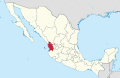 Nayarit in Mexico (location map scheme).svg 2,029 × 1,326; 1.43 MB
-
 Oaxaca in Mexico.svg 2,029 × 1,326; 1.43 MB
-
 Origami paper popper type4.svg 500 × 500; 14 KB
-
 Ortsteile von Horn-Bad Meinberg - Bad Meinberg.svg 531 × 542; 157 KB
-
 Pinnow (bei Schwerin) in LUP.svg 1,040 × 654; 526 KB
-
 Putzbrunn in M.svg 630 × 597; 637 KB
-
 Rehlingen-Siersburg in SLS.svg 3,680 × 3,680; 361 KB
-
 Samtgemeinde Börde Lamstedt in CUX.svg 1,771 × 1,870; 457 KB
-
 Schwarmstedt in HK.svg 2,152 × 2,152; 668 KB
-
 Schwobfeld in EIC.svg 1,149 × 1,140; 510 KB
-
 Sondershausen in German Democratic Republic.svg 618 × 789; 3 MB
-
 Sotterhausen in MSH.svg 1,293 × 914; 1.49 MB
-
 South Kurdufan in Sudan (+claims solid) (Kafia Kingi disputed).svg 1,654 × 1,450; 345 KB
-
 Verwaltungsgemeinschaft Teuschnitz in KC.svg 456 × 555; 1.05 MB
-
 Straßkirchen in SR.svg 772 × 649; 1.37 MB
-
 Khövsgöl in Mongolia.svg 1,777 × 842; 850 KB
-
 Selenge in Mongolia.svg 1,777 × 842; 850 KB
-
 Weightdiagram.svg 330 × 480; 4 KB
-
 IRWD Operating Budget FY 11-12 graphic.svg 416 × 337; 15 KB
-
 Ortsteile von Horn-Bad Meinberg - Wilberg.svg 531 × 542; 157 KB
-
 Map of Manchukuo divisions 1942.svg 512 × 561; 4.92 MB
-
 Elsteraue in BLK.svg 1,736 × 1,134; 435 KB
-
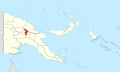 Jiwaka in Papua New Guinea.svg 2,280 × 1,370; 834 KB
-
 Marshall Islands on the globe (Polynesia centered).svg 861 × 861; 671 KB
-
 Olympic Green out of Beijing.svg 1,112 × 1,108; 12 KB
-
 Rhumspringe in GÖ.svg 1,532 × 1,050; 681 KB
-
 Ortsteile von Lemgo - Entrup.svg 1,287 × 1,371; 225 KB
-
 Papua New Guinea stop sign.svg 205 × 218; 80 KB
-
 Philippines road sign R1-1 (Highway Gothic).svg 602 × 602; 2 KB
-
 Republic of China edcp location map 1936 Heilungkiang.svg 512 × 399; 7.11 MB
-
 Republic of China edcp location map 1936 Kirin.svg 512 × 399; 7.1 MB
-
 Republic of China edcp location map 1936 Liaoning.svg 512 × 399; 7.1 MB
-
 Republic of China edcp location map 1936.svg 512 × 399; 7.1 MB
-
 Serbia in Europe (-rivers -mini map).svg 1,401 × 1,198; 955 KB
-
 Republic of China edcp location map (disputed territories).svg 512 × 399; 7.25 MB
-
 Garrel in CLP.svg 1,804 × 1,804; 645 KB
-
 Istarska županija in Croatia.svg 1,097 × 1,062; 748 KB
-
 Jade in BRA.svg 1,699 × 1,586; 474 KB
-
 Jordan in Asia.svg 1,181 × 1,050; 8.21 MB
-
 Oelsberg in EMS.svg 258 × 258; 231 KB
-
 Ortsteile Lügde - Niese.svg 384 × 502; 311 KB
-
 Schleswig-Holstein PI.svg 967 × 774; 214 KB
-
 Sukhumi in Abkhazia (no secession).svg 3,058 × 2,552; 484 KB
-
 Weißenburg in Bayern in WUG.svg 611 × 532; 1.02 MB
-
 Essen Stadtteil Steele.svg 771 × 813; 2.61 MB
-
 Europe, administrative divisions - Nmbrs.svg 1,401 × 1,198; 3.65 MB
-
 Germering in FFB.svg 446 × 390; 976 KB
-
 Hülsede in SHG.svg 1,308 × 1,317; 728 KB
-
 Kasbach-Ohlenberg in NR.svg 249 × 246; 442 KB
-
 Oberwesel in SIM.svg 889 × 903; 229 KB
-
 Seidnitz-Dobritz in Dresden.svg 799 × 689; 1.41 MB
-
 South Ossetia in Asia (relief).svg 1,181 × 1,050; 5.63 MB

.svg)

_(dotted_de-facto).svg)


.svg)


_(orthographic_projection).svg)
.svg)


_(full)_(%2BKuril_Islands_hatched),_administrative_divisions_-_Nmbrs_-_monochrome.svg)


.svg)
.svg)

.svg)

_(-mini_map_-rivers).svg)
_(-mini_map).svg)


.svg)

_(Zone_C_hatched).svg)
.svg)
.svg)

.svg)


.svg)
.svg)


_-_de_-_monochrome_(%2BLondon_zoom).svg)


.svg)


.svg)
.svg)


.svg)


.svg)


.svg)

_(Paris_zoom).svg)


_(-mini_map_-rivers).svg)

.svg)
.svg)

,_administrative_divisions_-_Nmbrs_-_monochrome.svg)
.svg)


_-_Nmbrs_geo-sort_-_colored.svg)
.svg)
.svg)


_(de-facto).svg)


_(-mini_map_-rivers).svg)

_(-mini_map).svg)

,_administrative_divisions_-_Nmbrs_-_colored.svg)


.svg)


.svg)

.svg)


_in_LUP.svg)


_(Kafia_Kingi_disputed).svg)


.svg)


.svg)


.svg)
.svg)


.svg)


.svg)