Category:SVG labeled maps of administrative divisions of the Kingdom of the Netherlands (location map scheme)
Jump to navigation
Jump to search


.svg)


_(Paris_zoom).svg)
.svg)
,_administrative_divisions_-_de_-_colored_(multizoom).svg)
_-_colored.svg)
.svg)
,_administrative_divisions_-_Nmbrs_(multizoom).svg)
,_administrative_divisions_-_de_-_colored.svg)
_-_de_-_colored.svg)

.svg)

.svg)
Subcategories
This category has only the following subcategory.
Media in category "SVG labeled maps of administrative divisions of the Kingdom of the Netherlands (location map scheme)"
The following 8 files are in this category, out of 8 total.
-
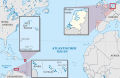
 Kingdom of the Netherlands. administrative divisions - de (1x zoom).svg 822 × 532; 4.46 MB
-
 Kingdom of the Netherlands. administrative divisions - de (3x zoom).svg 822 × 532; 4.51 MB
-
 Kingdom of the Netherlands. administrative divisions - de (marker).svg 822 × 532; 4.51 MB
-
 Kingdom of the Netherlands. administrative divisions - Nmbrs (1x zoom).svg 822 × 532; 4.42 MB
-
 Kingdom of the Netherlands. administrative divisions - Nmbrs (3x zoom).svg 822 × 532; 4.42 MB
-
 Kingdom of the Netherlands. administrative divisions - Nmbrs (marker).svg 822 × 532; 4.42 MB
-
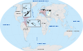 Kingdom of the Netherlands. administrative divisions - russian (3x zoom).svg 3,188 × 1,949; 4.67 MB
-
 Kingdom of the Netherlands. administrative divisions -mn (3x zoom).png 822 × 532; 177 KB
.svg)
.svg)
.svg)
.svg)
.svg)
.svg)
.png)