Category:SVG labeled maps of administrative divisions of the European Union (location map scheme)
Jump to navigation
Jump to search


.svg)


_(Paris_zoom).svg)
.svg)
,_administrative_divisions_-_de_-_colored_(multizoom).svg)
_-_colored.svg)
.svg)
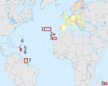
,_administrative_divisions_-_Nmbrs_(multizoom).svg)
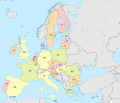
,_administrative_divisions_-_de_-_colored.svg)
_-_de_-_colored.svg)

.svg)

.svg)
Subcategories
This category has the following 27 subcategories, out of 27 total.
B
C
F
G
I
L
P
S
Media in category "SVG labeled maps of administrative divisions of the European Union (location map scheme)"
The following 33 files are in this category, out of 33 total.
-
 European Union (+integral overseas), administrative divisions - de (EU labeled).svg 1,401 × 1,198; 3.93 MB
-
-
 European Union (+integral overseas), administrative divisions - de - colored.svg 1,401 × 1,198; 4.27 MB
-
 European Union (+integral overseas), administrative divisions - de.svg 1,401 × 1,198; 4.29 MB
-
 European Union (+integral overseas), administrative divisions - ISO3166 (EU labeled).svg 1,401 × 1,198; 3.92 MB
-
-
 European Union (+integral overseas), administrative divisions - ISO3166 - colored.svg 1,401 × 1,198; 4.27 MB
-
 European Union (+integral overseas), administrative divisions - ISO3166.svg 1,401 × 1,198; 4.27 MB
-
 European Union (+integral overseas), administrative divisions - Nmbrs (EU labeled).svg 1,401 × 1,198; 3.92 MB
-

-
 European Union (+integral overseas), administrative divisions - Nmbrs - colored.svg 1,401 × 1,198; 4.26 MB
-
 European Union (+integral overseas), administrative divisions - Nmbrs.svg 1,401 × 1,198; 4.27 MB
-
 European Union (+OMR), administrative divisions - de (marker).svg 1,287 × 1,027; 5.24 MB
-
 European Union (+OMR), administrative divisions - de (multizoom).svg 1,287 × 1,027; 5.24 MB
-
 European Union (+OMR), administrative divisions - de - colored (marker).svg 1,287 × 1,027; 5.24 MB
-
 European Union (+OMR), administrative divisions - de - colored (multizoom).svg 1,287 × 1,027; 5.24 MB
-
 European Union (+OMR), administrative divisions - Nmbrs (marker).svg 1,287 × 1,027; 5.24 MB
-
 European Union (+OMR), administrative divisions - Nmbrs (multizoom).svg 1,287 × 1,027; 5.24 MB
-
 European Union (+OMR), administrative divisions - Nmbrs - colored (marker).svg 1,287 × 1,027; 5.24 MB
-
 European Union (+OMR), administrative divisions - Nmbrs - colored (multizoom).svg 1,287 × 1,027; 5.24 MB
-
 European Union, administrative divisions - de (EU labeled).svg 1,401 × 1,198; 3.93 MB
-
 European Union, administrative divisions - de - colored (EU labeled).svg 1,401 × 1,198; 3.92 MB
-
 European Union, administrative divisions - de - colored.svg 1,401 × 1,198; 4.28 MB
-
 European Union, administrative divisions - de.svg 1,401 × 1,198; 4.29 MB
-
 European Union, administrative divisions - ISO3166 (EU labeled).svg 1,401 × 1,198; 3.92 MB
-
 European Union, administrative divisions - ISO3166 - colored (EU labeled).svg 1,401 × 1,198; 3.91 MB
-
 European Union, administrative divisions - ISO3166 - colored.svg 1,401 × 1,198; 4.26 MB
-
 European Union, administrative divisions - ISO3166.svg 1,401 × 1,198; 4.27 MB
-
 European Union, administrative divisions - Nmbrs (EU labeled).svg 1,401 × 1,198; 3.91 MB
-
 European Union, administrative divisions - Nmbrs - colored (EU labeled).svg 1,401 × 1,198; 3.92 MB
-
 European Union, administrative divisions - Nmbrs - colored.svg 1,401 × 1,198; 4.26 MB
-
 European Union, administrative divisions - Nmbrs.svg 1,401 × 1,198; 4.27 MB
-
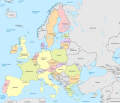
 European Union, administrative divisions, other countries and capitals - fr.svg 1,401 × 1,198; 3.29 MB
,_administrative_divisions_-_de_(EU_labeled).svg)
,_administrative_divisions_-_de_-_colored_(EU_labeled).svg)
,_administrative_divisions_-_de.svg)
,_administrative_divisions_-_ISO3166_(EU_labeled).svg)
,_administrative_divisions_-_ISO3166_-_colored_(EU_labeled).svg)
,_administrative_divisions_-_ISO3166_-_colored.svg)
,_administrative_divisions_-_ISO3166.svg)
,_administrative_divisions_-_Nmbrs_(EU_labeled).svg)
,_administrative_divisions_-_Nmbrs_-_colored_(EU_labeled).svg)
,_administrative_divisions_-_Nmbrs_-_colored.svg)
,_administrative_divisions_-_Nmbrs.svg)
,_administrative_divisions_-_de_(marker).svg)
,_administrative_divisions_-_de_(multizoom).svg)
,_administrative_divisions_-_de_-_colored_(marker).svg)
,_administrative_divisions_-_de_-_colored_(multizoom).svg)
,_administrative_divisions_-_Nmbrs_(marker).svg)
,_administrative_divisions_-_Nmbrs_(multizoom).svg)
,_administrative_divisions_-_Nmbrs_-_colored_(marker).svg)
,_administrative_divisions_-_Nmbrs_-_colored_(multizoom).svg)
.svg)
.svg)


.svg)
.svg)


.svg)
.svg)


