Category:SVG labeled maps of administrative divisions of countries of South America (location map scheme) (spanish)
Jump to navigation
Jump to search


.svg)


_(Paris_zoom).svg)
.svg)
,_administrative_divisions_-_de_-_colored_(multizoom).svg)
_-_colored.svg)
.svg)
,_administrative_divisions_-_Nmbrs_(multizoom).svg)
,_administrative_divisions_-_de_-_colored.svg)
_-_de_-_colored.svg)

.svg)

.svg)
Media in category "SVG labeled maps of administrative divisions of countries of South America (location map scheme) (spanish)"
The following 16 files are in this category, out of 16 total.
-
 Bolivia, administrative divisions - es - colored.svg 1,343 × 1,489; 415 KB
-
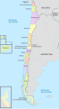 Chile (+Antarctica & Islands), administrative divisions - es - colored 2018.svg 1,474 × 2,685; 1.91 MB
-
 Chile (+Antarctica & Islands), administrative divisions - es - monochrome 2018.svg 1,474 × 2,685; 1.87 MB
-
 Chile, administrative divisions - es - colored 2018.svg 1,474 × 2,685; 1.2 MB
-
 Chile, administrative divisions - es - monochrome 2018.svg 1,474 × 2,685; 1.22 MB
-
 Colombia, administrative divisions - es - colored (+box).svg 1,380 × 1,864; 908 KB
-
 Colombia, administrative divisions - es - colored.svg 2,027 × 2,294; 1.69 MB
-
 Colombia, administrative divisions - es - monochrome (+box).svg 1,380 × 1,864; 908 KB
-
 Colombia, administrative divisions - es - monochrome.svg 2,027 × 2,294; 986 KB
-
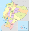 Ecuador, administrative divisions - es - colored.svg 1,535 × 1,654; 791 KB
-
 Panama, administrative divisions - es - colored.svg 1,242 × 623; 372 KB
-
 Peru, administrative divisions - es - colored (+zoom).svg 820 × 1,000; 1.39 MB
-
 Peru, administrative divisions - es - monochrome (+zoom).svg 820 × 1,000; 1.4 MB
-
 Uruguay, administrative divisions - es - colored.svg 1,000 × 1,056; 196 KB
-
 Venezuela, administrative divisions (+claims) - es - colored.svg 1,870 × 1,479; 1,019 KB
-
 Venezuela, administrative divisions (-claims) - es - colored.svg 1,648 × 1,486; 942 KB

,_administrative_divisions_-_es_-_colored_2018.svg)
,_administrative_divisions_-_es_-_monochrome_2018.svg)


.svg)

.svg)


.svg)
.svg)

_-_es_-_colored.svg)
_-_es_-_colored.svg)