Category:SVG maps of Mauritius
Jump to navigation
Jump to search
Subcategories
This category has the following 4 subcategories, out of 4 total.
Media in category "SVG maps of Mauritius"
The following 11 files are in this category, out of 11 total.
-
 Agalega Islands map-gl.png 3,333 × 4,054; 3.01 MB
-
 Map of Mauritius mk.svg 1,049 × 1,130; 1.43 MB
-
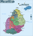 Map of Mauritius.svg 1,049 × 1,130; 1.43 MB
-
 Mauritius (+claim islands) mk.svg 500 × 463; 1.28 MB
-
 Mauritius (+claim islands).svg 500 × 463; 1.41 MB
-
 Mauritius blank map.svg 755 × 874; 184 KB
-
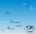
 Mauritius Island map-fr.svg 1,810 × 2,160; 1.44 MB
-
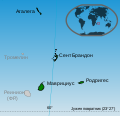 Mauritius location mk.svg 335 × 325; 1.22 MB
-
 Mauritius location.svg 335 × 325; 1.23 MB
-
 Rodrigues locations named.svg 664 × 436; 169 KB
-
 SVG-Koort Mauritius.svg 675 × 175; 25 KB


_mk.svg)
.svg)


