Category:SVG labeled maps of administrative divisions of Europe (location map scheme) (german)
Jump to navigation
Jump to search


.svg)


_(Paris_zoom).svg)
.svg)
,_administrative_divisions_-_de_-_colored_(multizoom).svg)
_-_colored.svg)
.svg)
,_administrative_divisions_-_Nmbrs_(multizoom).svg)
,_administrative_divisions_-_de_-_colored.svg)
_-_de_-_colored.svg)

.svg)

.svg)
Subcategories
This category has only the following subcategory.
Media in category "SVG labeled maps of administrative divisions of Europe (location map scheme) (german)"
The following 16 files are in this category, out of 16 total.
-
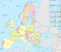
 Europe, administrative divisions - de - colored.svg 1,401 × 1,198; 3.69 MB
-
 Europe, administrative divisions - de.svg 1,401 × 1,198; 3.65 MB
-
 European Union (+integral overseas), administrative divisions - de (EU labeled).svg 1,401 × 1,198; 3.93 MB
-
-
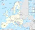
 European Union (+integral overseas), administrative divisions - de - colored.svg 1,401 × 1,198; 4.27 MB
-
 European Union (+integral overseas), administrative divisions - de.svg 1,401 × 1,198; 4.29 MB
-
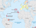
 European Union (+OMR), administrative divisions - de (marker).svg 1,287 × 1,027; 5.24 MB
-
 European Union (+OMR), administrative divisions - de (multizoom).svg 1,287 × 1,027; 5.24 MB
-
 European Union (+OMR), administrative divisions - de - colored (marker).svg 1,287 × 1,027; 5.24 MB
-
 European Union (+OMR), administrative divisions - de - colored (multizoom).svg 1,287 × 1,027; 5.24 MB
-
 European Union (+OMR), administrative divisions - Nmbrs (marker).svg 1,287 × 1,027; 5.24 MB
-
 European Union (+OMR), administrative divisions - Nmbrs (multizoom).svg 1,287 × 1,027; 5.24 MB
-
 European Union, administrative divisions - de (EU labeled).svg 1,401 × 1,198; 3.93 MB
-
 European Union, administrative divisions - de - colored (EU labeled).svg 1,401 × 1,198; 3.92 MB
-
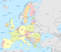 European Union, administrative divisions - de - colored.svg 1,401 × 1,198; 4.28 MB
-
 European Union, administrative divisions - de.svg 1,401 × 1,198; 4.29 MB


,_administrative_divisions_-_de_(EU_labeled).svg)
,_administrative_divisions_-_de_-_colored_(EU_labeled).svg)
,_administrative_divisions_-_de.svg)
,_administrative_divisions_-_de_(marker).svg)
,_administrative_divisions_-_de_(multizoom).svg)
,_administrative_divisions_-_de_-_colored_(marker).svg)
,_administrative_divisions_-_de_-_colored_(multizoom).svg)
,_administrative_divisions_-_Nmbrs_(marker).svg)
,_administrative_divisions_-_Nmbrs_(multizoom).svg)
.svg)
.svg)

