
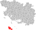
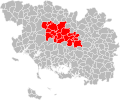
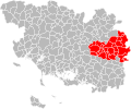
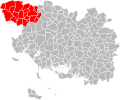
Category:Maps of groups of communes in Morbihan
Departments of Metropolitan France: Ain [01] · Aisne [02] · Allier [03] · Alpes-de-Haute-Provence [04] · Hautes-Alpes [05] · Alpes-Maritimes [06] · Ardèche [07] · Ardennes [08] · Ariège [09] · Aube [10] · Aude [11] · Aveyron [12] · Bouches-du-Rhône [13] · Calvados [14] · Cantal [15] · Charente [16] · Charente-Maritime [17] · Cher [18] · Corrèze [19] · Corse-du-Sud [2A]† · Haute-Corse [2B]† · Côte-d’Or [21] · Côtes-d'Armor [22] · Creuse [23] · Dordogne [24] · Doubs [25] · Drôme [26] · Eure [27] · Eure-et-Loir [28] · Finistère [29] · Gard [30] · Haute-Garonne [31] · Gers [32] · Gironde [33] · Hérault [34] · Ille-et-Vilaine [35] · Indre [36] · Indre-et-Loire [37] · Isère [38] · Jura [39] · Landes [40] · Loir-et-Cher [41] · Loire [42] · Haute-Loire [43] · Loire-Atlantique [44] · Loiret [45] · Lot [46] · Lot-et-Garonne [47] · Lozère [48] · Maine-et-Loire [49] · Manche [50] · Marne [51] · Haute-Marne [52] · Mayenne [53] · Meurthe-et-Moselle [54] · Meuse [55] · Morbihan [56] · Moselle [57] · Nièvre [58] · Nord [59] · Oise [60] · Orne [61] · Pas-de-Calais [62] · Puy-de-Dôme [63] · Pyrénées-Atlantiques [64] · Hautes-Pyrénées [65] · Pyrénées-Orientales [66] · Bas-Rhin [67] · Haut-Rhin [68] · departmental district of the Rhône [69] · Rhône [69D]‡ · Haute-Saône [70] · Saône-et-Loire [71] · Sarthe [72] · Savoie [73] · Haute-Savoie [74] · Seine-Maritime [76] · Seine-et-Marne [77] · Yvelines [78] · Deux-Sèvres [79] · Somme [80] · Tarn [81] · Tarn-et-Garonne [82] · Var [83] · Vaucluse [84] · Vendée [85] · Vienne [86] · Haute-Vienne [87] · Vosges [88] · Yonne [89] · Territoire de Belfort [90] · Essonne [91] · Hauts-de-Seine [92] · Seine-Saint-Denis [93] · Val-de-Marne [94] · Val-d'Oise [95]
Overseas departments and regions: Guadeloupe [971] · Martinique [972] · French Guiana [973] · Réunion [974] · Mayotte [976]
Sui generis territories: New Caledonia [988]
Overseas departments and regions: Guadeloupe [971] · Martinique [972] · French Guiana [973] · Réunion [974] · Mayotte [976]
Sui generis territories: New Caledonia [988]
| NO WIKIDATA ID FOUND! Search for Maps of groups of communes in Morbihan on Wikidata | |
| Upload media |
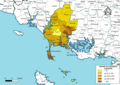
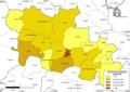
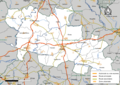
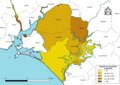
English: Maps of intercommunal cooperation public establishments in the French department of Morbihan.
Français : Cartes des établissements publics de coopération intercommunale (communautés de communes, d’agglomération ou urbaines, métropoles, syndicats intercommunaux) et syndicats mixtes (dont les pôles métropolitains) du département français des Morbihan.

Subcategories
This category has the following 5 subcategories, out of 5 total.
Media in category "Maps of groups of communes in Morbihan"
The following 84 files are in this category, out of 84 total.
-
 Gemeindeverbände im Département Morbihan 2023.png 3,500 × 2,014; 1.51 MB
-
 56-Intercos2019-200027027-Densités.png 3,519 × 2,480; 1.33 MB
-
 56-Intercos2019-200027027.png 3,519 × 2,480; 2.6 MB
-
 56-Intercos2019-200042174-Densités.png 3,519 × 2,480; 1.78 MB
-
 56-Intercos2019-200042174.png 3,519 × 2,480; 3.46 MB
-
 56-Intercos2019-200043123-Densités.png 3,519 × 2,480; 2.04 MB
-
 56-Intercos2019-200043123.png 3,519 × 2,480; 3.44 MB
-
 56-Intercos2019-200066777-Densités.png 3,519 × 2,480; 1.69 MB
-
 56-Intercos2019-200066777.png 3,519 × 2,480; 2.92 MB
-
 56-Intercos2019-200066785-Densités.png 3,519 × 2,480; 1.46 MB
-
 56-Intercos2019-200066785.png 3,519 × 2,480; 2.62 MB
-
 56-Intercos2019-200067221-Densités.png 3,519 × 2,480; 1.25 MB
-
 56-Intercos2019-200067221.png 3,519 × 2,480; 2.47 MB
-
 56-Intercos2019-200067932-Densités.png 3,519 × 2,480; 2.11 MB
-
 56-Intercos2019-200067932.png 3,519 × 2,480; 3.66 MB
-
 56-Intercos2019-245600440-Densités.png 3,519 × 2,480; 1.29 MB
-
 56-Intercos2019-245600440.png 3,519 × 2,480; 2.58 MB
-
 56-Intercos2019-245600465-Densités.png 3,519 × 2,480; 760 KB
-
 56-Intercos2019-245600465.png 3,519 × 2,480; 871 KB
-
 56-Intercos2019-245614383-Densités.png 3,519 × 2,480; 996 KB
-
 56-Intercos2019-245614383.png 3,519 × 2,480; 1.96 MB
-
 56-Intercos2019-245614417-Densités.png 3,519 × 2,480; 1.31 MB
-
 56-Intercos2019-245614417.png 3,519 × 2,480; 2.37 MB
-
 56-Intercos2019-245614433-Densités.png 3,519 × 2,480; 1.52 MB
-
 56-Intercos2019-245614433.png 3,519 × 2,480; 2.8 MB
-
 56-Morbihan-intercos-2019.png 3,507 × 2,480; 2.33 MB
-
 Gemeindeverband Arc Sud Bretagne 2019.png 3,500 × 2,014; 1.48 MB
-
 Gemeindeverband Auray Quiberon Terre Atlantique 2019.png 3,500 × 2,014; 1.48 MB
-
 Gemeindeverband Baud Communauté 2022.png 3,500 × 2,014; 1.48 MB
-
 Gemeindeverband Belle-Île-en-Mer 2019.png 3,500 × 2,014; 1.48 MB
-
 Gemeindeverband Blavet Bellevue Océan 2019.png 3,500 × 2,014; 1.48 MB
-
 Carte du territoire de Roi Morvan Communaute en bretagne.png 1,530 × 823; 1.16 MB
-
 Gemeindeverband Centre Morbihan Communauté 2022.png 3,500 × 2,014; 1.48 MB
-
 Composition Lorient Agglo 2014 2020 (carte).svg 631 × 794; 903 KB
-
 Gemeindeverband De l’Oust à Brocéliande Communauté 2019.png 3,500 × 2,014; 1.48 MB
-
 Gemeindeverband Pontivy Communauté 2022.png 3,500 × 2,014; 1.53 MB
-
 Gemeindeverband Golfe du Morbihan – Vannes Agglomération 2019.png 3,500 × 2,014; 1.48 MB
-
 Intercommunalités Morbihan 2017.svg 812 × 676; 429 KB
-
 Intercommunalités Morbihan 2022.svg 812 × 676; 428 KB
-
 Localisation CA Cap Atlantique dans la Loire-Atlantique, France.svg 742 × 637; 277 KB
-
-
 Localisation CA Lorient Agglomération dans le Morbihan, France.svg 812 × 676; 320 KB
-
 Localisation CC Arc Sud Bretagne dans le Morbihan, France.svg 812 × 676; 320 KB
-

-
 Localisation CC Belle-Île-en-Mer dans le Morbihan, France.svg 812 × 676; 320 KB
-
 Localisation CC Centre Morbihan Communauté dans le Morbihan, France.svg 812 × 676; 320 KB
-
 Localisation CC de Blavet Bellevue Océan dans le Morbihan, France.svg 812 × 676; 320 KB
-
-
 Localisation CC Ploërmel communauté dans le Morbihan, France.svg 812 × 676; 320 KB
-
 Localisation CC Pontivy communauté dans le Morbihan, France.svg 812 × 676; 320 KB
-
 Localisation CC Questembert Communauté dans le Morbihan, France.svg 812 × 676; 320 KB
-
 Localisation CC Roi Morvan Communauté dans le Morbihan, France.svg 812 × 676; 320 KB
-
 Localisation EPCI Arc sud Bretagne dans le Morbihan, France.svg 1,000 × 814; 115 KB
-
 Localisation EPCI Auray communauté dans le Morbihan, France.svg 1,000 × 814; 115 KB
-
 Localisation EPCI Auray Quiberon Terre Atlantique Morbihan, France.svg 1,000 × 814; 129 KB
-
 Localisation EPCI Baud communauté dans le Morbihan, France.svg 1,000 × 814; 115 KB
-
 Localisation EPCI de Belle-Île-en-Mer dans le Morbihan, France.svg 1,000 × 814; 115 KB
-
 Localisation EPCI de Blavet Bellevue océan dans le Morbihan, France.svg 1,000 × 814; 115 KB
-
 Localisation EPCI de la côte des Mégalithes dans le Morbihan, France.svg 1,000 × 814; 115 KB
-
 Localisation EPCI de la presqu'île de Rhuys dans le Morbihan, France.svg 1,000 × 814; 115 KB
-
 Localisation EPCI de la ria d'Étel dans le Morbihan, France.svg 1,000 × 814; 115 KB
-

-
 Localisation EPCI de Mauron en Brocéliande dans le Morbihan, France.svg 1,000 × 814; 115 KB
-
 Localisation EPCI des trois rivières dans le Morbihan, France.svg 1,000 × 814; 115 KB
-
 Localisation EPCI du loc'h dans le Morbihan, France.svg 1,000 × 814; 115 KB
-
 Localisation EPCI du pays de Guer dans le Morbihan, France.svg 1,000 × 814; 117 KB
-
 Localisation EPCI du pays de La Gacilly dans le Morbihan, France.svg 1,000 × 814; 115 KB
-
 Localisation EPCI du pays de Lorient dans le Morbihan, France.svg 1,000 × 814; 129 KB
-
 Localisation EPCI du pays de Questembert dans le Morbihan, France.svg 1,000 × 814; 115 KB
-
 Localisation EPCI du Porhoët dans le Morbihan, France.svg 1,000 × 814; 115 KB
-
 Localisation EPCI du val d'Oust et de Lanvaux dans le Morbihan, France.svg 1,000 × 814; 115 KB
-
 Localisation EPCI Josselin communauté dans le Morbihan, France.svg 1,000 × 814; 115 KB
-
 Localisation EPCI Locminé communauté dans le Morbihan, France.svg 1,000 × 814; 115 KB
-
 Localisation EPCI Ploërmel communauté dans le Morbihan, France.svg 1,000 × 814; 115 KB
-
 Localisation EPCI Pontivy communauté dans le Morbihan, France.svg 1,000 × 840; 119 KB
-
 Localisation EPCI Roi Morvan communauté dans le Morbihan, France.svg 1,000 × 814; 116 KB
-
 Localisation EPCI Saint-Jean communauté dans le Morbihan, France.svg 1,000 × 814; 129 KB
-
 Localisation EPCI Vannes Agglo dans le Morbihan, France.svg 1,000 × 814; 116 KB
-
 Gemeindeverband Lorient Agglomération 2019.png 3,500 × 2,014; 1.48 MB
-
 Gemeindeverband Ploërmel Communauté 2019.png 3,500 × 2,014; 1.48 MB
-
 Gemeindeverband Presqu'île de Guérande Atlantique - Bretagne 2019.png 3,500 × 2,014; 1.48 MB
-
 Gemeindeverband Questembert Communauté 2019.png 3,500 × 2,014; 1.48 MB
-
 Gemeindeverband Redon Agglomération - Bretagne 2019.png 3,500 × 2,014; 1.52 MB
-
 Gemeindeverband Roi Morvan Communauté 2019.png 3,500 × 2,014; 1.48 MB


.svg)


