Category:Maps of groups of communes in Lot (department)
Jump to navigation
Jump to search
Departments of Metropolitan France: Ain [01] · Aisne [02] · Allier [03] · Alpes-de-Haute-Provence [04] · Hautes-Alpes [05] · Alpes-Maritimes [06] · Ardèche [07] · Ardennes [08] · Ariège [09] · Aube [10] · Aude [11] · Aveyron [12] · Bouches-du-Rhône [13] · Calvados [14] · Cantal [15] · Charente [16] · Charente-Maritime [17] · Cher [18] · Corrèze [19] · Corse-du-Sud [2A]† · Haute-Corse [2B]† · Côte-d’Or [21] · Côtes-d'Armor [22] · Creuse [23] · Dordogne [24] · Doubs [25] · Drôme [26] · Eure [27] · Eure-et-Loir [28] · Finistère [29] · Gard [30] · Haute-Garonne [31] · Gers [32] · Gironde [33] · Hérault [34] · Ille-et-Vilaine [35] · Indre [36] · Indre-et-Loire [37] · Isère [38] · Jura [39] · Landes [40] · Loir-et-Cher [41] · Loire [42] · Haute-Loire [43] · Loire-Atlantique [44] · Loiret [45] · Lot [46] · Lot-et-Garonne [47] · Lozère [48] · Maine-et-Loire [49] · Manche [50] · Marne [51] · Haute-Marne [52] · Mayenne [53] · Meurthe-et-Moselle [54] · Meuse [55] · Morbihan [56] · Moselle [57] · Nièvre [58] · Nord [59] · Oise [60] · Orne [61] · Pas-de-Calais [62] · Puy-de-Dôme [63] · Pyrénées-Atlantiques [64] · Hautes-Pyrénées [65] · Pyrénées-Orientales [66] · Bas-Rhin [67] · Haut-Rhin [68] · departmental district of the Rhône [69] · Rhône [69D]‡ · Haute-Saône [70] · Saône-et-Loire [71] · Sarthe [72] · Savoie [73] · Haute-Savoie [74] · Seine-Maritime [76] · Seine-et-Marne [77] · Yvelines [78] · Deux-Sèvres [79] · Somme [80] · Tarn [81] · Tarn-et-Garonne [82] · Var [83] · Vaucluse [84] · Vendée [85] · Vienne [86] · Haute-Vienne [87] · Vosges [88] · Yonne [89] · Territoire de Belfort [90] · Essonne [91] · Hauts-de-Seine [92] · Seine-Saint-Denis [93] · Val-de-Marne [94] · Val-d'Oise [95]
Overseas departments and regions: Guadeloupe [971] · Martinique [972] · French Guiana [973] · Réunion [974] · Mayotte [976]
Sui generis territories: New Caledonia [988]
Overseas departments and regions: Guadeloupe [971] · Martinique [972] · French Guiana [973] · Réunion [974] · Mayotte [976]
Sui generis territories: New Caledonia [988]
| NO WIKIDATA ID FOUND! Search for Maps of groups of communes in Lot (department) on Wikidata | |
| Upload media |
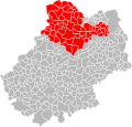
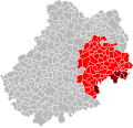
Français : Cartes des établissements publics de coopération intercommunale (communautés de communes, d’agglomération ou urbaines, métropoles, syndicats intercommunaux) et syndicats mixtes (dont les pôles métropolitains) du département français du Lot.
Subcategories
This category has the following 4 subcategories, out of 4 total.
Media in category "Maps of groups of communes in Lot (department)"
The following 37 files are in this category, out of 37 total.
-
Gemeindeverbände im Département Lot 2023.png 3,500 × 2,853; 2.65 MB
-
46-Lot-intercos-2019.png 3,507 × 2,480; 2.11 MB
-
Carte EPCI Lot.svg 1,000 × 961; 124 KB
-
Gemeindeverband Causse de Labastide-Murat 2023.png 3,500 × 2,853; 2.64 MB
-
Gemeindeverband Causses et Vallée de la Dordogne 2019.png 3,500 × 2,853; 2.63 MB
-
Gemeindeverband Cazals-Salviac 2019.png 3,500 × 2,853; 2.62 MB
-
CC Causses et vallée de la Dordogne 2017 dans le Lot.svg 1,002 × 964; 129 KB
-
Gemeindeverband Grand Cahors 2019.png 3,500 × 2,853; 2.63 MB
-
Localisation CC Causses et vallée de la Dordogne 2017 dans le Lot.svg 1,002 × 964; 122 KB
-
Localisation CC Causses et vallée de la Dordogne dans le Lot.svg 1,000 × 961; 122 KB
-
Localisation CC du Quercy Blanc.svg 1,000 × 961; 122 KB
-
Localisation CC Grand Figeac dans le Lot, France.svg 1,000 × 961; 142 KB
-
Localisation EPCI Causse Ségala Limargue dans le Lot, France.svg 1,000 × 961; 147 KB
-
Localisation EPCI Cazals Salviac dans le Lot, France.svg 1,000 × 961; 147 KB
-
Localisation EPCI Cère et Dordogne dans le Lot, France.svg 1,000 × 961; 147 KB
-
Localisation EPCI de Castelnau-Montratier dans le Lot, France.svg 1,000 × 961; 147 KB
-
Localisation EPCI de la vallée du Lot et du vignoble dans le Lot, France.svg 1,000 × 961; 148 KB
-
Localisation EPCI de la vallée et du Causse dans le Lot, France.svg 1,000 × 961; 147 KB
-
Localisation EPCI de Lalbenque dans le Lot, France.svg 1,000 × 961; 122 KB
-
Localisation EPCI du canton de Martel dans le Lot, France.svg 1,000 × 961; 147 KB
-
Localisation EPCI du canton de Montcuq dans le Lot, France.svg 1,000 × 961; 147 KB
-
Localisation EPCI du Causse de Labastide-Murat dans le Lot, France.svg 1,000 × 961; 122 KB
-
Localisation EPCI du haut Ségala dans le Lot, France.svg 1,000 × 961; 122 KB
-
Localisation EPCI du pays de Gramat dans le Lot, France.svg 1,000 × 961; 147 KB
-
Localisation EPCI du pays de Padirac dans le Lot, France.svg 1,000 × 961; 147 KB
-
Localisation EPCI du pays de Saint-Céré dans le Lot, France.svg 1,000 × 961; 147 KB
-
Localisation EPCI du pays de Souillac Rocamadour dans le Lot, France.svg 1,000 × 961; 147 KB
-
Localisation EPCI du pays de Sousceyrac dans le Lot, France.svg 1,000 × 961; 147 KB
-
Localisation EPCI du pays du haut Quercy Dordogne dans le Lot, France.svg 1,000 × 961; 147 KB
-
Localisation EPCI Figeac communauté dans le Lot, France.svg 1,000 × 961; 152 KB
-
Localisation EPCI Grand Cahors dans le Lot, France.svg 1,000 × 961; 122 KB
-
Localisation EPCI Lot - Célé dans le Lot, France.svg 1,000 × 961; 148 KB
-
Localisation EPCI Quercy - Bouriane dans le Lot, France.svg 1,000 × 961; 147 KB
-
Gemeindeverband Pays de Lalbenque-Limogne 2019.png 3,500 × 2,853; 2.62 MB
-
Gemeindeverband Quercy Blanc 2019.png 3,500 × 2,853; 2.62 MB
-
Gemeindeverband Quercy-Bouriane 2019.png 3,500 × 2,853; 2.62 MB
-
Gemeindeverband Vallée du Lot et du Vignoble 2019.png 3,500 × 2,853; 2.62 MB


