Category:Maps of groups of communes in Finistère
Appearance
Departments of Metropolitan France: Ain [01] · Aisne [02] · Allier [03] · Alpes-de-Haute-Provence [04] · Hautes-Alpes [05] · Alpes-Maritimes [06] · Ardèche [07] · Ardennes [08] · Ariège [09] · Aube [10] · Aude [11] · Aveyron [12] · Bouches-du-Rhône [13] · Calvados [14] · Cantal [15] · Charente [16] · Charente-Maritime [17] · Cher [18] · Corrèze [19] · Corse-du-Sud [2A]† · Haute-Corse [2B]† · Côte-d’Or [21] · Côtes-d'Armor [22] · Creuse [23] · Dordogne [24] · Doubs [25] · Drôme [26] · Eure [27] · Eure-et-Loir [28] · Finistère [29] · Gard [30] · Haute-Garonne [31] · Gers [32] · Gironde [33] · Hérault [34] · Ille-et-Vilaine [35] · Indre [36] · Indre-et-Loire [37] · Isère [38] · Jura [39] · Landes [40] · Loir-et-Cher [41] · Loire [42] · Haute-Loire [43] · Loire-Atlantique [44] · Loiret [45] · Lot [46] · Lot-et-Garonne [47] · Lozère [48] · Maine-et-Loire [49] · Manche [50] · Marne [51] · Haute-Marne [52] · Mayenne [53] · Meurthe-et-Moselle [54] · Meuse [55] · Morbihan [56] · Moselle [57] · Nièvre [58] · Nord [59] · Oise [60] · Orne [61] · Pas-de-Calais [62] · Puy-de-Dôme [63] · Pyrénées-Atlantiques [64] · Hautes-Pyrénées [65] · Pyrénées-Orientales [66] · Bas-Rhin [67] · Haut-Rhin [68] · departmental district of the Rhône [69] · Rhône [69D]‡ · Haute-Saône [70] · Saône-et-Loire [71] · Sarthe [72] · Savoie [73] · Haute-Savoie [74] · Seine-Maritime [76] · Seine-et-Marne [77] · Yvelines [78] · Deux-Sèvres [79] · Somme [80] · Tarn [81] · Tarn-et-Garonne [82] · Var [83] · Vaucluse [84] · Vendée [85] · Vienne [86] · Haute-Vienne [87] · Vosges [88] · Yonne [89] · Territoire de Belfort [90] · Essonne [91] · Hauts-de-Seine [92] · Seine-Saint-Denis [93] · Val-de-Marne [94] · Val-d'Oise [95]
Overseas departments and regions: Guadeloupe [971] · Martinique [972] · French Guiana [973] · Réunion [974] · Mayotte [976]
Sui generis territories: New Caledonia [988]
Overseas departments and regions: Guadeloupe [971] · Martinique [972] · French Guiana [973] · Réunion [974] · Mayotte [976]
Sui generis territories: New Caledonia [988]
| NO WIKIDATA ID FOUND! Search for Maps of groups of communes in Finistère on Wikidata | |
| Upload media |
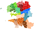
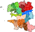
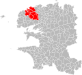
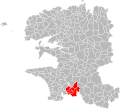
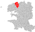
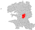
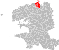
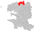
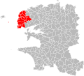
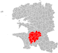
English: Maps of intercommunal cooperation public establishments in the French department of Finistère.
Français : Cartes des établissements publics de coopération intercommunale (communautés de communes, d’agglomération ou urbaines, métropoles, syndicats intercommunaux) et syndicats mixtes (dont les pôles métropolitains) du département français du Finistère.
Subcategories
This category has the following 6 subcategories, out of 6 total.
2
C
Media in category "Maps of groups of communes in Finistère"
The following 95 files are in this category, out of 95 total.
-
Gemeindeverbände im Département Finistère 2024.png 3,500 × 2,014; 1.55 MB
-
29-Finistère-intercos-2019.png 3,507 × 2,480; 2.13 MB
-
29-Intercos2019-200066868-Densités.png 3,519 × 2,480; 1.42 MB
-
29-Intercos2019-200066868.png 3,519 × 2,480; 2.38 MB
-
29-Intercos2019-200067072-Densités.png 3,519 × 2,480; 1.15 MB
-
29-Intercos2019-200067072.png 3,519 × 2,480; 2.01 MB
-
29-Intercos2019-200067197-Densités.png 3,519 × 2,480; 1.25 MB
-
29-Intercos2019-200067197.png 3,519 × 2,480; 2.29 MB
-
29-Intercos2019-200067247-Densités.png 3,519 × 2,480; 1.26 MB
-
29-Intercos2019-200067247.png 3,519 × 2,480; 2.24 MB
-
29-Intercos2019-200068120-Densités.png 3,519 × 2,480; 1.44 MB
-
29-Intercos2019-200068120.png 3,519 × 2,480; 2.79 MB
-
29-Intercos2019-242900074-Densités.png 3,519 × 2,480; 1.1 MB
-
29-Intercos2019-242900074.png 3,519 × 2,480; 1.95 MB
-
29-Intercos2019-242900314-Densités.png 3,519 × 2,480; 1.01 MB
-
29-Intercos2019-242900314.png 3,519 × 2,480; 2.07 MB
-
29-Intercos2019-242900553-Densités.png 3,519 × 2,480; 1.39 MB
-
29-Intercos2019-242900553.png 3,519 × 2,480; 2.46 MB
-
29-Intercos2019-242900561-Densités.png 3,519 × 2,480; 1.38 MB
-
29-Intercos2019-242900561.png 3,519 × 2,480; 2.6 MB
-
29-Intercos2019-242900629-Densités.png 3,519 × 2,480; 820 KB
-
29-Intercos2019-242900629.png 3,519 × 2,480; 1.14 MB
-
29-Intercos2019-242900645-Densités.png 3,519 × 2,480; 893 KB
-
29-Intercos2019-242900645.png 3,519 × 2,480; 1.32 MB
-
29-Intercos2019-242900660-Densités.png 3,519 × 2,480; 1.2 MB
-
29-Intercos2019-242900660.png 3,519 × 2,480; 2.18 MB
-
29-Intercos2019-242900694-Densités.png 3,519 × 2,480; 1.53 MB
-
29-Intercos2019-242900694.png 3,519 × 2,480; 2.94 MB
-
29-Intercos2019-242900702-Densités.png 3,519 × 2,480; 1.17 MB
-
29-Intercos2019-242900702.png 3,519 × 2,480; 1.87 MB
-
29-Intercos2019-242900710-Densités.png 3,519 × 2,480; 1.02 MB
-
29-Intercos2019-242900710.png 3,519 × 2,480; 1.84 MB
-
29-Intercos2019-242900744-Densités.png 3,519 × 2,480; 1.12 MB
-
29-Intercos2019-242900744.png 3,519 × 2,480; 1.99 MB
-
29-Intercos2019-242900751-Densités.png 3,519 × 2,480; 1.76 MB
-
29-Intercos2019-242900751.png 3,519 × 2,480; 3.43 MB
-
29-Intercos2019-242900769-Densités.png 3,519 × 2,480; 1.31 MB
-
29-Intercos2019-242900769.png 3,519 × 2,480; 2.67 MB
-
29-Intercos2019-242900793-Densités.png 3,519 × 2,480; 1.49 MB
-
29-Intercos2019-242900793.png 3,519 × 2,480; 2.66 MB
-
29-Intercos2019-242900801-Densités.png 3,519 × 2,480; 1.52 MB
-
29-Intercos2019-242900801.png 3,519 × 2,480; 2.97 MB
-
29-Intercos2019-242900835-Densités.png 3,519 × 2,480; 1.7 MB
-
29-Intercos2019-242900835.png 3,519 × 2,480; 3.14 MB
-
Gemeindeverband Brest métropole 2019.png 3,500 × 2,014; 1.5 MB
-
Gemeindeverband Cap Sizun - Pointe du Raz 2023.png 3,500 × 2,014; 1.5 MB
-
Gemeindeverband Concarneau Cornouaille Agglomération 2019.png 3,500 × 2,014; 1.5 MB
-
Gemeindeverband Douarnenez Communauté 2019.png 3,500 × 2,014; 1.49 MB
-
Gemeindeverband Poher Communauté 2019.png 3,500 × 2,014; 1.52 MB
-
Gemeindeverband Haut Pays Bigouden 2019.png 3,500 × 2,014; 1.5 MB
-
Gemeindeverband Haut-Léon Communauté 2019.png 3,500 × 2,014; 1.5 MB
-
Gemeindeverband Haute Cornouaille 2019.png 3,500 × 2,014; 1.5 MB
-
Intercommunalités Finistère 2017.svg 343 × 291; 139 KB
-
Intercommunalités Finistère 2020.svg 768 × 696; 502 KB
-
Gemeindeverband Lesneven Côte des Légendes 2023.png 3,500 × 2,014; 1.5 MB
-
Localisation Brest Métropole dans le Finistère, France.svg 768 × 696; 411 KB
-
Localisation CC Cap Sizun - Pointe du Raz dans le Finistère, France.svg 768 × 696; 411 KB
-
Localisation CC de Haute Cornouaille dans le Finistère, France.svg 768 × 696; 411 KB
-
Localisation CC du Haut Pays Bigouden dans le Finistère, France.svg 768 × 696; 411 KB
-
Localisation CC du Pays Bigouden Sud dans le Finistère, France.svg 768 × 696; 411 KB
-
Localisation CC du Pays de Landivisiau dans le Finistère, France.svg 768 × 696; 411 KB
-
Localisation CC du pays des Abers dans le Finistère, France.svg 768 × 696; 411 KB
-
Localisation CC du Pays fouesnantais dans le Finistère, France.svg 768 × 696; 411 KB
-
Localisation Douarnenez Communauté dans le Finistère, France.svg 768 × 696; 411 KB
-
Localisation EPCI de la baie du Kernic dans le Finistère, France.svg 1,000 × 848; 125 KB
-
Localisation EPCI de la région de Pleyben dans le Finistère, France.svg 1,000 × 848; 125 KB
-
Localisation EPCI de Quimper communauté dans le Finistère, France.svg 1,000 × 848; 125 KB
-
Localisation EPCI des monts d'Arrée dans le Finistère, France.svg 1,000 × 848; 125 KB
-
Localisation EPCI du pays glazik dans le Finistère, France.svg 1,000 × 848; 125 KB
-
Localisation EPCI du pays léonard dans le Finistère, France.svg 1,000 × 848; 125 KB
-
Localisation Haut-Léon Communauté dans le Finistère, France.svg 768 × 696; 411 KB
-
Localisation Monts d'Arrée Communauté dans le Finistère, France.svg 768 × 696; 411 KB
-
Localisation Morlaix Communauté dans le Finistère, France.svg 768 × 696; 411 KB
-
Localisation Pays d'Iroise Communauté dans le Finistère, France.svg 768 × 696; 411 KB
-
Localisation Poher communauté dans le Finistère, France.svg 768 × 696; 414 KB
-
Localisation Quimper Bretagne Occidentale dans le Finistère, France.svg 768 × 696; 411 KB
-
Localisation Quimperlé Communauté dans le Finistère, France.svg 768 × 696; 411 KB
-
Gemeindeverband Monts d’Arrée Communauté 2019.png 3,500 × 2,014; 1.5 MB
-
Gemeindeverband Morlaix Communauté 2019.png 3,500 × 2,014; 1.5 MB
-
Gemeindeverband Pays Bigouden Sud 2019.png 3,500 × 2,014; 1.5 MB
-
Gemeindeverband Pays de Landerneau-Daoulas 2024.png 3,500 × 2,014; 1.5 MB
-
Gemeindeverband Pays de Landivisiau 2019.png 3,500 × 2,014; 1.5 MB
-
Gemeindeverband Pays des Abers 2019.png 3,500 × 2,014; 1.5 MB
-
Gemeindeverband Pays d’Iroise 2019.png 3,500 × 2,014; 1.5 MB
-
Gemeindeverband Pays Fouesnantais 2019.png 3,500 × 2,014; 1.5 MB
-
PaysdeBrest.svg 1,442 × 931; 9.05 MB
-
Gemeindeverband Pleyben-Châteaulin-Porzay 2019.png 3,500 × 2,014; 1.5 MB
-
Gemeindeverband Presqu’île de Crozon-Aulne maritime 2019.png 3,500 × 2,014; 1.5 MB
-
Gemeindeverband Quimper Bretagne Occidentale 2019.png 3,500 × 2,014; 1.5 MB
-
Gemeindeverband Quimperlé Communauté 2019.png 3,500 × 2,014; 1.5 MB


