Category:Maps of groups of communes in Bretagne
Jump to navigation
Jump to search
Administrative regions and territorial collectivity of Metropolitan France (‡ since start of 2016):
Auvergne-Rhône-Alpes‡ · Bourgogne-Franche-Comté‡ · Brittany · Centre-Val de Loire · Corsica · Grand Est‡ · Hauts-de-France‡ · Île-de-France · Normandy‡ · New Aquitaine‡ · Occitania‡ · Pays de la Loire · Provence-Alpes-Côte d'Azur
Overseas departments and regions: Guadeloupe · Martinique · French Guiana · Réunion · Mayotte
Sui generis territories: New Caledonia
| NO WIKIDATA ID FOUND! Search for Maps of groups of communes in Bretagne on Wikidata | |
| Upload media |
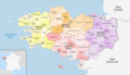
English: Maps of intercommunal cooperation public establishments in the French region of Bretagne.
Français : Cartes des établissements publics de coopération intercommunale (communautés de communes, d’agglomération ou urbaines, métropoles, syndicats intercommunaux) et syndicats mixtes (dont les pôles métropolitains) dans la région française de la Bretagne.

Subcategories
This category has the following 8 subcategories, out of 8 total.
Media in category "Maps of groups of communes in Bretagne"
The following 2 files are in this category, out of 2 total.
-
 Fasvdem Brittany.png 1,860 × 1,038; 103 KB
-
 Region Bretagne Gemeindeverbände 2024.png 3,500 × 2,014; 1.8 MB

