Category:Maps of groups of communes in Ardèche
Jump to navigation
Jump to search
Departments of Metropolitan France: Ain [01] · Aisne [02] · Allier [03] · Alpes-de-Haute-Provence [04] · Hautes-Alpes [05] · Alpes-Maritimes [06] · Ardèche [07] · Ardennes [08] · Ariège [09] · Aube [10] · Aude [11] · Aveyron [12] · Bouches-du-Rhône [13] · Calvados [14] · Cantal [15] · Charente [16] · Charente-Maritime [17] · Cher [18] · Corrèze [19] · Corse-du-Sud [2A]† · Haute-Corse [2B]† · Côte-d’Or [21] · Côtes-d'Armor [22] · Creuse [23] · Dordogne [24] · Doubs [25] · Drôme [26] · Eure [27] · Eure-et-Loir [28] · Finistère [29] · Gard [30] · Haute-Garonne [31] · Gers [32] · Gironde [33] · Hérault [34] · Ille-et-Vilaine [35] · Indre [36] · Indre-et-Loire [37] · Isère [38] · Jura [39] · Landes [40] · Loir-et-Cher [41] · Loire [42] · Haute-Loire [43] · Loire-Atlantique [44] · Loiret [45] · Lot [46] · Lot-et-Garonne [47] · Lozère [48] · Maine-et-Loire [49] · Manche [50] · Marne [51] · Haute-Marne [52] · Mayenne [53] · Meurthe-et-Moselle [54] · Meuse [55] · Morbihan [56] · Moselle [57] · Nièvre [58] · Nord [59] · Oise [60] · Orne [61] · Pas-de-Calais [62] · Puy-de-Dôme [63] · Pyrénées-Atlantiques [64] · Hautes-Pyrénées [65] · Pyrénées-Orientales [66] · Bas-Rhin [67] · Haut-Rhin [68] · departmental district of the Rhône [69] · Rhône [69D]‡ · Haute-Saône [70] · Saône-et-Loire [71] · Sarthe [72] · Savoie [73] · Haute-Savoie [74] · Seine-Maritime [76] · Seine-et-Marne [77] · Yvelines [78] · Deux-Sèvres [79] · Somme [80] · Tarn [81] · Tarn-et-Garonne [82] · Var [83] · Vaucluse [84] · Vendée [85] · Vienne [86] · Haute-Vienne [87] · Vosges [88] · Yonne [89] · Territoire de Belfort [90] · Essonne [91] · Hauts-de-Seine [92] · Seine-Saint-Denis [93] · Val-de-Marne [94] · Val-d'Oise [95]
Overseas departments and regions: Guadeloupe [971] · Martinique [972] · French Guiana [973] · Réunion [974] · Mayotte [976]
Sui generis territories: New Caledonia [988]
Overseas departments and regions: Guadeloupe [971] · Martinique [972] · French Guiana [973] · Réunion [974] · Mayotte [976]
Sui generis territories: New Caledonia [988]
| NO WIKIDATA ID FOUND! Search for Maps of groups of communes in Ardèche on Wikidata | |
| Upload media |
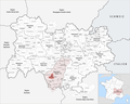
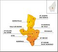
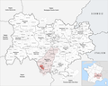
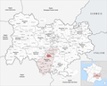
Français : Cartes des établissements publics de coopération intercommunale (communautés de communes, d’agglomération ou urbaines, métropoles, syndicats intercommunaux) et syndicats mixtes (dont les pôles métropolitains) du département français de l’Ardèche.

Subcategories
This category has the following 3 subcategories, out of 3 total.
Media in category "Maps of groups of communes in Ardèche"
The following 61 files are in this category, out of 61 total.
-
 Gemeindeverbände im Département Ardèche 2023.png 3,500 × 2,793; 2.6 MB
-
 07-Intercos-2019.png 3,507 × 2,480; 1.54 MB
-
 Anciennes EPCI qui ont fusionné en CC Porte de DrômArdèche.jpg 600 × 378; 38 KB
-
 Gemeindeverband Annonay Rhône Agglo 2019.png 3,500 × 2,793; 2.63 MB
-
 Gemeindeverband Arche Agglo 2023.png 3,500 × 2,793; 2.59 MB
-
 Gemeindeverband Ardèche des Sources et Volcans 2019.png 3,500 × 2,793; 2.63 MB
-
 Gemeindeverband Ardèche Rhône Coiron 2019.png 3,500 × 2,793; 2.63 MB
-
 Gemeindeverband Bassin d’Aubenas 2019.png 3,500 × 2,793; 2.63 MB
-
 Gemeindeverband Berg et Coiron 2019.png 3,500 × 2,793; 2.63 MB
-
 Carte Intercommunalités Ardèche 2019.svg 70 × 102; 172 KB
-
 Carte-ccpav.jpg 578 × 517; 77 KB
-
 Gemeindeverband Cèze Cévennes - Auvergne-Rhône-Alpes 2019.png 3,500 × 2,793; 2.63 MB
-
 Gemeindeverband Gorges de l’Ardèche 2019.png 3,500 × 2,793; 2.63 MB
-
 Localisation EPCI Barrès Coiron dans l'Ardèche, France.svg 1,000 × 1,516; 146 KB
-
 Localisation EPCI Cévenne et montagne ardéchoises dans l'Ardèche, France.svg 1,000 × 1,516; 146 KB
-
 Localisation EPCI Cévennes vivaroises dans l'Ardèche, France.svg 1,000 × 1,516; 146 KB
-
 Localisation EPCI d'Eyrieux aux Serres dans l'Ardèche, France.svg 1,000 × 1,516; 146 KB
-
 Localisation EPCI de Berg et Coiron dans l'Ardèche, France.svg 1,000 × 1,516; 146 KB
-
 Localisation EPCI de la roche de Gourdon dans l'Ardèche, France.svg 1,000 × 1,516; 146 KB
-
 Localisation EPCI des Boutières dans l'Ardèche, France.svg 1,000 × 1,516; 146 KB
-
 Localisation EPCI des Châtaigniers dans l'Ardèche, France.svg 1,000 × 1,516; 146 KB
-

-
 Localisation EPCI des grands Serres dans l'Ardèche, France.svg 1,000 × 1,516; 146 KB
-
 Localisation EPCI des grands sites des gorges de l'Ardèche dans l'Ardèche, France.svg 1,000 × 1,516; 146 KB
-
 Localisation EPCI des sources de la Loire dans l'Ardèche, France.svg 1,000 × 1,516; 146 KB
-
 Localisation EPCI du bassin Aubenas dans l'Ardèche, France.svg 1,000 × 1,516; 133 KB
-
 Localisation EPCI du bassin d'Annonay dans l'Ardèche, France.svg 1,000 × 1,516; 146 KB
-
 Localisation EPCI du haut Vivarais dans l'Ardèche, France.svg 1,000 × 1,516; 146 KB
-
 Localisation EPCI du pays de Beaume Drobie dans l'Ardèche, France.svg 1,000 × 1,516; 146 KB
-
 Localisation EPCI du pays de Lamastre dans l'Ardèche, France.svg 1,000 × 1,516; 146 KB
-
 Localisation EPCI du pays de Saint-Félicien dans l'Ardèche, France.svg 1,000 × 1,516; 146 KB
-
 Localisation EPCI du pays de Vals dans l'Ardèche, France.svg 1,000 × 1,516; 146 KB
-
 Localisation EPCI du pays de Vernoux dans l'Ardèche, France.svg 1,000 × 1,516; 146 KB
-
 Localisation EPCI du pays du Cheylard dans l'Ardèche, France.svg 1,000 × 1,516; 146 KB
-
 Localisation EPCI du Rhône aux gorges de l'Ardèche dans l'Ardèche, France.svg 1,000 × 1,516; 146 KB
-
 Localisation EPCI du Tournonais dans l'Ardèche, France.svg 1,000 × 1,516; 146 KB
-
 Localisation EPCI du val d'Ay dans l'Ardèche, France.svg 1,000 × 1,516; 146 KB
-
 Localisation EPCI du Vinobre dans l'Ardèche, France.svg 1,000 × 1,516; 146 KB
-
 Localisation EPCI entre Loire et Allier dans l'Ardèche, France.svg 1,000 × 1,516; 146 KB
-
 Localisation EPCI le pays des Vans dans l'Ardèche, France.svg 1,000 × 1,516; 146 KB
-
 Localisation EPCI les deux Chênes dans l'Ardèche, France.svg 1,000 × 1,516; 146 KB
-
 Localisation EPCI Montagne de l'Ardèche dans l'Ardèche, France.svg 1,000 × 1,516; 157 KB
-
 Localisation EPCI Pays de Jalès dans l'Ardèche, France.svg 1,000 × 1,516; 146 KB
-
 Localisation EPCI Porte des hautes Cévennes ardéchoises dans l'Ardèche, France.svg 1,000 × 1,516; 146 KB
-
 Localisation EPCI Privas Rhône et vallées dans l'Ardèche, France.svg 1,000 × 1,516; 146 KB
-
 Localisation EPCI Rhône Crussol dans l'Ardèche, France.svg 1,000 × 1,516; 146 KB
-
 Localisation EPCI Rhône Helvie dans l'Ardèche, France.svg 1,000 × 1,516; 146 KB
-
 Localisation EPCI Sources de l'Ardèche dans l'Ardèche, France.svg 1,000 × 1,516; 146 KB
-
 Localisation EPCI Val de Ligne dans l'Ardèche, France.svg 1,000 × 1,516; 146 KB
-
 Localisation EPCI Vivarhône dans l'Ardèche, France.svg 1,000 × 1,516; 146 KB
-
 Gemeindeverband Montagne d’Ardèche 2019.png 3,500 × 2,793; 2.63 MB
-
 Gemeindeverband Pays Beaume-Drobie 2019.png 3,500 × 2,793; 2.63 MB
-
 Gemeindeverband Pays de Lamastre 2019.png 3,500 × 2,793; 2.63 MB
-
 Gemeindeverband Pays des Vans en Cévennes 2019.png 3,500 × 2,793; 2.63 MB
-
 Gemeindeverband Porte de DrômArdèche 2022.png 3,500 × 2,793; 2.66 MB
-
 Gemeindeverband Privas Centre Ardèche 2019.png 3,500 × 2,793; 2.63 MB
-
 Gemeindeverband Rhône aux Gorges de l’Ardèche 2019.png 3,500 × 2,793; 2.63 MB
-
 Gemeindeverband Rhône Crussol 2019.png 3,500 × 2,793; 2.63 MB
-
 Gemeindeverband Val de Ligne 2019.png 3,500 × 2,793; 2.63 MB
-
 Gemeindeverband Val d’Ay 2019.png 3,500 × 2,793; 2.63 MB
-
 Gemeindeverband Val Eyrieux 2019.png 3,500 × 2,793; 2.63 MB


