Category:Maps of groups of communes in Bas-Rhin
Jump to navigation
Jump to search
Departments of Metropolitan France: Ain [01] · Aisne [02] · Allier [03] · Alpes-de-Haute-Provence [04] · Hautes-Alpes [05] · Alpes-Maritimes [06] · Ardèche [07] · Ardennes [08] · Ariège [09] · Aube [10] · Aude [11] · Aveyron [12] · Bouches-du-Rhône [13] · Calvados [14] · Cantal [15] · Charente [16] · Charente-Maritime [17] · Cher [18] · Corrèze [19] · Corse-du-Sud [2A]† · Haute-Corse [2B]† · Côte-d’Or [21] · Côtes-d'Armor [22] · Creuse [23] · Dordogne [24] · Doubs [25] · Drôme [26] · Eure [27] · Eure-et-Loir [28] · Finistère [29] · Gard [30] · Haute-Garonne [31] · Gers [32] · Gironde [33] · Hérault [34] · Ille-et-Vilaine [35] · Indre [36] · Indre-et-Loire [37] · Isère [38] · Jura [39] · Landes [40] · Loir-et-Cher [41] · Loire [42] · Haute-Loire [43] · Loire-Atlantique [44] · Loiret [45] · Lot [46] · Lot-et-Garonne [47] · Lozère [48] · Maine-et-Loire [49] · Manche [50] · Marne [51] · Haute-Marne [52] · Mayenne [53] · Meurthe-et-Moselle [54] · Meuse [55] · Morbihan [56] · Moselle [57] · Nièvre [58] · Nord [59] · Oise [60] · Orne [61] · Pas-de-Calais [62] · Puy-de-Dôme [63] · Pyrénées-Atlantiques [64] · Hautes-Pyrénées [65] · Pyrénées-Orientales [66] · Bas-Rhin [67] · Haut-Rhin [68] · departmental district of the Rhône [69] · Rhône [69D]‡ · Haute-Saône [70] · Saône-et-Loire [71] · Sarthe [72] · Savoie [73] · Haute-Savoie [74] · Seine-Maritime [76] · Seine-et-Marne [77] · Yvelines [78] · Deux-Sèvres [79] · Somme [80] · Tarn [81] · Tarn-et-Garonne [82] · Var [83] · Vaucluse [84] · Vendée [85] · Vienne [86] · Haute-Vienne [87] · Vosges [88] · Yonne [89] · Territoire de Belfort [90] · Essonne [91] · Hauts-de-Seine [92] · Seine-Saint-Denis [93] · Val-de-Marne [94] · Val-d'Oise [95]
Overseas departments and regions: Guadeloupe [971] · Martinique [972] · French Guiana [973] · Réunion [974] · Mayotte [976]
Sui generis territories: New Caledonia [988]
Overseas departments and regions: Guadeloupe [971] · Martinique [972] · French Guiana [973] · Réunion [974] · Mayotte [976]
Sui generis territories: New Caledonia [988]
| NO WIKIDATA ID FOUND! Search for Maps of groups of communes in Bas-Rhin on Wikidata | |
| Upload media |
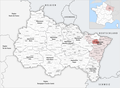
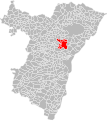
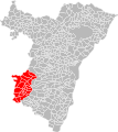
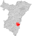
Français : Cartes des établissements publics de coopération intercommunale (communautés de communes, d’agglomération ou urbaines, métropoles, syndicats intercommunaux) et syndicats mixtes (dont les pôles métropolitains) du département français du Bas-Rhin.

Subcategories
This category has the following 4 subcategories, out of 4 total.
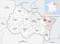
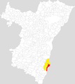
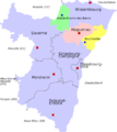
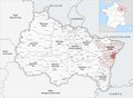
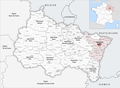
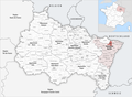
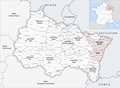
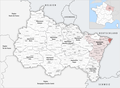
Media in category "Maps of groups of communes in Bas-Rhin"
The following 81 files are in this category, out of 81 total.
-
 Gemeindeverbände im Département Bas-Rhin 2023.png 3,499 × 2,580; 2.97 MB
-
 67-Bas-Rhin-intercos-2019.png 3,507 × 2,480; 2.34 MB
-
 Gemeindeverband Alsace Bossue 2019.png 3,499 × 2,580; 2.73 MB
-
 Gemeindeverband Basse Zorn 2023.png 3,499 × 2,580; 2.91 MB
-
 Gemeindeverband Canton d’Erstein 2019.png 3,499 × 2,580; 2.73 MB
-
 Communauté de communes de l'Alsace Bossue.png 461 × 517; 20 KB
-
 Communauté de communes de l'outre forêt.png 461 × 517; 28 KB
-
 Communauté de communes du bas rhin.png 461 × 517; 21 KB
-
 Communauté de communes du Rhin.png 461 × 517; 28 KB
-
 Communauté de communes pays rhénan.png 461 × 517; 28 KB
-
 Communauté de communes Rhin-Moder.png 461 × 517; 27 KB
-
 Els-bas-ha.png 461 × 517; 14 KB
-
 Els-bas-mo.png 461 × 517; 15 KB
-
 Els-bas-sa-als.png 461 × 517; 7 KB
-
 Els-bas-sa.png 461 × 517; 15 KB
-
 Els-bas-se.png 461 × 517; 15 KB
-
 Els-bas-st.png 461 × 517; 16 KB
-
 Els-bas-sv.png 461 × 517; 16 KB
-
 Els-bas-wi.png 461 × 517; 15 KB
-
 Gemeindeverband Eurométropole de Strasbourg 2019.png 3,499 × 2,580; 2.73 MB
-
 Gemeindeverband Haguenau 2019.png 3,499 × 2,580; 2.73 MB
-
 Gemeindeverband Hanau-La Petite Pierre 2019.png 3,499 × 2,580; 2.73 MB
-
 Gemeindeverband Kochersberg 2019.png 3,499 × 2,580; 2.73 MB
-
 Localisation EPCI Barr - Bernstein dans le Bas-Rhin, France.svg 1,000 × 1,122; 187 KB
-
 Localisation EPCI de Benfeld et environs dans le Bas-Rhin, France.svg 1,000 × 1,122; 186 KB
-
 Localisation EPCI de Bischwiller et environs dans le Bas-Rhin, France.svg 1,000 × 1,122; 186 KB
-
 Localisation EPCI de l'Alsace bossue dans le Bas-Rhin, France.svg 1,000 × 1,122; 187 KB
-
 Localisation EPCI de l'Uffried dans le Bas-Rhin, France.svg 1,000 × 1,122; 186 KB
-
 Localisation EPCI de la basse-Zorn dans le Bas-Rhin, France.svg 1,000 × 1,122; 186 KB
-
 Localisation EPCI de la Lauter dans le Bas-Rhin, France.svg 1,000 × 1,122; 186 KB
-
 Localisation EPCI de la plaine de la Sauer et du Seltzbach dans le Bas-Rhin, France.svg 1,000 × 1,122; 186 KB
-
 Localisation EPCI de la région de Brumath dans le Bas-Rhin, France.svg 1,000 × 1,122; 186 KB
-
 Localisation EPCI de la région de Haguenau dans le Bas-Rhin, France.svg 1,000 × 1,122; 187 KB
-
 Localisation EPCI de la région de Molsheim - Mutzig dans le Bas-Rhin, France.svg 1,000 × 1,122; 187 KB
-
 Localisation EPCI de la région de Saverne dans le Bas-Rhin, France.svg 1,000 × 1,122; 187 KB
-
 Localisation EPCI de la vallée de la Bruche dans le Bas-Rhin, France.svg 1,000 × 1,122; 187 KB
-
 Localisation EPCI de Seltz Delta de la Sauer dans le Bas-Rhin, France.svg 1,000 × 1,122; 186 KB
-
 Localisation EPCI de Strasbourg dans le Bas-Rhin, France.svg 1,000 × 1,122; 187 KB
-
 Localisation EPCI de Sélestat dans le Bas-Rhin, France.svg 1,000 × 1,122; 186 KB
-
 Localisation EPCI des coteaux de la Mossig dans le Bas-Rhin, France.svg 1,000 × 1,122; 186 KB
-
 Localisation EPCI du canton de Rosheim dans le Bas-Rhin, France.svg 1,000 × 1,122; 186 KB
-
 Localisation EPCI du canton de Villé dans le Bas-Rhin, France.svg 1,000 × 1,122; 187 KB
-
 Localisation EPCI du Hattgau et environs dans le Bas-Rhin, France.svg 1,000 × 1,122; 186 KB
-
 Localisation EPCI du Kochersberg dans le Bas-Rhin, France.svg 1,000 × 1,122; 187 KB
-
 Localisation EPCI du pays d'Erstein dans le Bas-Rhin, France.svg 1,000 × 1,122; 186 KB
-
 Localisation EPCI du pays de Hanau dans le Bas-Rhin, France.svg 1,000 × 1,122; 187 KB
-
 Localisation EPCI du pays de La Petite-Pierre dans le Bas-Rhin, France.svg 1,000 × 1,122; 187 KB
-
 Localisation EPCI du pays de la Zorn dans le Bas-Rhin, France.svg 1,000 × 1,122; 187 KB
-
 Localisation EPCI du pays de Marmoutier - Sommerau dans le Bas-Rhin, France.svg 1,000 × 1,122; 186 KB
-
 Localisation EPCI du pays de Niederbronn-les-Bains dans le Bas-Rhin, France.svg 1,000 × 1,122; 186 KB
-
 Localisation EPCI du pays de Sainte-Odile dans le Bas-Rhin, France.svg 1,000 × 1,122; 186 KB
-
 Localisation EPCI du pays de Sarre-Union dans le Bas-Rhin, France.svg 1,000 × 1,122; 187 KB
-
 Localisation EPCI du pays de Wissembourg dans le Bas-Rhin, France.svg 1,000 × 1,122; 186 KB
-
 Localisation EPCI du Rhin dans le Bas-Rhin, France.svg 1,000 × 1,122; 186 KB
-
 Localisation EPCI du ried de Marckolsheim dans le Bas-Rhin, France.svg 1,000 × 1,122; 187 KB
-
 Localisation EPCI du Soultzerland dans le Bas-Rhin, France.svg 1,000 × 1,122; 186 KB
-
 Localisation EPCI du val de Moder dans le Bas-Rhin, France.svg 1,000 × 1,122; 186 KB
-
 Localisation EPCI Espace rhénan dans le Bas-Rhin, France.svg 1,000 × 1,122; 186 KB
-
 Localisation EPCI Gambsheim - Kilstett dans le Bas-Rhin, France.svg 1,000 × 1,122; 186 KB
-
 Localisation EPCI La porte du vignoble dans le Bas-Rhin, France.svg 1,000 × 1,122; 186 KB
-
 Localisation EPCI Les châteaux dans le Bas-Rhin, France.svg 1,000 × 1,122; 186 KB
-
 Localisation EPCI Rhin - Moder dans le Bas-Rhin, France.svg 1,000 × 1,122; 186 KB
-
 Localisation EPCI Sauer - Pechelbronn dans le Bas-Rhin, France.svg 1,000 × 1,122; 187 KB
-
 Gemeindeverband Mossig et Vignoble 2019.png 3,499 × 2,580; 2.73 MB
-
 Gemeindeverband Outre-Forêt 2019.png 3,499 × 2,580; 2.73 MB
-
 Gemeindeverband Pays de Barr 2019.png 3,499 × 2,580; 2.73 MB
-
 Gemeindeverband Pays de la Zorn 2019.png 3,499 × 2,580; 2.73 MB
-
 Gemeindeverband Pays de Niederbronn-les-Bains 2019.png 3,499 × 2,580; 2.73 MB
-
 Gemeindeverband Pays de Sainte-Odile 2019.png 3,499 × 2,580; 2.73 MB
-
 Gemeindeverband Pays de Saverne 2019.png 3,499 × 2,580; 2.73 MB
-
 Gemeindeverband Pays de Wissembourg 2019.png 3,499 × 2,580; 2.73 MB
-
 Gemeindeverband Pays Rhénan 2019.png 3,499 × 2,580; 2.73 MB
-
 Gemeindeverband Plaine du Rhin 2019.png 3,499 × 2,580; 2.73 MB
-
 Gemeindeverband Portes de Rosheim 2019.png 3,499 × 2,580; 2.73 MB
-
 Gemeindeverband Ried de Marckolsheim 2019.png 3,499 × 2,580; 2.76 MB
-
 Gemeindeverband Région de Molsheim-Mutzig 2019.png 3,499 × 2,580; 2.73 MB
-
 Gemeindeverband Sarreguemines Confluences 2019.png 3,499 × 2,580; 2.79 MB
-
 Gemeindeverband Sauer-Pechelbronn 2019.png 3,499 × 2,580; 2.73 MB
-
 Gemeindeverband Sélestat 2019.png 3,499 × 2,580; 2.73 MB
-
 Gemeindeverband Vallée de la Bruche 2019.png 3,499 × 2,580; 2.73 MB
-
 Gemeindeverband Vallée de Villé 2019.png 3,499 × 2,580; 2.73 MB


