Category:Maps of groups of communes in Cantal
Jump to navigation
Jump to search
Departments of Metropolitan France: Ain [01] · Aisne [02] · Allier [03] · Alpes-de-Haute-Provence [04] · Hautes-Alpes [05] · Alpes-Maritimes [06] · Ardèche [07] · Ardennes [08] · Ariège [09] · Aube [10] · Aude [11] · Aveyron [12] · Bouches-du-Rhône [13] · Calvados [14] · Cantal [15] · Charente [16] · Charente-Maritime [17] · Cher [18] · Corrèze [19] · Corse-du-Sud [2A]† · Haute-Corse [2B]† · Côte-d’Or [21] · Côtes-d'Armor [22] · Creuse [23] · Dordogne [24] · Doubs [25] · Drôme [26] · Eure [27] · Eure-et-Loir [28] · Finistère [29] · Gard [30] · Haute-Garonne [31] · Gers [32] · Gironde [33] · Hérault [34] · Ille-et-Vilaine [35] · Indre [36] · Indre-et-Loire [37] · Isère [38] · Jura [39] · Landes [40] · Loir-et-Cher [41] · Loire [42] · Haute-Loire [43] · Loire-Atlantique [44] · Loiret [45] · Lot [46] · Lot-et-Garonne [47] · Lozère [48] · Maine-et-Loire [49] · Manche [50] · Marne [51] · Haute-Marne [52] · Mayenne [53] · Meurthe-et-Moselle [54] · Meuse [55] · Morbihan [56] · Moselle [57] · Nièvre [58] · Nord [59] · Oise [60] · Orne [61] · Pas-de-Calais [62] · Puy-de-Dôme [63] · Pyrénées-Atlantiques [64] · Hautes-Pyrénées [65] · Pyrénées-Orientales [66] · Bas-Rhin [67] · Haut-Rhin [68] · departmental district of the Rhône [69] · Rhône [69D]‡ · Haute-Saône [70] · Saône-et-Loire [71] · Sarthe [72] · Savoie [73] · Haute-Savoie [74] · Seine-Maritime [76] · Seine-et-Marne [77] · Yvelines [78] · Deux-Sèvres [79] · Somme [80] · Tarn [81] · Tarn-et-Garonne [82] · Var [83] · Vaucluse [84] · Vendée [85] · Vienne [86] · Haute-Vienne [87] · Vosges [88] · Yonne [89] · Territoire de Belfort [90] · Essonne [91] · Hauts-de-Seine [92] · Seine-Saint-Denis [93] · Val-de-Marne [94] · Val-d'Oise [95]
Overseas departments and regions: Guadeloupe [971] · Martinique [972] · French Guiana [973] · Réunion [974] · Mayotte [976]
Sui generis territories: New Caledonia [988]
Overseas departments and regions: Guadeloupe [971] · Martinique [972] · French Guiana [973] · Réunion [974] · Mayotte [976]
Sui generis territories: New Caledonia [988]
| NO WIKIDATA ID FOUND! Search for Maps of groups of communes in Cantal on Wikidata | |
| Upload media |
Français : Cartes des établissements publics de coopération intercommunale (communautés de communes, d’agglomération ou urbaines, métropoles, syndicats intercommunaux) et syndicats mixtes (dont les pôles métropolitains) du département français du Cantal.
Subcategories
This category has the following 4 subcategories, out of 4 total.
Media in category "Maps of groups of communes in Cantal"
The following 35 files are in this category, out of 35 total.
-
Gemeindeverbände im Département Cantal 2025.png 3,500 × 2,793; 3.07 MB
-
15-Intercos-2019.png 3,507 × 2,480; 1.67 MB
-
Gemeindeverband Bassin d’Aurillac 2019.png 3,500 × 2,793; 2.62 MB
-
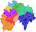
Carte Intercommunalités Cantal 2019.svg 89 × 79; 142 KB
-
Gemeindeverband Châtaigneraie Cantalienne 2019.png 3,500 × 2,793; 2.62 MB
-
Gemeindeverband Cère et Goul en Carladès 2019.png 3,500 × 2,793; 2.62 MB
-
Gemeindeverband Hautes Terres 2025.png 3,500 × 2,793; 3.41 MB
-
Localisation EPCI Châtaigneraie Cantalienne dans le Cantal, France.svg 1,067 × 999; 415 KB
-
Localisation EPCI Cère et Goul en Carladès dans le Cantal, France.svg 1,000 × 937; 377 KB
-
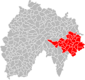
Localisation EPCI Cère et Rance en Châtaigneraie dans le Cantal, France.svg 1,000 × 937; 131 KB
-
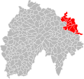
Localisation EPCI de Caldaguès Aubrac dans le Cantal, France.svg 1,000 × 937; 131 KB
-
Localisation EPCI de la Planèze dans le Cantal, France.svg 1,000 × 937; 131 KB
-
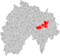
Localisation EPCI du bassin d'Aurillac dans le Cantal, France.svg 1,000 × 937; 392 KB
-
Localisation EPCI du Cézallier dans le Cantal, France.svg 1,000 × 937; 131 KB
-
Localisation EPCI du pays de Massiac dans le Cantal, France.svg 1,000 × 937; 131 KB
-
Localisation EPCI du pays de Mauriac dans le Cantal, France.svg 1,000 × 937; 376 KB
-
Localisation EPCI du pays de Maurs dans le Cantal, France.svg 1,000 × 937; 131 KB
-
Localisation EPCI du pays de Montsalvy dans le Cantal, France.svg 1,000 × 937; 131 KB
-
Localisation EPCI du pays de Murat dans le Cantal, France.svg 1,000 × 937; 131 KB
-
Localisation EPCI du pays de Pierrefort - Neuvéglise dans le Cantal, France.svg 1,000 × 937; 131 KB
-
Localisation EPCI du pays de Saint-Flour dans le Cantal, France.svg 1,000 × 937; 131 KB
-
Localisation EPCI du pays de Saint-Flour Margeride dans le Cantal, France.svg 1,000 × 937; 132 KB
-
Localisation EPCI du pays gentiane dans le Cantal, France.svg 1,000 × 937; 385 KB
-
Localisation EPCI entre deux lacs dans le Cantal, France.svg 1,000 × 937; 131 KB
-
Localisation EPCI Hautes Terres Communauté dans le Cantal, France.svg 1,000 × 937; 403 KB
-
Localisation EPCI Margeride Truyère dans le Cantal, France.svg 1,000 × 937; 131 KB
-
Localisation EPCI Pays de Salers dans le Cantal, France.svg 1,000 × 937; 393 KB
-
Localisation EPCI Saint-Flour Communauté dans le Cantal, France.svg 1,000 × 937; 425 KB
-
Localisation EPCI Sumène - Artense dans le Cantal, France.svg 1,000 × 937; 381 KB
-
Gemeindeverband Massif du Sancy 2019.png 3,500 × 2,793; 2.69 MB
-
Gemeindeverband Pays de Mauriac 2019.png 3,500 × 2,793; 2.62 MB
-
Gemeindeverband Pays de Salers 2019.png 3,500 × 2,793; 2.62 MB
-
Gemeindeverband Pays Gentiane 2019.png 3,500 × 2,793; 2.62 MB
-
Gemeindeverband Saint-Flour Communauté 2019.png 3,500 × 2,793; 2.63 MB
-
Gemeindeverband Sumène - Artense 2023.png 3,500 × 2,793; 2.56 MB


