Category:Maps of groups of communes in Cher
Jump to navigation
Jump to search
Departments of Metropolitan France: Ain [01] · Aisne [02] · Allier [03] · Alpes-de-Haute-Provence [04] · Hautes-Alpes [05] · Alpes-Maritimes [06] · Ardèche [07] · Ardennes [08] · Ariège [09] · Aube [10] · Aude [11] · Aveyron [12] · Bouches-du-Rhône [13] · Calvados [14] · Cantal [15] · Charente [16] · Charente-Maritime [17] · Cher [18] · Corrèze [19] · Corse-du-Sud [2A]† · Haute-Corse [2B]† · Côte-d’Or [21] · Côtes-d'Armor [22] · Creuse [23] · Dordogne [24] · Doubs [25] · Drôme [26] · Eure [27] · Eure-et-Loir [28] · Finistère [29] · Gard [30] · Haute-Garonne [31] · Gers [32] · Gironde [33] · Hérault [34] · Ille-et-Vilaine [35] · Indre [36] · Indre-et-Loire [37] · Isère [38] · Jura [39] · Landes [40] · Loir-et-Cher [41] · Loire [42] · Haute-Loire [43] · Loire-Atlantique [44] · Loiret [45] · Lot [46] · Lot-et-Garonne [47] · Lozère [48] · Maine-et-Loire [49] · Manche [50] · Marne [51] · Haute-Marne [52] · Mayenne [53] · Meurthe-et-Moselle [54] · Meuse [55] · Morbihan [56] · Moselle [57] · Nièvre [58] · Nord [59] · Oise [60] · Orne [61] · Pas-de-Calais [62] · Puy-de-Dôme [63] · Pyrénées-Atlantiques [64] · Hautes-Pyrénées [65] · Pyrénées-Orientales [66] · Bas-Rhin [67] · Haut-Rhin [68] · departmental district of the Rhône [69] · Rhône [69D]‡ · Haute-Saône [70] · Saône-et-Loire [71] · Sarthe [72] · Savoie [73] · Haute-Savoie [74] · Seine-Maritime [76] · Seine-et-Marne [77] · Yvelines [78] · Deux-Sèvres [79] · Somme [80] · Tarn [81] · Tarn-et-Garonne [82] · Var [83] · Vaucluse [84] · Vendée [85] · Vienne [86] · Haute-Vienne [87] · Vosges [88] · Yonne [89] · Territoire de Belfort [90] · Essonne [91] · Hauts-de-Seine [92] · Seine-Saint-Denis [93] · Val-de-Marne [94] · Val-d'Oise [95]
Overseas departments and regions: Guadeloupe [971] · Martinique [972] · French Guiana [973] · Réunion [974] · Mayotte [976]
Sui generis territories: New Caledonia [988]
Overseas departments and regions: Guadeloupe [971] · Martinique [972] · French Guiana [973] · Réunion [974] · Mayotte [976]
Sui generis territories: New Caledonia [988]
| NO WIKIDATA ID FOUND! Search for Maps of groups of communes in Cher on Wikidata | |
| Upload media |
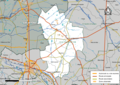
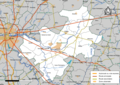
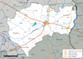
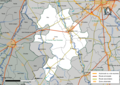
Français : Cartes des établissements publics de coopération intercommunale (communautés de communes, d’agglomération ou urbaines, métropoles, syndicats intercommunaux) et syndicats mixtes (dont les pôles métropolitains) du département français du Cher.

Subcategories
This category has the following 5 subcategories, out of 5 total.
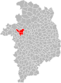
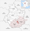
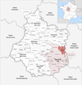
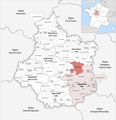
Media in category "Maps of groups of communes in Cher"
The following 83 files are in this category, out of 83 total.
-
 Gemeindeverbände im Département Cher 2024.png 3,500 × 3,619; 2.6 MB
-
 18-Intercos-2019.png 3,519 × 2,480; 1.87 MB
-
 18-Intercos2019-200000933.png 3,519 × 2,480; 1.58 MB
-
 18-Intercos2019-200007177.png 3,519 × 2,480; 1.33 MB
-
 18-Intercos2019-200011781.png 3,519 × 2,480; 1.28 MB
-
 18-Intercos2019-200027076-Densités.png 3,519 × 2,480; 1.31 MB
-
 18-Intercos2019-200032514-Densités.png 3,519 × 2,480; 1.19 MB
-
 18-Intercos2019-200033207-Densités.png 3,519 × 2,480; 1.16 MB
-
 18-Intercos2019-200036135-Densités.png 3,519 × 2,480; 1.47 MB
-
 18-Intercos2019-200049484-Densités.png 3,519 × 2,480; 2.12 MB
-
 18-Intercos2019-200066330-Densités.png 3,519 × 2,480; 1.51 MB
-
 18-Intercos2019-200069227-Densités.png 3,519 × 2,480; 1.81 MB
-
 18-Intercos2019-200070571-Densités.png 3,519 × 2,480; 1.16 MB
-
 18-Intercos2019-241800325-Densités.png 3,519 × 2,480; 1.04 MB
-
 18-Intercos2019-241800374-Densités.png 3,519 × 2,480; 1.45 MB
-
 18-Intercos2019-241800424-Densités.png 3,519 × 2,480; 1.28 MB
-
 18-Intercos2019-241800432-Densités.png 3,519 × 2,480; 1.02 MB
-
 18-Intercos2019-241800457-Densités.png 3,519 × 2,480; 1.29 MB
-
 18-Intercos2019-241800507-Densités.png 3,519 × 2,480; 1.45 MB
-
 Gemeindeverband Arnon Boischaut Cher 2019.png 3,500 × 3,619; 2.58 MB
-
 Gemeindeverband Berry Grand Sud 2019.png 3,500 × 3,619; 2.58 MB
-
 Gemeindeverband Berry-Loire-Vauvise 2019.png 3,500 × 3,619; 2.58 MB
-
 Gemeindeverband Bourges Plus 2020.png 3,500 × 3,619; 2.58 MB
-
 Gemeindeverband Cœur de Berry 2020.png 3,500 × 3,619; 2.58 MB
-
 Gemeindeverband Cœur de France 2019.png 3,500 × 3,619; 2.58 MB
-
 Gemeindeverband FerCher 2023.png 3,500 × 3,619; 2.55 MB
-
 Intercos2019-200000933.png 3,519 × 2,480; 3.41 MB
-
 Intercos2019-200007177.png 3,519 × 2,480; 2.49 MB
-
 Intercos2019-200011781.png 3,519 × 2,480; 2.73 MB
-
 Intercos2019-200027076.png 3,519 × 2,480; 2.47 MB
-
 Intercos2019-200032514.png 3,519 × 2,480; 2.28 MB
-
 Intercos2019-200033207.png 3,519 × 2,480; 2.54 MB
-
 Intercos2019-200036135.png 3,519 × 2,480; 2.72 MB
-
 Intercos2019-200049484.png 3,519 × 2,480; 3.61 MB
-
 Intercos2019-200066330.png 3,519 × 2,480; 3.06 MB
-
 Intercos2019-200068088.png 3,519 × 2,480; 3.24 MB
-
 Intercos2019-200069227.png 3,519 × 2,480; 3.26 MB
-
 Intercos2019-200070571.png 3,519 × 2,480; 2.52 MB
-
 Intercos2019-241800325.png 3,519 × 2,480; 2.58 MB
-
 Intercos2019-241800374.png 3,519 × 2,480; 2.81 MB
-
 Intercos2019-241800424.png 3,519 × 2,480; 2.29 MB
-
 Intercos2019-241800432.png 3,519 × 2,480; 1.87 MB
-
 Intercos2019-241800457.png 3,519 × 2,480; 2.64 MB
-
 Intercos2019-241800507.png 3,519 × 2,480; 3.06 MB
-
 Intercos2019-243600236.png 3,519 × 2,480; 3.3 MB
-
 Gemeindeverband La Septaine 2019.png 3,500 × 3,619; 2.58 MB
-
 Gemeindeverband Le Dunois 2024.png 3,500 × 3,619; 2.58 MB
-
 Gemeindeverband Les Bertranges - Centre-Val de Loire 2023.png 3,500 × 3,619; 2.55 MB
-
 Gemeindeverband Les Trois Provinces 2019.png 3,500 × 3,619; 2.58 MB
-
 Localisation EPCI Arnon Boischaut Cher dans le Cher, France.svg 1,000 × 1,358; 134 KB
-
 Localisation EPCI Berry Loire Vauvize dans le Cher, France.svg 1,000 × 1,358; 134 KB
-
 Localisation EPCI Boischaut - Marche dans le Cher, France.svg 1,000 × 1,358; 134 KB
-
 Localisation EPCI Bourges Plus dans le Cher, France.svg 1,000 × 1,358; 134 KB
-
 Localisation EPCI Coeur de Berry dans le Cher, France.svg 1,000 × 1,358; 136 KB
-
 Localisation EPCI Cœur de France dans le Cher, France.svg 1,000 × 1,358; 134 KB
-
 Localisation EPCI Cœur du pays fort dans le Cher, France.svg 1,000 × 1,358; 134 KB
-
 Localisation EPCI de la Septaine dans le Cher, France.svg 1,000 × 1,358; 134 KB
-
 Localisation EPCI des hautes terres en haut Berry dans le Cher, France.svg 1,000 × 1,358; 134 KB
-
-
 Localisation EPCI des terres du Grand Meaulnes dans le Cher, France.svg 1,000 × 1,358; 134 KB
-
 Localisation EPCI des trois provinces dans le Cher, France.svg 1,000 × 1,358; 134 KB
-
 Localisation EPCI du Dunois dans le Cher, France.svg 1,000 × 1,358; 134 KB
-
 Localisation EPCI du pays de Nérondes dans le Cher, France.svg 1,000 × 1,358; 134 KB
-
 Localisation EPCI du Sancerrois dans le Cher, France.svg 1,000 × 1,358; 134 KB
-
 Localisation EPCI en terres vives dans le Cher, France.svg 1,000 × 1,358; 134 KB
-
 Localisation EPCI Fercher Pays florentais dans le Cher, France.svg 1,000 × 1,358; 134 KB
-
 Localisation EPCI Haut Berry Val de Loire dans le Cher, France.svg 1,000 × 1,358; 134 KB
-
 Localisation EPCI les terres d'Yèvre dans le Cher, France.svg 1,000 × 1,358; 134 KB
-
 Localisation EPCI les terroirs d'Angillon dans le Cher, France.svg 1,000 × 1,358; 134 KB
-
 Localisation EPCI les vals de Cher et d'Arnon dans le Cher, France.svg 1,000 × 1,358; 134 KB
-
 Localisation EPCI les villages de la forêt dans le Cher, France.svg 1,000 × 1,358; 134 KB
-
 Localisation EPCI Pays Fort Sancerrois Val de Loire dans le Cher, France.svg 1,000 × 1,358; 146 KB
-
 Localisation EPCI Sauldre et Sologne dans le Cher, France.svg 1,000 × 1,358; 134 KB
-
 Localisation EPCI Terres du Haut Berry dans le Cher, France.svg 1,000 × 1,358; 147 KB
-
 Localisation EPCI Vierzon - Sologne - Berry dans le Cher, France.svg 1,000 × 1,358; 135 KB
-
 Gemeindeverband Loire, Nièvre et Bertranges - Centre-Val de Loire 2019.png 3,500 × 3,619; 2.59 MB
-
 Gemeindeverband Pays de Nérondes 2019.png 3,500 × 3,619; 2.58 MB
-
 Gemeindeverband Pays d’Issoudun 2019.png 3,500 × 3,619; 2.6 MB
-
 Gemeindeverband Pays Fort Sancerrois Val de Loire 2019.png 3,500 × 3,619; 2.59 MB
-
 Gemeindeverband Portes du Berry entre Loire et Val d’Aubois 2019.png 3,500 × 3,619; 2.58 MB
-
 Gemeindeverband Sauldre et Sologne 2021.png 3,500 × 3,619; 2.58 MB
-
 Gemeindeverband Terres du Haut Berry 2019.png 3,500 × 3,619; 2.59 MB
-
 Gemeindeverband Vierzon-Sologne-Berry 2023.png 3,500 × 3,619; 2.55 MB


