Category:Maps of groups of communes in Yvelines
Jump to navigation
Jump to search
Departments of Metropolitan France: Ain [01] · Aisne [02] · Allier [03] · Alpes-de-Haute-Provence [04] · Hautes-Alpes [05] · Alpes-Maritimes [06] · Ardèche [07] · Ardennes [08] · Ariège [09] · Aube [10] · Aude [11] · Aveyron [12] · Bouches-du-Rhône [13] · Calvados [14] · Cantal [15] · Charente [16] · Charente-Maritime [17] · Cher [18] · Corrèze [19] · Corse-du-Sud [2A]† · Haute-Corse [2B]† · Côte-d’Or [21] · Côtes-d'Armor [22] · Creuse [23] · Dordogne [24] · Doubs [25] · Drôme [26] · Eure [27] · Eure-et-Loir [28] · Finistère [29] · Gard [30] · Haute-Garonne [31] · Gers [32] · Gironde [33] · Hérault [34] · Ille-et-Vilaine [35] · Indre [36] · Indre-et-Loire [37] · Isère [38] · Jura [39] · Landes [40] · Loir-et-Cher [41] · Loire [42] · Haute-Loire [43] · Loire-Atlantique [44] · Loiret [45] · Lot [46] · Lot-et-Garonne [47] · Lozère [48] · Maine-et-Loire [49] · Manche [50] · Marne [51] · Haute-Marne [52] · Mayenne [53] · Meurthe-et-Moselle [54] · Meuse [55] · Morbihan [56] · Moselle [57] · Nièvre [58] · Nord [59] · Oise [60] · Orne [61] · Pas-de-Calais [62] · Puy-de-Dôme [63] · Pyrénées-Atlantiques [64] · Hautes-Pyrénées [65] · Pyrénées-Orientales [66] · Bas-Rhin [67] · Haut-Rhin [68] · departmental district of the Rhône [69] · Rhône [69D]‡ · Haute-Saône [70] · Saône-et-Loire [71] · Sarthe [72] · Savoie [73] · Haute-Savoie [74] · Seine-Maritime [76] · Seine-et-Marne [77] · Yvelines [78] · Deux-Sèvres [79] · Somme [80] · Tarn [81] · Tarn-et-Garonne [82] · Var [83] · Vaucluse [84] · Vendée [85] · Vienne [86] · Haute-Vienne [87] · Vosges [88] · Yonne [89] · Territoire de Belfort [90] · Essonne [91] · Hauts-de-Seine [92] · Seine-Saint-Denis [93] · Val-de-Marne [94] · Val-d'Oise [95]
Overseas departments and regions: Guadeloupe [971] · Martinique [972] · French Guiana [973] · Réunion [974] · Mayotte [976]
Sui generis territories: New Caledonia [988]
Overseas departments and regions: Guadeloupe [971] · Martinique [972] · French Guiana [973] · Réunion [974] · Mayotte [976]
Sui generis territories: New Caledonia [988]
| NO WIKIDATA ID FOUND! Search for Maps of groups of communes in Yvelines on Wikidata | |
| Upload media |
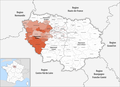
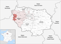
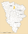
Français : Cartes des établissements publics de coopération intercommunale (communautés de communes, d’agglomération ou urbaines, métropoles, syndicats intercommunaux) et syndicats mixtes (dont les pôles métropolitains) du département français des Yvelines.

Subcategories
This category has the following 3 subcategories, out of 3 total.
Media in category "Maps of groups of communes in Yvelines"
The following 56 files are in this category, out of 56 total.
-
 Gemeindeverbände im Département Yvelines 2023.png 3,500 × 2,550; 1.7 MB
-
 78-Yvelines-intercos-2019.png 3,507 × 2,480; 2.63 MB
-
 Gemeindeverband Cergy-Pontoise 2019.png 3,500 × 2,550; 1.7 MB
-
 Communauté d'agglomération des Deux Rives de Seine (Green).png 2,000 × 1,924; 554 KB
-
 Communauté Urbaine Grand Paris Seine et Oise.png 478 × 599; 66 KB
-
 Gemeindeverband Cœur d’Yvelines 2019.png 3,500 × 2,550; 1.69 MB
-
 Gemeindeverband Gally Mauldre 2019.png 3,500 × 2,550; 1.69 MB
-
 Gemeindeverband Grand Paris Seine et Oise 2019.png 3,500 × 2,550; 1.69 MB
-
 Gemeindeverband Haute Vallée de Chevreuse 2019.png 3,500 × 2,550; 1.69 MB
-
 Gemeindeverband Les Portes de l’Île-de-France 2023.png 3,500 × 2,550; 1.68 MB
-
 Localisation EPCI Contrée d'Ablis - Porte d'Yvelines dans les Yvelines, France.svg 1,000 × 1,253; 93 KB
-
 Localisation EPCI Coteaux du Vexin dans les Yvelines, France.svg 1,000 × 1,253; 93 KB
-
 Localisation EPCI Cœur d'Yvelines dans les Yvelines, France.svg 1,000 × 1,253; 93 KB
-
 Localisation EPCI de la boucle de la Seine dans les Yvelines, France.svg 1,000 × 1,253; 93 KB
-
 Localisation EPCI de Mantes en Yvelines dans les Yvelines, France.svg 1,000 × 1,253; 94 KB
-
 Localisation EPCI de Saint-Quentin en Yvelines dans les Yvelines, France.svg 1,000 × 1,253; 93 KB
-
 Localisation EPCI des coteaux de Seine dans les Yvelines, France.svg 1,000 × 1,253; 93 KB
-
 Localisation EPCI des deux rives de la Seine dans les Yvelines, France.svg 1,000 × 1,253; 93 KB
-
 Localisation EPCI des portes de l'Île-de-France dans les Yvelines, France.svg 1,000 × 1,253; 93 KB
-
 Localisation EPCI des étangs dans les Yvelines, France.svg 1,000 × 1,253; 93 KB
-
 Localisation EPCI du pays houdanais dans les Yvelines, France.svg 1,000 × 1,253; 98 KB
-
 Localisation EPCI du plateau de Lommoye dans les Yvelines, France.svg 1,000 × 1,253; 93 KB
-
 Localisation EPCI Gally - Mauldre dans les Yvelines, France.svg 1,000 × 1,253; 93 KB
-
 Localisation EPCI Haute vallée de Chevreuse dans les Yvelines, France.svg 1,000 × 1,253; 93 KB
-
 Localisation EPCI Maisons - Mesnil dans les Yvelines, France.svg 1,000 × 1,253; 93 KB
-
 Localisation EPCI Plaines et forêts d'Yvelines dans les Yvelines, France.svg 1,000 × 1,253; 94 KB
-
 Localisation EPCI Seine Mauldre dans les Yvelines, France.svg 1,000 × 1,253; 93 KB
-
 Localisation EPCI Versailles Grand parc dans les Yvelines, France.svg 1,010 × 1,256; 82 KB
-
 Localisation EPCI Vexin Seine dans les Yvelines, France.svg 1,000 × 1,253; 93 KB
-
 Loupe CASQY 2016.svg 1,000 × 1,000; 148 KB
-
 Mantois.svg 2,745 × 3,321; 676 KB
-
 Gemeindeverband Pays Houdanais - Île-de-France 2019.png 3,500 × 2,550; 1.69 MB
-
 Plaine de Versailles - communes.svg 1,000 × 1,253; 111 KB
-
 Gemeindeverband Rambouillet Territoires 2019.png 3,500 × 2,550; 1.69 MB
-
 Gemeindeverband Saint Quentin en Yvelines 2023.png 3,500 × 2,550; 1.68 MB
-
 Gemeindeverband Saint-Germain Boucles de Seine 2019.png 3,500 × 2,550; 1.7 MB
-
 Gemeindeverband Versailles Grand Parc 2019.png 3,500 × 2,550; 1.71 MB
-
 Yvelines CA de Mantes-en-Yvelines.svg 2,745 × 3,321; 670 KB
-
 Yvelines CA de Saint-Quentin-en-Yvelines.svg 2,745 × 3,321; 670 KB
-
 Yvelines CA des Deux Rives de la Seine.svg 2,745 × 3,321; 676 KB
-
 Yvelines CA Seine-Vexin.svg 2,745 × 3,321; 712 KB
-
 Yvelines CA Versailles Grand Parc.svg 2,745 × 3,321; 672 KB
-
 Yvelines CC Boucle de la Seine.svg 2,745 × 3,321; 676 KB
-
 Yvelines CC Contrée d'Ablis - Portes d'Yvelines.svg 2,745 × 3,321; 676 KB
-
 Yvelines CC Coteaux de Seine.svg 2,745 × 3,321; 676 KB
-
 Yvelines CC Cœur d'Yvelines.svg 2,745 × 3,321; 670 KB
-
 Yvelines CC des Étangs.svg 2,745 × 3,321; 523 KB
-
 Yvelines CC du Pays houdanais.svg 2,745 × 3,321; 678 KB
-
 Yvelines CC du Plateau de Lommoye.svg 2,745 × 3,321; 676 KB
-
 Yvelines CC Portes de l'Île-de-France.svg 2,745 × 3,321; 678 KB
-
 Yvelines CC Seine-Mauldre.svg 2,745 × 3,321; 681 KB
-
 Yvelines CC Vexin-Seine.svg 2,745 × 3,321; 676 KB
-
 Yvelines communes sous-minées.svg 2,489 × 3,099; 846 KB
-
 Yvelines intercommunalité 2011.svg 2,611 × 3,232; 595 KB
-
 Yvelines intercommunalité.svg 2,971 × 3,678; 488 KB
-
 Yvelines Intercommunalités.svg 2,489 × 3,099; 436 KB


.png)


