Category:Maps of groups of communes in Calvados
Jump to navigation
Jump to search
Departments of Metropolitan France: Ain [01] · Aisne [02] · Allier [03] · Alpes-de-Haute-Provence [04] · Hautes-Alpes [05] · Alpes-Maritimes [06] · Ardèche [07] · Ardennes [08] · Ariège [09] · Aube [10] · Aude [11] · Aveyron [12] · Bouches-du-Rhône [13] · Calvados [14] · Cantal [15] · Charente [16] · Charente-Maritime [17] · Cher [18] · Corrèze [19] · Corse-du-Sud [2A]† · Haute-Corse [2B]† · Côte-d’Or [21] · Côtes-d'Armor [22] · Creuse [23] · Dordogne [24] · Doubs [25] · Drôme [26] · Eure [27] · Eure-et-Loir [28] · Finistère [29] · Gard [30] · Haute-Garonne [31] · Gers [32] · Gironde [33] · Hérault [34] · Ille-et-Vilaine [35] · Indre [36] · Indre-et-Loire [37] · Isère [38] · Jura [39] · Landes [40] · Loir-et-Cher [41] · Loire [42] · Haute-Loire [43] · Loire-Atlantique [44] · Loiret [45] · Lot [46] · Lot-et-Garonne [47] · Lozère [48] · Maine-et-Loire [49] · Manche [50] · Marne [51] · Haute-Marne [52] · Mayenne [53] · Meurthe-et-Moselle [54] · Meuse [55] · Morbihan [56] · Moselle [57] · Nièvre [58] · Nord [59] · Oise [60] · Orne [61] · Pas-de-Calais [62] · Puy-de-Dôme [63] · Pyrénées-Atlantiques [64] · Hautes-Pyrénées [65] · Pyrénées-Orientales [66] · Bas-Rhin [67] · Haut-Rhin [68] · departmental district of the Rhône [69] · Rhône [69D]‡ · Haute-Saône [70] · Saône-et-Loire [71] · Sarthe [72] · Savoie [73] · Haute-Savoie [74] · Seine-Maritime [76] · Seine-et-Marne [77] · Yvelines [78] · Deux-Sèvres [79] · Somme [80] · Tarn [81] · Tarn-et-Garonne [82] · Var [83] · Vaucluse [84] · Vendée [85] · Vienne [86] · Haute-Vienne [87] · Vosges [88] · Yonne [89] · Territoire de Belfort [90] · Essonne [91] · Hauts-de-Seine [92] · Seine-Saint-Denis [93] · Val-de-Marne [94] · Val-d'Oise [95]
Overseas departments and regions: Guadeloupe [971] · Martinique [972] · French Guiana [973] · Réunion [974] · Mayotte [976]
Sui generis territories: New Caledonia [988]
Overseas departments and regions: Guadeloupe [971] · Martinique [972] · French Guiana [973] · Réunion [974] · Mayotte [976]
Sui generis territories: New Caledonia [988]
| NO WIKIDATA ID FOUND! Search for Maps of groups of communes in Calvados on Wikidata | |
| Upload media |
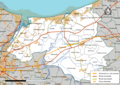
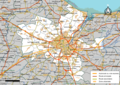
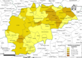
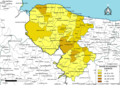
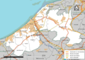
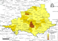
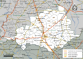
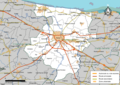
Français : Cartes des établissements publics de coopération intercommunale (communautés de communes, d’agglomération ou urbaines, métropoles, syndicats intercommunaux) et syndicats mixtes (dont les pôles métropolitains) du département français du Calvados.

Subcategories
This category has the following 6 subcategories, out of 6 total.
2
Media in category "Maps of groups of communes in Calvados"
The following 51 files are in this category, out of 51 total.
-
 Gemeindeverbände im Département Calvados 2025.png 3,500 × 2,766; 2.35 MB
-
 14-Intercos-2019.png 3,507 × 2,480; 2.26 MB
-
 14-Intercos2019-200065563-Densités.png 3,519 × 2,480; 1.59 MB
-
 14-Intercos2019-200065563.png 3,519 × 2,480; 2.81 MB
-
 14-Intercos2019-200065589-Densités.png 3,519 × 2,480; 1.36 MB
-
 14-Intercos2019-200065589.png 3,519 × 2,480; 2.66 MB
-
 14-Intercos2019-200065597-Densités.png 3,519 × 2,480; 2.29 MB
-
 14-Intercos2019-200065597.png 3,519 × 2,480; 4.19 MB
-
 14-Intercos2019-200066710-Densités.png 3,519 × 2,480; 1.78 MB
-
 14-Intercos2019-200066710.png 3,519 × 2,480; 2.7 MB
-
 14-Intercos2019-200066728-Densités.png 3,519 × 2,480; 1.33 MB
-
 14-Intercos2019-200066728.png 3,519 × 2,480; 2.43 MB
-
 14-Intercos2019-200066801-Densités.png 3,519 × 2,480; 2.29 MB
-
 14-Intercos2019-200066801.png 3,519 × 2,480; 3.67 MB
-
 14-Intercos2019-200066827-Densités.png 3,519 × 2,480; 1.45 MB
-
 14-Intercos2019-200066827.png 3,519 × 2,480; 2.55 MB
-
 14-Intercos2019-200068799-Densités.png 3,519 × 2,480; 2 MB
-
 14-Intercos2019-200068799.png 3,519 × 2,480; 3.52 MB
-
 14-Intercos2019-200069516-Densités.png 3,519 × 2,480; 2.02 MB
-
 14-Intercos2019-200069516.png 3,519 × 2,480; 3.55 MB
-
 14-Intercos2019-200069524-Densités.png 3,519 × 2,480; 1.86 MB
-
 14-Intercos2019-200069524.png 3,519 × 2,480; 3.09 MB
-
 14-Intercos2019-200069532-Densités.png 3,519 × 2,480; 2.35 MB
-
 14-Intercos2019-200069532.png 3,519 × 2,480; 3.8 MB
-
 14-Intercos2019-241400415-Densités.png 3,519 × 2,480; 1.13 MB
-
 14-Intercos2019-241400415.png 3,519 × 2,480; 1.96 MB
-
 14-Intercos2019-241400514-Densités.png 3,519 × 2,480; 2.08 MB
-
 14-Intercos2019-241400514.png 3,519 × 2,480; 3.19 MB
-
 14-Intercos2019-241400555.png 3,519 × 2,480; 2.71 MB
-
 14-Intercos2019-241400860-Densités.png 3,519 × 2,480; 1 MB
-
 14-Intercos2019-241400860.png 3,519 × 2,480; 1.87 MB
-
 14-Intercos2019-241400878-Densités.png 3,519 × 2,480; 1.89 MB
-
 14-Intercos2019-241400878.png 3,519 × 2,480; 2.84 MB
-
 Gemeindeverband Bayeux Intercom 2019.png 3,500 × 2,766; 2.03 MB
-
 Gemeindeverband Blangy Pont-l’Évêque Intercom 2019.png 3,500 × 2,766; 2.03 MB
-
 Gemeindeverband Caen la Mer 2020.png 3,500 × 2,766; 2.03 MB
-
 Gemeindeverband Cingal-Suisse Normande 2025.png 3,500 × 2,766; 2.32 MB
-
 Gemeindeverband Cœur Côte Fleurie 2019.png 3,500 × 2,766; 2.03 MB
-
 Gemeindeverband Cœur de Nacre 2019.png 3,500 × 2,766; 2.03 MB
-
 Gemeindeverband Vire au Noireau 2019.png 3,500 × 2,766; 2.03 MB
-
 Gemeindeverband Isigny-Omaha Intercom 2019.png 3,500 × 2,766; 2.03 MB
-
 Gemeindeverband Lisieux Normandie 2019.png 3,500 × 2,766; 2.03 MB
-
 Map of Bayeux Intercom.png 3,519 × 2,480; 1.61 MB
-
 Gemeindeverband Normandie-Cabourg-Pays d’Auge 2025.png 3,500 × 2,766; 2.32 MB
-
 Gemeindeverband Pays de Falaise 2019.png 3,500 × 2,766; 2.03 MB
-
 Gemeindeverband Pays de Honfleur-Beuzeville 2019.png 3,500 × 2,766; 2.06 MB
-
 Gemeindeverband Pré-Bocage Intercom 2019.png 3,500 × 2,766; 2.03 MB
-
 Gemeindeverband Seulles Terre et Mer 2019.png 3,500 × 2,766; 2.03 MB
-
 Gemeindeverband Terre d’Auge 2020.png 3,500 × 2,766; 2.03 MB
-
 Gemeindeverband Val ès Dunes 2025.png 3,500 × 2,766; 2.32 MB
-
 Gemeindeverband Vallées de l’Orne et de l’Odon 2025.png 3,500 × 2,766; 2.32 MB


