Category:Maps of groups of communes in Corrèze
Jump to navigation
Jump to search
Departments of Metropolitan France: Ain [01] · Aisne [02] · Allier [03] · Alpes-de-Haute-Provence [04] · Hautes-Alpes [05] · Alpes-Maritimes [06] · Ardèche [07] · Ardennes [08] · Ariège [09] · Aube [10] · Aude [11] · Aveyron [12] · Bouches-du-Rhône [13] · Calvados [14] · Cantal [15] · Charente [16] · Charente-Maritime [17] · Cher [18] · Corrèze [19] · Corse-du-Sud [2A]† · Haute-Corse [2B]† · Côte-d’Or [21] · Côtes-d'Armor [22] · Creuse [23] · Dordogne [24] · Doubs [25] · Drôme [26] · Eure [27] · Eure-et-Loir [28] · Finistère [29] · Gard [30] · Haute-Garonne [31] · Gers [32] · Gironde [33] · Hérault [34] · Ille-et-Vilaine [35] · Indre [36] · Indre-et-Loire [37] · Isère [38] · Jura [39] · Landes [40] · Loir-et-Cher [41] · Loire [42] · Haute-Loire [43] · Loire-Atlantique [44] · Loiret [45] · Lot [46] · Lot-et-Garonne [47] · Lozère [48] · Maine-et-Loire [49] · Manche [50] · Marne [51] · Haute-Marne [52] · Mayenne [53] · Meurthe-et-Moselle [54] · Meuse [55] · Morbihan [56] · Moselle [57] · Nièvre [58] · Nord [59] · Oise [60] · Orne [61] · Pas-de-Calais [62] · Puy-de-Dôme [63] · Pyrénées-Atlantiques [64] · Hautes-Pyrénées [65] · Pyrénées-Orientales [66] · Bas-Rhin [67] · Haut-Rhin [68] · departmental district of the Rhône [69] · Rhône [69D]‡ · Haute-Saône [70] · Saône-et-Loire [71] · Sarthe [72] · Savoie [73] · Haute-Savoie [74] · Seine-Maritime [76] · Seine-et-Marne [77] · Yvelines [78] · Deux-Sèvres [79] · Somme [80] · Tarn [81] · Tarn-et-Garonne [82] · Var [83] · Vaucluse [84] · Vendée [85] · Vienne [86] · Haute-Vienne [87] · Vosges [88] · Yonne [89] · Territoire de Belfort [90] · Essonne [91] · Hauts-de-Seine [92] · Seine-Saint-Denis [93] · Val-de-Marne [94] · Val-d'Oise [95]
Overseas departments and regions: Guadeloupe [971] · Martinique [972] · French Guiana [973] · Réunion [974] · Mayotte [976]
Sui generis territories: New Caledonia [988]
Overseas departments and regions: Guadeloupe [971] · Martinique [972] · French Guiana [973] · Réunion [974] · Mayotte [976]
Sui generis territories: New Caledonia [988]
| NO WIKIDATA ID FOUND! Search for Maps of groups of communes in Corrèze on Wikidata | |
| Upload media |
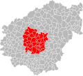
Français : Cartes des établissements publics de coopération intercommunale (communautés de communes, d’agglomération ou urbaines, métropoles, syndicats intercommunaux) et syndicats mixtes (dont les pôles métropolitains) du département français de la Corrèze.

Subcategories
This category has the following 4 subcategories, out of 4 total.
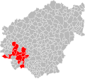
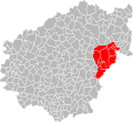
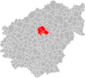
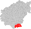
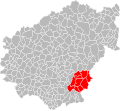
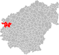
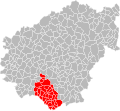
Media in category "Maps of groups of communes in Corrèze"
The following 69 files are in this category, out of 69 total.
-
 Gemeindeverbände im Département Corrèze 2023.png 3,500 × 4,020; 3.12 MB
-
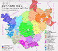
 19-Intercos-2019.png 3,507 × 2,480; 1.96 MB
-
 19-Intercos2019-200043172-Densités.png 3,519 × 2,480; 2.31 MB
-
 19-Intercos2019-200043172.png 3,519 × 2,480; 4.08 MB
-
 19-Intercos2019-200066603-Densités.png 3,519 × 2,480; 1.43 MB
-
 19-Intercos2019-200066603.png 3,519 × 2,480; 2.64 MB
-
 19-Intercos2019-200066645.png 3,519 × 2,480; 2.87 MB
-
 19-Intercos2019-200066744.png 3,519 × 2,480; 5.46 MB
-
 19-Intercos2019-200066751-Densités.png 3,519 × 2,480; 1.93 MB
-
 19-Intercos2019-200066751.png 3,519 × 2,480; 3.21 MB
-
 19-Intercos2019-200066769-Densités.png 3,519 × 2,480; 2.04 MB
-
 19-Intercos2019-200066769.png 3,519 × 2,480; 3.61 MB
-
 19-Intercos2019-241900133-Densités.png 3,519 × 2,480; 1.8 MB
-
 19-Intercos2019-241900133.png 3,519 × 2,480; 3.37 MB
-
 19-Intercos2019-241927201-Densités.png 3,519 × 2,480; 2.18 MB
-
 19-Intercos2019-241927201.png 3,519 × 2,480; 4.1 MB
-
 19-Intercos2019-241927243-Densités.png 3,519 × 2,480; 1.73 MB
-
 19-Intercos2019-241927243.png 3,519 × 2,480; 3.17 MB
-
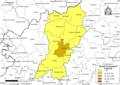
 Gemeindeverband Bassin de Brive 2019.png 3,500 × 4,020; 3.1 MB
-
 CA Brive carte.png 1,371 × 1,344; 185 KB
-
 EPCI Correze 19 2011.png 9,060 × 8,770; 6.93 MB
-
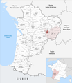
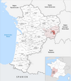
 FileLocalisation EPCI de Haute-Corrèze Communauté dans le Limousin, France.png 1,598 × 1,653; 690 KB
-
 Gemeindeverband Haute-Corrèze Communauté 2023.png 3,500 × 4,020; 3.15 MB
-
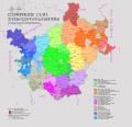
 Intercom 19.jpg 7,924 × 6,981; 14.69 MB
-
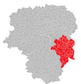
 Localisation EPCI Bassin de Brive dans la Corrèze, France.svg 1,000 × 921; 136 KB
-

-
 Localisation EPCI de Brive dans la Corrèze, France.svg 1,000 × 921; 138 KB
-

-

-
 Localisation EPCI de Juillac - Loyre - Auvézère dans la Corrèze, France.svg 1,000 × 921; 137 KB
-
 Localisation EPCI de Lubersac - Auvézère dans la Corrèze, France.svg 1,000 × 921; 137 KB
-
 Localisation EPCI de Ventadour dans la Corrèze, France.svg 1,000 × 921; 138 KB
-
 Localisation EPCI de Vézère Monédières dans la Corrèze, France.svg 1,000 × 921; 137 KB
-
 Localisation EPCI de Vézère Monédières Millesources dans la Corrèze, France.svg 1,000 × 921; 146 KB
-
 Localisation EPCI des gorges de la haute Dordogne dans la Corrèze, France.svg 1,000 × 921; 137 KB
-
 Localisation EPCI des Monédières dans la Corrèze, France.svg 1,000 × 921; 137 KB
-
 Localisation EPCI des portes du Causse dans la Corrèze, France.svg 1,000 × 921; 137 KB
-
 Localisation EPCI des trois A A20, A89 et Avenir dans la Corrèze, France.svg 1,000 × 921; 137 KB
-
 Localisation EPCI des villages du Midi corrézien dans la Corrèze, France.svg 1,000 × 921; 137 KB
-
 Localisation EPCI du canton de Beynat dans la Corrèze, France.svg 1,000 × 921; 137 KB
-
 Localisation EPCI du canton de MerCœur dans la Corrèze, France.svg 1,000 × 921; 137 KB
-
 Localisation EPCI du canton de Saint-Privat dans la Corrèze, France.svg 1,000 × 921; 137 KB
-

-
 Localisation EPCI du pays d'Argentat dans la Corrèze, France.svg 1,000 × 921; 137 KB
-
 Localisation EPCI du pays d'Eygurande dans la Corrèze, France.svg 1,000 × 921; 137 KB
-
 Localisation EPCI du pays d'Uzerche dans la Corrèze, France.svg 1,000 × 921; 137 KB
-
 Localisation EPCI du pays de l'Yssandonnais dans la Corrèze, France.svg 1,000 × 921; 137 KB
-
 Localisation EPCI du Pays de Lubersac-Pompadour dans la Corrèze, France.svg 1,000 × 921; 141 KB
-
 Localisation EPCI du pays de Pompadour dans la Corrèze, France.svg 1,000 × 921; 137 KB
-
 Localisation EPCI du plateau bortois dans la Corrèze, France.svg 1,000 × 921; 137 KB
-
 Localisation EPCI du sud corrézien dans la Corrèze, France.svg 1,000 × 921; 137 KB
-
 Localisation EPCI Midi Corrézien dans la Corrèze, France.svg 1,000 × 921; 154 KB
-
 Localisation EPCI Tulle Agglo dans la Corrèze, France.svg 1,000 × 921; 138 KB
-
 Localisation EPCI Ussel - Meymac, haute-Corrèze dans la Corrèze, France.svg 1,000 × 921; 138 KB
-
 Localisation EPCI Val et plateaux bortois dans la Corrèze, France.svg 1,075 × 923; 120 KB
-
 Localisation EPCI Vézère - Causse dans la Corrèze, France.svg 1,000 × 921; 137 KB
-
 Localisation EPCI Xaintrie ValDordogne dans la Corrèze, France.svg 1,000 × 921; 149 KB
-
 Gemeindeverband Midi Corrézien 2019.png 3,500 × 4,020; 3.1 MB
-
 Gemeindeverband Pays de Lubersac-Pompadour 2019.png 3,500 × 4,020; 3.1 MB
-
 Gemeindeverband Pays de Saint Yrieix 2023.png 3,500 × 4,020; 3.14 MB
-
 Gemeindeverband Pays d’Uzerche 2019.png 3,500 × 4,020; 3.1 MB
-
 Reforme EPCI Argentat Correze.png 5,941 × 5,941; 12.46 MB
-
 Reforme EPCI Brive Correze.png 5,941 × 5,941; 12.29 MB
-
 Reforme EPCI Tulle Correze.png 5,941 × 5,941; 12.41 MB
-
 Reforme EPCI Ussel Correze.png 5,941 × 5,941; 10.78 MB
-
 Gemeindeverband Tulle Agglo 2019.png 3,500 × 4,020; 3.1 MB
-
 Gemeindeverband Ventadour - Égletons - Monédières 2023.png 3,500 × 4,020; 3.11 MB
-
 Gemeindeverband Vézère-Monédières-Millesources 2023.png 3,500 × 4,020; 3.11 MB
-
 Gemeindeverband Xaintrie Val’Dordogne 2019.png 3,500 × 4,020; 3.1 MB


