Category:Maps of groups of communes in Nièvre
Jump to navigation
Jump to search
Departments of Metropolitan France: Ain [01] · Aisne [02] · Allier [03] · Alpes-de-Haute-Provence [04] · Hautes-Alpes [05] · Alpes-Maritimes [06] · Ardèche [07] · Ardennes [08] · Ariège [09] · Aube [10] · Aude [11] · Aveyron [12] · Bouches-du-Rhône [13] · Calvados [14] · Cantal [15] · Charente [16] · Charente-Maritime [17] · Cher [18] · Corrèze [19] · Corse-du-Sud [2A]† · Haute-Corse [2B]† · Côte-d’Or [21] · Côtes-d'Armor [22] · Creuse [23] · Dordogne [24] · Doubs [25] · Drôme [26] · Eure [27] · Eure-et-Loir [28] · Finistère [29] · Gard [30] · Haute-Garonne [31] · Gers [32] · Gironde [33] · Hérault [34] · Ille-et-Vilaine [35] · Indre [36] · Indre-et-Loire [37] · Isère [38] · Jura [39] · Landes [40] · Loir-et-Cher [41] · Loire [42] · Haute-Loire [43] · Loire-Atlantique [44] · Loiret [45] · Lot [46] · Lot-et-Garonne [47] · Lozère [48] · Maine-et-Loire [49] · Manche [50] · Marne [51] · Haute-Marne [52] · Mayenne [53] · Meurthe-et-Moselle [54] · Meuse [55] · Morbihan [56] · Moselle [57] · Nièvre [58] · Nord [59] · Oise [60] · Orne [61] · Pas-de-Calais [62] · Puy-de-Dôme [63] · Pyrénées-Atlantiques [64] · Hautes-Pyrénées [65] · Pyrénées-Orientales [66] · Bas-Rhin [67] · Haut-Rhin [68] · departmental district of the Rhône [69] · Rhône [69D]‡ · Haute-Saône [70] · Saône-et-Loire [71] · Sarthe [72] · Savoie [73] · Haute-Savoie [74] · Seine-Maritime [76] · Seine-et-Marne [77] · Yvelines [78] · Deux-Sèvres [79] · Somme [80] · Tarn [81] · Tarn-et-Garonne [82] · Var [83] · Vaucluse [84] · Vendée [85] · Vienne [86] · Haute-Vienne [87] · Vosges [88] · Yonne [89] · Territoire de Belfort [90] · Essonne [91] · Hauts-de-Seine [92] · Seine-Saint-Denis [93] · Val-de-Marne [94] · Val-d'Oise [95]
Overseas departments and regions: Guadeloupe [971] · Martinique [972] · French Guiana [973] · Réunion [974] · Mayotte [976]
Sui generis territories: New Caledonia [988]
Overseas departments and regions: Guadeloupe [971] · Martinique [972] · French Guiana [973] · Réunion [974] · Mayotte [976]
Sui generis territories: New Caledonia [988]
| NO WIKIDATA ID FOUND! Search for Maps of groups of communes in Nièvre on Wikidata | |
| Upload media |
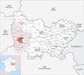
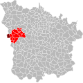
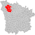
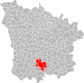
Français : Cartes des établissements publics de coopération intercommunale (communautés de communes, d’agglomération ou urbaines, métropoles, syndicats intercommunaux) et syndicats mixtes (dont les pôles métropolitains) du département français de la Nièvre.

Subcategories
This category has the following 5 subcategories, out of 5 total.
Media in category "Maps of groups of communes in Nièvre"
The following 44 files are in this category, out of 44 total.
-
 Gemeindeverbände im Département Nièvre 2024.png 3,500 × 3,111; 2.56 MB
-
 58-Nièvre-intercos-2019.png 3,507 × 2,480; 2 MB
-
 Gemeindeverband Amognes Cœur du Nivernais 2019.png 3,500 × 3,111; 2.55 MB
-
 Gemeindeverband Bazois Loire Morvan 2019.png 3,500 × 3,111; 2.55 MB
-
 Gemeindeverband Cœur de Loire 2023.png 3,500 × 3,111; 2.51 MB
-
 Gemeindeverband Haut Nivernais-Val d’Yonne 2019.png 3,500 × 3,111; 2.58 MB
-
 Gemeindeverband Les Bertranges - Bourgogne-Franche-Comté 2023.png 3,500 × 3,111; 2.51 MB
-
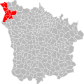
 Localisation EPCI de Nevers dans la Nièvre, France.svg 1,000 × 992; 103 KB
-
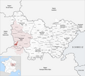
 Localisation EPCI des Amognes dans la Nièvre, France.svg 1,000 × 992; 104 KB
-
 Localisation EPCI des Bertranges à la Nièvre dans la Nièvre, France.svg 1,000 × 992; 103 KB
-
 Localisation EPCI des portes sud du Morvan dans la Nièvre, France.svg 1,000 × 992; 103 KB
-
 Localisation EPCI des vaux d'Yonne dans la Nièvre, France.svg 1,000 × 992; 103 KB
-
 Localisation EPCI du Bazois dans la Nièvre, France.svg 1,000 × 992; 103 KB
-
 Localisation EPCI du haut Morvan dans la Nièvre, France.svg 1,000 × 992; 104 KB
-
 Localisation EPCI du Nivernais Bourbonnais dans la Nièvre, France.svg 1,000 × 992; 103 KB
-
 Localisation EPCI du pays charitois dans la Nièvre, France.svg 1,000 × 992; 104 KB
-
 Localisation EPCI du pays corbigeois dans la Nièvre, France.svg 1,000 × 992; 104 KB
-
 Localisation EPCI du sud Morvan dans la Nièvre, France.svg 1,000 × 992; 103 KB
-
 Localisation EPCI du sud Nivernais dans la Nièvre, France.svg 1,000 × 992; 103 KB
-
 Localisation EPCI du val de Sauzay dans la Nièvre, France.svg 1,000 × 992; 103 KB
-
 Localisation EPCI du val du Beuvron dans la Nièvre, France.svg 1,000 × 992; 104 KB
-
 Localisation EPCI en Donziais dans la Nièvre, France.svg 1,000 × 992; 103 KB
-
 Localisation EPCI entre Loire et forêt dans la Nièvre, France.svg 1,000 × 992; 103 KB
-
 Localisation EPCI entre Loire et Morvan dans la Nièvre, France.svg 1,000 × 992; 103 KB
-
 Localisation EPCI entre Nièvres et forêts dans la Nièvre, France.svg 1,000 × 992; 103 KB
-
 Localisation EPCI Fil de Loire dans la Nièvre, France.svg 1,000 × 992; 103 KB
-
 Localisation EPCI La fleur du Nivernais dans la Nièvre, France.svg 1,000 × 992; 104 KB
-
 Localisation EPCI Le bon pays dans la Nièvre, France.svg 1,000 × 992; 103 KB
-
 Localisation EPCI Le cœur du Nivernais dans la Nièvre, France.svg 1,000 × 992; 103 KB
-
 Localisation EPCI Les grands lacs du Morvan dans la Nièvre, France.svg 1,000 × 992; 103 KB
-
 Localisation EPCI Les portes du Morvan dans la Nièvre, France.svg 1,000 × 992; 103 KB
-
 Localisation EPCI Loire et Allier dans la Nièvre, France.svg 1,000 × 992; 103 KB
-
 Localisation EPCI Loire et Nohain dans la Nièvre, France.svg 1,000 × 992; 103 KB
-
 Localisation EPCI Loire et Vignoble dans la Nièvre, France.svg 1,000 × 992; 103 KB
-
 Localisation EPCI Puisaye nivernaise dans la Nièvre, France.svg 1,000 × 992; 103 KB
-
 Localisation EPCI Sologne Bourbonnais-Nivernais dans la Nièvre, France.svg 1,000 × 992; 103 KB
-
 Gemeindeverband Loire et Allier 2024.png 3,500 × 3,111; 2.54 MB
-
 Gemeindeverband Morvan Sommets et Grands Lacs 2019.png 3,500 × 3,111; 2.55 MB
-
 Gemeindeverband Moulins Communauté - Bourgogne-Franche-Comté 2019.png 3,500 × 3,111; 2.55 MB
-
 Gemeindeverband Nevers 2024.png 3,500 × 3,111; 2.55 MB
-
 Gemeindeverband Nivernais Bourbonnais 2019.png 3,500 × 3,111; 2.55 MB
-
 Gemeindeverband Puisaye-Forterre 2019.png 3,500 × 3,111; 2.58 MB
-
 Gemeindeverband Sud Nivernais 2019.png 3,500 × 3,111; 2.55 MB
-
 Gemeindeverband Tannay-Brinon-Corbigny 2019.png 3,500 × 3,111; 2.55 MB


