Category:Maps of groups of communes in Cher to 2018
Jump to navigation
Jump to search
Media in category "Maps of groups of communes in Cher to 2018"
The following 46 files are in this category, out of 46 total.
-
 Gemeindeverband Arnon Boischaut Cher 2018.png 3,500 × 3,619; 2.59 MB
-
 Gemeindeverband Berry Grand Sud 2018.png 3,500 × 3,619; 2.59 MB
-
 Gemeindeverband Berry-Loire-Vauvise 2018.png 3,500 × 3,619; 2.59 MB
-
 Gemeindeverband Bourges Plus 2018.png 3,500 × 3,619; 2.59 MB
-
 Gemeindeverband Cœur de Berry 2018.png 3,500 × 3,619; 2.59 MB
-
 Gemeindeverband Cœur de France 2018.png 3,500 × 3,619; 2.59 MB
-
 Gemeindeverband Fercher Pays Florentais 2018.png 3,500 × 3,619; 2.59 MB
-
 Gemeindeverbände im Département Cher 2018.png 3,500 × 3,619; 2.61 MB
-
 Gemeindeverband La Septaine 2018.png 3,500 × 3,619; 2.59 MB
-
 Gemeindeverband Le Dunois 2018.png 3,500 × 3,619; 2.59 MB
-
 Gemeindeverband Les Trois Provinces 2018.png 3,500 × 3,619; 2.59 MB
-
 Gemeindeverband Les Villages de la Forêt 2018.png 3,500 × 3,619; 2.59 MB
-
 Localisation EPCI Arnon Boischaut Cher dans le Cher, France.svg 1,000 × 1,358; 134 KB
-
 Localisation EPCI Berry Loire Vauvize dans le Cher, France.svg 1,000 × 1,358; 134 KB
-
 Localisation EPCI Boischaut - Marche dans le Cher, France.svg 1,000 × 1,358; 134 KB
-
 Localisation EPCI Bourges Plus dans le Cher, France.svg 1,000 × 1,358; 134 KB
-
 Localisation EPCI Coeur de Berry dans le Cher, France.svg 1,000 × 1,358; 136 KB
-
 Localisation EPCI Cœur de France dans le Cher, France.svg 1,000 × 1,358; 134 KB
-
 Localisation EPCI Cœur du pays fort dans le Cher, France.svg 1,000 × 1,358; 134 KB
-
 Localisation EPCI de la Septaine dans le Cher, France.svg 1,000 × 1,358; 134 KB
-
 Localisation EPCI des hautes terres en haut Berry dans le Cher, France.svg 1,000 × 1,358; 134 KB
-
-
 Localisation EPCI des terres du Grand Meaulnes dans le Cher, France.svg 1,000 × 1,358; 134 KB
-
 Localisation EPCI des trois provinces dans le Cher, France.svg 1,000 × 1,358; 134 KB
-
 Localisation EPCI du Dunois dans le Cher, France.svg 1,000 × 1,358; 134 KB
-
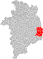
 Localisation EPCI du pays de Nérondes dans le Cher, France.svg 1,000 × 1,358; 134 KB
-
 Localisation EPCI du Sancerrois dans le Cher, France.svg 1,000 × 1,358; 134 KB
-
 Localisation EPCI en terres vives dans le Cher, France.svg 1,000 × 1,358; 134 KB
-
 Localisation EPCI Fercher Pays florentais dans le Cher, France.svg 1,000 × 1,358; 134 KB
-
 Localisation EPCI Haut Berry Val de Loire dans le Cher, France.svg 1,000 × 1,358; 134 KB
-
 Localisation EPCI les terres d'Yèvre dans le Cher, France.svg 1,000 × 1,358; 134 KB
-
 Localisation EPCI les terroirs d'Angillon dans le Cher, France.svg 1,000 × 1,358; 134 KB
-
 Localisation EPCI les vals de Cher et d'Arnon dans le Cher, France.svg 1,000 × 1,358; 134 KB
-
 Localisation EPCI les villages de la forêt dans le Cher, France.svg 1,000 × 1,358; 134 KB
-
 Localisation EPCI Pays Fort Sancerrois Val de Loire dans le Cher, France.svg 1,000 × 1,358; 146 KB
-
 Localisation EPCI Sauldre et Sologne dans le Cher, France.svg 1,000 × 1,358; 134 KB
-
 Localisation EPCI Terres du Haut Berry dans le Cher, France.svg 1,000 × 1,358; 147 KB
-
 Localisation EPCI Vierzon - Sologne - Berry dans le Cher, France.svg 1,000 × 1,358; 135 KB
-
 Gemeindeverband Loire, Nièvre et Bertranges - Centre-Val de Loire 2018.png 3,500 × 3,619; 2.59 MB
-
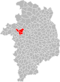
 Gemeindeverband Pays de Nérondes 2018.png 3,500 × 3,619; 2.59 MB
-
 Gemeindeverband Pays d’Issoudun 2018.png 3,500 × 3,619; 2.6 MB
-
 Gemeindeverband Pays Fort Sancerrois Val de Loire 2018.png 3,500 × 3,619; 2.59 MB
-
 Gemeindeverband Portes du Berry entre Loire et Val d’Aubois 2018.png 3,500 × 3,619; 2.59 MB
-
 Gemeindeverband Sauldre et Sologne 2018.png 3,500 × 3,619; 2.59 MB
-
 Gemeindeverband Terres du Haut Berry 2018.png 3,500 × 3,619; 2.59 MB
-
 Gemeindeverband Vierzon-Sologne-Berry 2018.png 3,500 × 3,619; 2.59 MB


