Category:Topographic maps of France
Appearance
Subcategories
This category has the following 16 subcategories, out of 16 total.
Media in category "Topographic maps of France"
The following 86 files are in this category, out of 86 total.
-
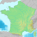
1800x1730-France-Découpe-Relief.jpg 1,800 × 1,730; 797 KB
-
1800x1730-France-villes.jpg 1,800 × 1,730; 463 KB
-
1914 Guerre Européenne 1915. Carte relief no 2, Les Vosges - btv1b10223545n.jpg 6,400 × 5,053; 4.14 MB
-
2000x2000-France-radar-Régions.jpg 2,000 × 2,000; 1.41 MB
-
343x340-FRANCE RADAR 1.PNG 400 × 385; 341 KB
-
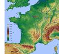
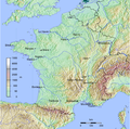
500x500-GMT France topo.jpg 500 × 500; 115 KB
-
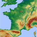
600x600 GMT France topo-R1.jpg 600 × 600; 343 KB
-
800x768-France-Topo-Montagnes.png 800 × 768; 1.26 MB
-
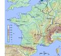
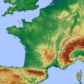
800x769-France-topo-R1.jpg 800 × 769; 209 KB
-
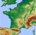
800x769-France-topo-Régions-R1.jpg 800 × 769; 221 KB
-
800x769-France-topo-V.svg 800 × 769; 1.4 MB
-
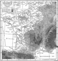
90 of 'La France Illustrée- géographie générale ... Par F. J' (11200002736).jpg 1,271 × 1,710; 821 KB
-
After Action Report - Amiens - NARA - 100384897.jpg 10,796 × 7,810; 10.95 MB
-
After Action Report - Arlon - NARA - 100384899.jpg 10,800 × 7,776; 10.46 MB
-
After Action Report - Verdun - NARA - 100384901.jpg 10,792 × 7,773; 10.49 MB
-
Bassigny-localisation.jpg 720 × 688; 101 KB
-
Bordeaux dot2.png 567 × 568; 559 KB
-
Borne (rivière de l'Ardèche) OSM.png 872 × 1,192; 2.02 MB
-
Carte de la France avec ses établissements politiques, militaires, civils et religieux (15521001).jpg 30,252 × 20,234; 170.67 MB
-
Carte du nivellement général de la France figuré par des courbes d'altitude - btv1b53083207m.jpg 15,129 × 15,791; 39.76 MB
-
Carte France geo R2.png 645 × 634; 321 KB
-
Carte France geo R2c.png 645 × 634; 282 KB
-
Carte-de-France.jpg 1,454 × 1,352; 2.57 MB
-
DEMsuedlicher-oberrhein.jpg 3,172 × 2,084; 833 KB
-
France airport map.pdf 1,283 × 1,181; 513 KB
-
France alti nord.png 1,500 × 623; 596 KB
-
France alti sud.png 1,350 × 624; 677 KB
-
France cities.png 1,797 × 1,796; 3.53 MB
-
France jms.png 280 × 278; 28 KB
-
France Large East topographic map-fr.png 2,000 × 1,922; 4.63 MB
-
France Large East topographic map.png 2,000 × 1,922; 4.63 MB
-
France Midi 45° Latitude.jpg 2,003 × 1,924; 2.25 MB
-
France NL regions.png 742 × 722; 899 KB
-
France radar 2.jpg 2,172 × 2,074; 3.13 MB
-
France radar.jpg 2,172 × 2,074; 3.2 MB
-
France relief location carte carte regions et departements.png 800 × 769; 946 KB
-
France relief location map Large South west highlighted.png 2,000 × 1,922; 4.65 MB
-
France relief location map South East highlighted-fr.png 2,000 × 1,922; 4.66 MB
-
France relief location map South East highlighted.png 2,000 × 1,922; 4.66 MB
-
France relief location map South West highlighted-fr.png 2,000 × 1,922; 5.57 MB
-
France relief location map.jpg 2,000 × 1,922; 907 KB
-
France relief-es.png 1,000 × 961; 57 KB
-
France relief.png 1,000 × 961; 102 KB
-
France sites unesco.png 2,000 × 1,796; 4.56 MB
-
France with Corsica (demis).png 697 × 698; 838 KB
-
France with Corsica2 (demis).png 697 × 698; 681 KB
-
France русский.gif 1,050 × 827; 154 KB
-
France1911topo.png 1,840 × 1,928; 3.28 MB
-
France2.JPG 1,034 × 1,422; 223 KB
-
Frankrijk map.png 1,280 × 948; 1.88 MB
-
Frejus.citiesFrance.png 800 × 765; 228 KB
-
FrenchTop25Cities.png 1,022 × 970; 1.67 MB
-
GMT France 2.pdf 1,283 × 1,181; 433 KB
-
GMT France 2.png 600 × 600; 185 KB
-
GMT France 20 largest cities.pdf 1,283 × 1,181; 508 KB
-
GMT France 20 largest cities.png 1,841 × 1,832; 4.3 MB
-
GMT France with altitudes 30s.png 2,000 × 1,992; 3.57 MB
-
GMT France with altitudes.pdf 1,181 × 1,181; 145 KB
-
GMT France with altitudes.png 1,000 × 992; 377 KB
-
Karte der Gebirgsgruppen in den Alpen.png 9,930 × 5,848; 9.32 MB
-
La2-demis-france.png 698 × 717; 207 KB
-
LGV Bordeaux Toulouse sur une carte topographique.svg 1,028 × 885; 2.91 MB
-
Localisation barrois.jpg 2,172 × 2,074; 1.26 MB
-
Location Authie and Bresle River-fr.svg 1,145 × 1,200; 567 KB
-
LondonCalaisParis.png 1,229 × 789; 1.43 MB
-
Map of Gauray - NARA - 100384779.jpg 7,252 × 5,811; 5.43 MB
-
Massif central Relief.png 3,447 × 4,772; 2.27 MB
-
Maures carte.jpg 2,000 × 1,898; 2.21 MB
-
Mountain ranges of France map-fr.svg 2,602 × 2,525; 2.08 MB
-
Northeast Atlantic bathymetry.png 413 × 323; 347 KB
-
Orographische Karte von Frankreich - btv1b53260595g.jpg 14,634 × 13,200; 26.95 MB
-
Adour basin.png 395 × 401; 326 KB
-
Reliefkarte Frankreich.png 2,958 × 2,869; 10.28 MB
-
Frankreich Relief.png 685 × 660; 837 KB
-
Sologne France topo.jpg 2,519 × 2,480; 2.02 MB
-
Sologne localization.jpg 2,172 × 2,074; 1.11 MB
-
W France slope map.png 3,074 × 5,117; 3.82 MB
-
WEB-RSF-carte-zone-de-diffusion4.gif 517 × 456; 101 KB
-
Winde Frankreich.png 828 × 528; 605 KB
-
الجارون.png 608 × 555; 625 KB


