Category:SVG topographic maps of France
Jump to navigation
Jump to search
Countries of Europe: Albania · Andorra · Armenia‡ · Austria · Azerbaijan‡ · Belarus · Belgium · Bosnia and Herzegovina · Bulgaria · Croatia · Cyprus‡ · Czech Republic · Denmark · Estonia · Finland · France‡ · Georgia‡ · Germany · Greece · Hungary · Iceland · Republic of Ireland · Italy · Kazakhstan‡ · Latvia · Liechtenstein · Lithuania · Luxembourg · Malta · Moldova · Montenegro · Netherlands‡ · North Macedonia · Norway · Poland · Portugal‡ · Romania · Russia‡ · San Marino · Serbia · Slovakia · Slovenia · Spain‡ · Sweden · Switzerland · Turkey‡ · Ukraine · United Kingdom
‡: partly located in Europe
‡: partly located in Europe
Media in category "SVG topographic maps of France"
The following 36 files are in this category, out of 36 total.
-
 Alpenkarte.svg 3,178 × 1,871; 2.42 MB
-
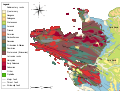
 Armorican Massif geological map-fr.svg 1,770 × 1,300; 981 KB
-
 Arques drainage basin-fr.svg 2,258 × 1,975; 2 MB
-
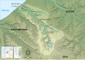 Bresle Drainage Basin-fr.svg 1,024 × 717; 308 KB
-
 Carte physique simplifiée de la France-br.svg 1,797 × 1,796; 358 KB
-
 Carte physique simplifiée de la France-es.svg 1,797 × 1,796; 388 KB
-
 Carte physique simplifiée de la France.svg 1,797 × 1,796; 336 KB
-
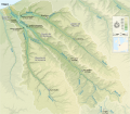
 Carte topographique du bassin du Grand Morin (France).svg 1,099 × 683; 3.94 MB
-
 Fond de carte Tour de France-blank.svg 2,110 × 2,525; 1.79 MB
-
 France in Europe (natural) (-mini map).svg 1,401 × 1,198; 7.16 MB
-
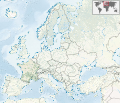 France in Europe (natural).svg 1,401 × 1,198; 8.42 MB
-
 France in Europe (relief) (-mini map).svg 1,401 × 1,198; 8.09 MB
-
 France in Europe (relief).svg 1,401 × 1,198; 11.64 MB
-
 France map Lambert-93 topographic with regions and departements-blank.svg 2,000 × 1,898; 1.67 MB
-
 France map Lambert-93 topographic with regions-blank.svg 2,000 × 1,898; 1.61 MB
-
 France map Lambert-93 topographic-blank.svg 2,000 × 1,898; 1.56 MB
-
 Geologic map Armorican Massif BR.svg 1,770 × 1,340; 985 KB
-
 Geologic map Armorican Massif EN.svg 1,770 × 1,340; 986 KB
-
 Geologic map Armorican Massif es.svg 1,770 × 1,340; 1.13 MB
-
 Geologic map Armorican Massif FR.svg 1,770 × 1,340; 962 KB
-
 Geologic map of Armorican Massif FR.png 846 × 647; 389 KB
-
 Geologic map SE England & Channel EN.svg 1,374 × 890; 1.65 MB
-
 Geologic map SE England & NW France FR.svg 1,374 × 890; 1.44 MB
-
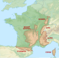 Mountain ranges of France map-fr.svg 2,602 × 2,525; 2.08 MB
-
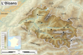 Oisans topographic map-fr.svg 1,953 × 1,302; 2.34 MB
-
 Red Ball 1944 august 25-fr.svg 973 × 589; 830 KB
-
 Red Ball 1944 november 30-fr.svg 973 × 589; 990 KB
-
 Red Ball 1944 october 10-fr.svg 973 × 589; 949 KB
-
 Red Ball 1944 october 16-fr.svg 973 × 589; 962 KB
-
 Red Ball 1944 september 10-fr.svg 973 × 589; 901 KB
-
 Red Ball 1944 september 16-fr.svg 973 × 589; 921 KB
-
 Red Ball 1944 september 20-fr.svg 973 × 589; 923 KB
-
 Topographic map of Garonne and Adour.svg 642 × 627; 2.9 MB
-
 Topographic map of South-West France with main rivers and cities.svg 1,028 × 885; 2.9 MB
-
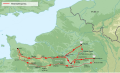
 Tour de France base map empty.svg 2,385 × 2,292; 5.87 MB
-
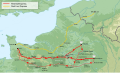
 Tour de France base map.svg 2,385 × 2,292; 5.85 MB


.svg)
_(-mini_map).svg)
.svg)
_(-mini_map).svg)
.svg)


