Category:Topographic maps of Kazakhstan
Jump to navigation
Jump to search
Countries of Europe: Albania · Andorra · Armenia‡ · Austria · Azerbaijan‡ · Belarus · Belgium · Bosnia and Herzegovina · Bulgaria · Croatia · Cyprus‡ · Czech Republic · Denmark · Estonia · Finland · France‡ · Georgia‡ · Germany · Greece · Hungary · Iceland · Republic of Ireland · Italy · Kazakhstan‡ · Latvia · Liechtenstein · Lithuania · Luxembourg · Malta · Moldova · Monaco · Montenegro · Netherlands‡ · North Macedonia · Norway · Poland · Portugal‡ · Romania · Russia‡ · San Marino · Serbia · Slovakia · Slovenia · Spain‡ · Sweden · Switzerland · Turkey‡ · Ukraine · United Kingdom
Specific status: Faroe Islands · Isle of Man · Svalbard – Limited recognition: Kosovo
‡: partly located in Europe
Specific status: Faroe Islands · Isle of Man · Svalbard – Limited recognition: Kosovo
‡: partly located in Europe
Subcategories
This category has only the following subcategory.
S
Media in category "Topographic maps of Kazakhstan"
The following 26 files are in this category, out of 26 total.
-
 Altai, Tienschan-Orte.png 660 × 471; 560 KB
-
 KazahDribSopk.PNG 507 × 426; 410 KB
-
 Kazakhstan Physiography.jpg 2,003 × 2,017; 1.69 MB
-
 Kazakhstan topographic location map conic.png 1,200 × 700; 1.39 MB
-
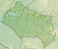
 KZ Akmola Region Relief.png 835 × 561; 820 KB
-
 KZ Aktobe Region Relief.png 629 × 561; 754 KB
-
 KZ Almaty Region Relief.png 804 × 626; 830 KB
-
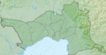 KZ Atyrau Region Relief.png 865 × 446; 685 KB
-
 KZ East Kazakhstan Region Relief.png 649 × 561; 583 KB
-
 KZ Jambyl Region Relief.png 743 × 561; 595 KB
-
 KZ Karaganda Region Relief.png 985 × 585; 922 KB
-
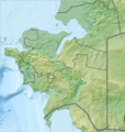
 KZ Kostanay Region Relief.png 455 × 561; 558 KB
-
 KZ Kyzylorda Region Relief.png 658 × 561; 475 KB
-
 KZ Mangystau Region Relief.png 534 × 561; 533 KB
-
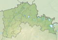 KZ North Kazakhstan Region Relief.png 825 × 574; 557 KB
-
 KZ Pavlodar Region Relief.png 520 × 600; 605 KB
-
 KZ Turkistan Region Relief.png 413 × 621; 435 KB
-
 KZ West Kazakhstan Region Relief.png 783 × 566; 747 KB
-
 Locator map of Gora Saryshoky in Kazakhstan.png 256 × 145; 61 KB
-
 Markakol map-ru librsvg.png 1,278 × 1,949; 2.76 MB
-
 Markakol map-ru rendersvg.png 1,278 × 1,949; 3.65 MB
-
 Relief Map of Central Kazakhstan.jpg 482 × 659; 282 KB
-
 Relief Map of Eastern Kazakhstan.png 516 × 656; 660 KB
-
 Relief Map of Kazakhstan.png 1,200 × 686; 1.24 MB
-
 Relief Map of Western Kazakhstan.jpg 515 × 686; 284 KB
-
 Рельєфна карта Північно-Казахстанської області.png 351 × 213; 150 KB


