
Category:Topographic maps of volcanoes in France
Subcategories
This category has the following 3 subcategories, out of 3 total.
Media in category "Topographic maps of volcanoes in France"
The following 7 files are in this category, out of 7 total.
-

-
 Monts Dore Volcano Relief Map, SRTM-1.jpg 1,500 × 1,500; 1.43 MB
-
 Monts du Cantal Relief Map, SRTM-1.jpg 2,000 × 2,000; 3 MB
-
 Piton Fournaise topo map-fr.svg 1,000 × 1,166; 461 KB
-
 Puy de Dôme Relief Map, SRTM-1.jpg 800 × 600; 267 KB
-
 Puy de Lassolas.png 494 × 469; 198 KB
-
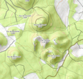
 Puy Pariou.png 511 × 474; 199 KB


