Category:Topographic maps of Greece
Jump to navigation
Jump to search
Subcategories
This category has the following 11 subcategories, out of 11 total.
C
- Topographic maps of Crete (15 F)
M
S
- SVG topographic maps of Greece (83 F)
T
- Topographic maps of Chios (5 F)
- Topographic maps of Corfu (15 F)
Media in category "Topographic maps of Greece"
The following 133 files are in this category, out of 133 total.
-
 Greece relief location map.jpg 1,003 × 825; 691 KB
-
 Reliefkarte Griechenland.png 2,943 × 2,557; 7.36 MB
-
 Aderes map.png 831 × 545; 348 KB
-
 Imbris 1910 year map.jpg 7,604 × 5,017; 7.55 MB
-
 Aegean Sea map bathymetry ar.svg 4,688 × 5,700; 5.18 MB
-
 Agia Paraskevi Morphological Marking.jpg 980 × 931; 254 KB
-
 Ancient Regions Epirus and Macedon.png 800 × 800; 603 KB
-
 Argolic gulf.jpg 906 × 574; 109 KB
-
 Cape Matapan.PNG 1,197 × 1,056; 212 KB
-
 Chalkidiki - DEM Map Topo - DE.png 2,072 × 1,296; 1.42 MB
-
 Corinth.png 460 × 344; 69 KB
-
 Dimos Agias Topo.png 776 × 1,087; 1.03 MB
-
 Dimos Alexandreias Topo.png 1,264 × 1,072; 1,022 KB
-
 Dimos Alexandroupolis Topo.png 1,253 × 952; 1.21 MB
-
 Dimos Almirou Topo.png 1,544 × 1,084; 1.9 MB
-
 Dimos Almopias Topo.png 1,404 × 1,001; 2.4 MB
-
 Dimos Amfipolis Topo.png 1,215 × 977; 1.25 MB
-
 Dimos AmpelokiponMenemenis Road.png 1,680 × 1,085; 1.54 MB
-
 Dimos Amyntaiou Topo.png 1,088 × 1,009; 1.42 MB
-
 Dimos Argitheas Topo.png 1,001 × 1,005; 2.27 MB
-
 Dimos Aristoteli Topo.png 1,381 × 1,175; 1.54 MB
-
 Dimos Arrianon Topo.png 1,121 × 977; 1.68 MB
-
 Dimos Avdiron Map.png 1,113 × 1,040; 990 KB
-
 Dimos Delta Topo.png 1,186 × 1,179; 744 KB
-
 Dimos Deskatis Topo.png 1,191 × 1,009; 2.24 MB
-
 Dimos Didymotichou Topo.png 1,356 × 856; 964 KB
-
 Dimos Diou Olympou Topo.png 943 × 1,112; 1.04 MB
-
 Dimos DistomouArachovasAntikyras Topo.png 1,023 × 981; 1.85 MB
-
 Dimos Doxatou Topo.png 1,521 × 1,095; 793 KB
-
 Dimos Dramas Topo.png 657 × 1,063; 1.25 MB
-
 Dimos Edessas Map.png 1,499 × 1,005; 562 KB
-
 Dimos Edessas Topo.png 1,487 × 1,007; 2.68 MB
-
 Dimos Elassonas Topo.png 1,013 × 1,092; 2.07 MB
-
 Dimos Emmanouil Papa Topo.png 894 × 1,065; 1.37 MB
-
 Dimos Eordaias Topo.png 1,103 × 1,008; 1.59 MB
-
 Dimos Farkadonas Topo.png 1,302 × 1,079; 2.09 MB
-
 Dimos Farsalon Topo.png 1,319 × 1,087; 1.76 MB
-
 Dimos Florinas Topo.png 1,602 × 1,117; 2.29 MB
-
 Dimos Grevenon Topo.png 1,429 × 1,005; 2.81 MB
-
 Dimos Halkidonos Topo.png 1,167 × 1,112; 1.22 MB
-
 Dimos Iasmou Map.png 1,012 × 978; 989 KB
-
 Dimos Irakleias Topo.png 1,046 × 1,060; 953 KB
-
 Dimos Kalampakas Topo.png 1,920 × 1,014; 3.46 MB
-
 Dimos Karditsas Topo.png 856 × 1,074; 1.35 MB
-
 Dimos Kassandras Topo.png 1,667 × 1,172; 1.2 MB
-
 Dimos Kastorias Topo.png 1,162 × 1,009; 1.97 MB
-
 Dimos Katerinis Topo.png 1,657 × 1,200; 3.1 MB
-
 Dimos Kato Nevrokopiou Topo.png 1,316 × 984; 2.25 MB
-
 Dimos Kileler Topo.png 1,524 × 1,084; 1.46 MB
-
 Dimos Kilkis Topo.png 878 × 1,032; 1.17 MB
-
 Dimos Komotinis Topo.png 997 × 981; 1.17 MB
-
 Dimos KordeliouEvosmou Road.png 1,392 × 1,148; 1.12 MB
-
 Dimos Kozanis Topo.png 1,142 × 1,011; 1.94 MB
-
 Dimos Langada Topo.png 877 × 1,117; 1.54 MB
-
 Dimos Lariseon Road.png 1,296 × 1,144; 718 KB
-
 Dimos Lariseon Topo.png 1,150 × 1,079; 1.57 MB
-
 Dimos Limnis Plastira Topo.png 1,231 × 1,081; 2.11 MB
-
 Dimos Maronias-Sapon Map.png 1,242 × 898; 1.2 MB
-
 Dimos Mouzakiou Topo.png 1,571 × 1,082; 2.44 MB
-
 Dimos Mykis Map.png 1,275 × 942; 2.13 MB
-
 Dimos Naousas Topo.png 1,352 × 976; 2 MB
-
 Dimos NeapolisSykeon Road.png 1,550 × 1,117; 1.54 MB
-
 Dimos Neas Propontidas Topo.png 1,073 × 1,172; 1.15 MB
-
 Dimos Nestoriou Topo.png 743 × 1,071; 1.57 MB
-
 Dimos Nestou Map.png 724 × 934; 798 KB
-
 Dimos Notiou Piliou Topo.png 993 × 1,144; 1.13 MB
-
 Dimos Orestiadas Topo.png 1,298 × 967; 1.14 MB
-
 Dimos OrestidosTopo.png 1,670 × 948; 2.8 MB
-
 Dimos Paionias Topo.png 1,100 × 1,009; 1.36 MB
-
 Dimos Palama Topo.png 1,759 × 1,042; 1.62 MB
-
 Dimos Pangeou Map.png 1,305 × 950; 1.2 MB
-
 Dimos Paranestiou Topo.png 952 × 1,013; 1.93 MB
-
 Dimos Pavlou Mela Road.png 958 × 1,106; 938 KB
-
 Dimos Pellas Topo 2.png 1,191 × 1,019; 1.09 MB
-
 Dimos Pellas Topo.png 1,255 × 1,148; 975 KB
-
 Dimos Polygyrou Topo.png 1,354 × 1,175; 1.92 MB
-
 Dimos Prespon Topo.png 1,049 × 1,116; 2.01 MB
-
 Dimos Prosotsanis Topo.png 1,165 × 984; 1.45 MB
-
 Dimos Pydnas-Kolindrou Topo.png 1,477 × 1,117; 2.14 MB
-
 Dimos Pylis Topo.png 1,920 × 1,054; 3.99 MB
-
 Dimos Riga Feraiou Topo.png 1,146 × 1,148; 1.48 MB
-
 Dimos Serron Topo.png 967 × 1,001; 1.12 MB
-
 Dimos Servion-Velventou Topo.png 896 × 1,012; 1.52 MB
-
 Dimos Sintikis Topo.png 1,663 × 871; 2.09 MB
-
 Dimos Sithonias Topo.png 955 × 1,172; 825 KB
-
 Dimos Skydras Topo.png 760 × 1,065; 1.13 MB
-
 Dimos Sofadon Topo.png 817 × 1,148; 1.09 MB
-
 Dimos Soufliou Topo.png 1,113 × 978; 1.53 MB
-
 Dimos Tempon Topo.png 853 × 1,142; 1.32 MB
-
 Dimos Thermaikou Topo.png 1,290 × 1,172; 1.23 MB
-
 Dimos Thermis Topo.png 1,322 × 1,117; 2.23 MB
-
 Dimos Trikkaion Topo.png 1,291 × 1,085; 1.77 MB
-
 Dimos Veroias Topo.png 1,058 × 999; 1.5 MB
-
 Dimos Visaltias Topo.png 1,636 × 980; 2.02 MB
-
 Dimos Voiou Topo.png 1,560 × 1,005; 2.52 MB
-
 Dimos Volvis Topo.png 1,732 × 1,099; 3.02 MB
-
 Dimos Xanthis Topo.png 1,624 × 1,005; 2.55 MB
-
 EpirusMycynaen.jpg 359 × 353; 32 KB
-
 Euboea topo.png 1,500 × 1,117; 1.68 MB
-
 Gerakas Morphological Marking.jpg 980 × 931; 254 KB
-
 Greece (ancient) Attica (relief-cropped).png 640 × 578; 380 KB
-
 Greece (ancient) Central (relief-cropped).png 640 × 414; 305 KB
-
 Greece (ancient) Chalcidice (relief-cropped).png 1,024 × 774; 615 KB
-
 Greece (ancient) Epirus (relief-cropped).png 640 × 603; 346 KB
-
 Greece (ancient) Euboea (relief-cropped).png 1,024 × 796; 717 KB
-
 Greece (ancient) IonianIslands (relief-cropped).png 828 × 1,280; 292 KB
-
 Greece (ancient) Macedonia (relief-cropped).png 1,024 × 716; 590 KB
-
 Greece (ancient) Thessaly (relief-cropped).png 640 × 336; 203 KB
-
 Greece 34 43 17 30 blank map.png 1,197 × 1,056; 107 KB
-
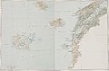
 Greece and the Aegean (Times Survey Atlas of the World 1922).jpg 901 × 715; 313 KB
-
 Greece Physiography.jpg 2,008 × 2,673; 1.54 MB
-
 Greece topo.jpg 1,400 × 1,193; 547 KB
-
 Griechenland topo.jpg 1,400 × 1,193; 535 KB
-
 Halandri Morphological Map.jpg 980 × 931; 255 KB
-
 Imbris 1829 year map.jpg 3,714 × 2,472; 3.9 MB
-
 Kreta topo prefekturen inseln.jpg 636 × 271; 39 KB
-
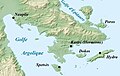
 Le golfe de corinthe.png 630 × 454; 361 KB
-
 Location of Locris.png 301 × 301; 51 KB
-
 Map-of-greece.jpg 1,276 × 1,214; 1.52 MB
-
 Mesogeia attica map.png 794 × 523; 340 KB
-
 Meyisti.png 587 × 381; 58 KB
-
 Peloponnesian War - North - Culture.png 1,600 × 1,207; 634 KB
-
 Pendeli Map.jpg 950 × 978; 257 KB
-
 Prespavalley.png 725 × 904; 484 KB
-
 Rhodos topo.png 1,500 × 1,496; 1 MB
-
 Samothraki Topo.png 1,485 × 908; 1.11 MB
-
 Skorpios map.png 717 × 800; 212 KB
-
 Thasos Topo.png 1,174 × 1,148; 1.29 MB
-
 Thriasio map.png 690 × 472; 274 KB
-
 Topographic Map Of Chech.png 1,952 × 1,373; 3.92 MB
-
 Valley of Spercheios location map.png 800 × 325; 338 KB
-
 Valley of Spercheios map.png 800 × 362; 379 KB
-
 केलिप्सो गर्त.png 1,003 × 825; 1.47 MB


_Attica_(relief-cropped).png)
_Central_(relief-cropped).png)
_Chalcidice_(relief-cropped).png)
_Epirus_(relief-cropped).png)
_Euboea_(relief-cropped).png)
_IonianIslands_(relief-cropped).png)
_Macedonia_(relief-cropped).png)
_Thessaly_(relief-cropped).png)
.jpg)


