Category:Topographic maps of Serbia
Jump to navigation
Jump to search
Subcategories
This category has the following 3 subcategories, out of 3 total.
M
S
T
Media in category "Topographic maps of Serbia"
The following 16 files are in this category, out of 16 total.
-
 Carpathians-satellite.jpg 2,625 × 2,521; 2.6 MB
-
 Central Serbia relief map.png 745 × 792; 1.49 MB
-
 Muntii Banatului.png 1,024 × 738; 1.2 MB
-
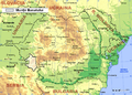
 Mureș basin.png 600 × 300; 301 KB
-
 Nordwestbulgarien.png 1,342 × 835; 2.01 MB
-
 Relief map of Serbia.png 2,087 × 2,957; 11.58 MB
-
 Reliefkarte Serbien.png 3,741 × 5,333; 29.08 MB
-
 Serbia mountain ranges.png 429 × 620; 75 KB
-
 Serbia Physiography.jpg 1,990 × 2,604; 2.05 MB
-
 Serbia relief light.png 429 × 620; 89 KB
-
 Serbia relief map.png 735 × 997; 524 KB
-
 Serbien topo.png 1,200 × 1,100; 1.81 MB
-
 Someș basin.png 400 × 300; 239 KB
-
 Sv sava topography P.Cikovac.jpg 1,587 × 2,381; 834 KB
-
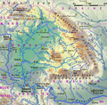 Tisza Karte.png 838 × 821; 1.2 MB
-
 Сербия.png 1,300 × 1,900; 2.26 MB


