Category:Maps of the Pyrenees
Appearance
| NO WIKIDATA ID FOUND! Search for Maps of the Pyrenees on Wikidata | |
| Upload media |
Maps of the Pyrenees, main mountain range of Southwestern Europe, in northern Spain and southern France.
Subcategories
This category has the following 7 subcategories, out of 7 total.
Media in category "Maps of the Pyrenees"
The following 86 files are in this category, out of 86 total.
-
218 AC - Iter Gnaei Scipionis in Hispania.png 3,200 × 1,900; 6.04 MB
-
Adour basin.png 395 × 401; 326 KB
-
Aquitani tribes map-pt.svg 878 × 750; 1.26 MB
-
Aure.jpg 1,212 × 1,653; 714 KB
-
Autoroutes zone pyrénéenne 2.png 1,509 × 744; 572 KB
-
Autoroutes zone pyrénéenne.png 1,062 × 386; 252 KB
-
Carte de la route des cols.jpg 547 × 345; 113 KB
-
Carte des boucles à la journée pour la route des cols.jpg 542 × 343; 132 KB
-
Carte des Parcs Naturels Régionaux des Pyrénées.png 836 × 616; 41 KB
-
Carte des sites Natura 2000 des Pyrénées.png 836 × 616; 58 KB
-
Carte des Sites Paysagers Classés des Pyrénées.png 836 × 616; 43 KB
-
Carte des Sites Paysagers Inscrits des Pyrénées.png 836 × 616; 43 KB
-
Carte des ZNIEFF de type 1 des Pyrénées.png 836 × 616; 57 KB
-
Carte des ZNIEFF de type 2 des Pyrénées.png 836 × 616; 58 KB
-
Carte générale des Espaces protégés dans les Pyrénées Françaises.jpg 835 × 616; 129 KB
-
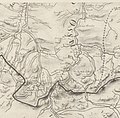
Carte Junker.jpg 2,846 × 2,808; 1.01 MB
-
Carte Parc National des Pyrénées.png 836 × 616; 42 KB
-
Carte Réserves Naturelles des Pyrénées.png 836 × 616; 40 KB
-
Carte Tomme des Pyrénées.jpg 2,000 × 1,512; 616 KB
-
Carte train Artouste.svg 1,017 × 719; 7.21 MB
-
Carte-des-Pays-du-Massif-des-Pyrénées.jpg 800 × 400; 110 KB
-
Cartelagelasaux.jpg 729 × 826; 547 KB
-
Circo Colomers.jpg 1,387 × 1,343; 322 KB
-
CTP amb Jaca.png 379 × 197; 25 KB
-
Des ours inégalement réparties .jpg 639 × 480; 91 KB
-
Distribució de l'os bru als Pirineus en el 2019 .jpg 2,048 × 911; 350 KB
-
Eastern Pyrenees 0.96990E 42.78225N.jpg 1,280 × 958; 304 KB
-
Europe Pyrenees locator map.png 454 × 422; 12 KB
-
FMIB 43930 Storm in the Pyrenees (After Lartigue).jpeg 749 × 835; 120 KB
-
FMIB 43931 Storm in the Pyrenees (after Lartigue).jpeg 753 × 822; 104 KB
-
French Pyrenees mountain range map.svg 810 × 280; 2.01 MB
-
Garona1.jpg 1,496 × 2,168; 1.47 MB
-
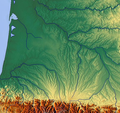
Garonne Adour 2.png 586 × 554; 676 KB
-
GERBER2.jpg 1,474 × 1,242; 415 KB
-
Grenzverlauf F-E.png 3,540 × 2,266; 10.08 MB
-
Iruñeko faila.png 1,244 × 1,288; 3.96 MB
-
Lagos de Espot.jpg 1,159 × 1,023; 132 KB
-
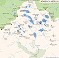
LAGOSCABDELLA.jpg 1,355 × 1,342; 339 KB
-
Le Mont-Perdu sur la Carte de Roussel (1730).jpg 1,058 × 1,058; 1.19 MB
-
Pyrenees map shaded relief-fr.svg 3,200 × 1,900; 5.58 MB
-
Pyrenees relief map with rivers-fr.svg 3,200 × 1,900; 2.41 MB
-
Pyrenees topo map-blank.jpg 4,787 × 2,842; 4.82 MB
-
Pyrenees topographic map-ca.svg 3,200 × 1,900; 6.27 MB
-
Pyrenees topographic map-en.svg 3,200 × 1,900; 6.3 MB
-
Pyrenees topographic map-eo.svg 3,200 × 1,900; 6.01 MB
-
Pyrenees topographic map-es.svg 3,200 × 1,900; 6.15 MB
-
Pyrenees topographic map-it.svg 3,200 × 1,900; 6.3 MB
-
Pyrenees topographic map-pl.svg 3,200 × 1,900; 6.31 MB
-
Pyrenees topographic map-ru.svg 3,200 × 1,900; 6.3 MB
-
Map - A book of the Pyrenees.jpg 2,944 × 1,856; 936 KB
-
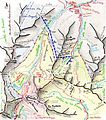
Mapa del Pico de Posets.png 500 × 500; 234 KB
-
Mapa del tunel Benasque-Luchon.svg 512 × 300; 11.05 MB
-
Mapa Transpirenaica.png 1,833 × 884; 1.77 MB
-
Massif pyreneen.png 836 × 616; 58 KB
-
Particularités territoriales.png 1,497 × 549; 360 KB
-
Pirinioak.jpg 867 × 414; 174 KB
-
Piémont pyrénéen.png 710 × 357; 624 KB
-
Points de passage de la frontière 2.png 1,502 × 670; 463 KB
-
Points de passage de la frontière.png 1,503 × 679; 466 KB
-
Positiekaart Corbières.png 4,505 × 1,953; 13.89 MB
-
PUIGMAL NURIA.jpg 1,116 × 1,037; 317 KB
-
Pyrenees composite NASA.jpg 669 × 229; 44 KB
-
Pyrenees map shaded relief-sp.svg 3,200 × 1,900; 5.58 MB
-
Pyrenees Relief France Large South-West highlighted.png 1,266 × 786; 2.1 MB
-
Pyrenees topographic map-eu.svg 3,200 × 1,900; 6.26 MB
-
Pyrenees topographic map-mk.svg 3,200 × 1,900; 7.54 MB
-
Pyrenees topographic map.png 1,264 × 796; 2.08 MB
-
Pyrenees w.jpg 1,280 × 958; 540 KB
-
Pyrenees-Atlantiques topographic map-eu.png 2,350 × 1,600; 3.34 MB
-
Pyrenees-Atlantiques topographic map-fr.jpg 2,350 × 1,600; 1.23 MB
-
Pyrenees-Atlantiques topographic map-fr.svg 2,350 × 1,600; 2.61 MB
-
Pyrenees-Atlantiques-fr-cropped.png 1,738 × 782; 2.26 MB
-
Rnc cerdanya urgell cadi.jpg 931 × 675; 131 KB
-
RNC Freser Setcases PN capçaleres del Ter.pdf 1,754 × 1,239; 4.76 MB
-
Robinson Crusoe's route across the Pyrenees mountains.jpg 1,000 × 602; 230 KB
-
Serra del Cadi.png 4,505 × 1,953; 13.89 MB
-
Valle de Peguera.jpg 1,315 × 1,055; 219 KB
-
VALLE NURIA.jpg 1,116 × 1,037; 327 KB
-
VALLEDETOR.jpg 1,604 × 1,230; 444 KB
-
Vasconia wide 740 3 - 80-ar.jpg 549 × 478; 249 KB
-
Vasconia wide 740 3 - 80.jpg 549 × 478; 101 KB
-
Zaragoza 2008-Pyrenees topographic map-es.jpg 3,264 × 2,448; 2.02 MB
-
Étage de végétation au pays basque nord.jpg 3,507 × 2,480; 1.33 MB


