Category:Topographic maps of Bulgaria
Jump to navigation
Jump to search
Countries of Europe: Albania · Andorra · Armenia‡ · Austria · Azerbaijan‡ · Belarus · Belgium · Bosnia and Herzegovina · Bulgaria · Croatia · Cyprus‡ · Czech Republic · Denmark · Estonia · Finland · France‡ · Georgia‡ · Germany · Greece · Hungary · Iceland · Republic of Ireland · Italy · Kazakhstan‡ · Latvia · Liechtenstein · Lithuania · Luxembourg · Malta · Moldova · Monaco · Montenegro · Netherlands‡ · North Macedonia · Norway · Poland · Portugal‡ · Romania · Russia‡ · San Marino · Serbia · Slovakia · Slovenia · Spain‡ · Sweden · Switzerland · Turkey‡ · Ukraine · United Kingdom
Specific status: Faroe Islands · Isle of Man · Svalbard – Limited recognition: Kosovo
‡: partly located in Europe
Specific status: Faroe Islands · Isle of Man · Svalbard – Limited recognition: Kosovo
‡: partly located in Europe
Subcategories
This category has only the following subcategory.
S
Media in category "Topographic maps of Bulgaria"
The following 99 files are in this category, out of 99 total.
-
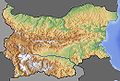
 Balkan Witoscha Rila Pirin.png 1,351 × 835; 2.37 MB
-
 Baltschik BG City Vorschlag.jpg 600 × 600; 180 KB
-
 Belasiza Balkan topo de.jpg 600 × 500; 96 KB
-
 BG topo600x600 10.jpg 520 × 350; 117 KB
-
 BG topo600x600 11.jpg 520 × 350; 117 KB
-
 BG topo600x600 12.jpg 520 × 350; 117 KB
-
 BG topo600x600 13.jpg 520 × 350; 117 KB
-
 BG topo600x600 16.png 520 × 520; 297 KB
-
 BG topo600x600 17.png 520 × 520; 271 KB
-
 BG topo600x600 18.png 520 × 520; 271 KB
-
 BG topo600x600 19.png 520 × 520; 297 KB
-
 BG topo600x600 3.jpg 520 × 350; 128 KB
-
 BG topo600x600 4.jpg 520 × 350; 130 KB
-
 BG topo600x600 5.jpg 520 × 350; 116 KB
-
 BG topo600x600 8.jpg 520 × 350; 114 KB
-
 BG topo600x600 9.jpg 520 × 350; 117 KB
-
 BG topo600x600.jpg 600 × 600; 179 KB
-
 BG topoHE.png 520 × 427; 269 KB
-
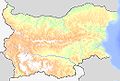
 Bgmap topo.jpg 1,179 × 792; 339 KB
-
 Bucht von Burgas.png 1,348 × 788; 1.3 MB
-
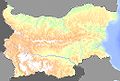
 Topographic Map of Bulgaria Bulgarian.png 2,200 × 1,500; 5.3 MB
-
 Topographic Map of Bulgaria Polish.png 2,200 × 1,500; 5.31 MB
-
 Bulgaria topographic map - portuguese.png 1,286 × 790; 2.25 MB
-
 Bulgarien BG.png 711 × 477; 690 KB
-
 Bulgarien DE.png 700 × 470; 762 KB
-
 Bulgarien Dewnja Vorschlag.png 550 × 400; 268 KB
-
 Bulgarien EN.png 700 × 470; 698 KB
-
 Czepyn.png 800 × 545; 796 KB
-
 Czepyn2.png 444 × 405; 395 KB
-
 Dobrudscha Balkan topo de.jpg 600 × 550; 292 KB
-
 Dobrudscha2 Balkan topo de.jpg 620 × 620; 109 KB
-
 Dzumaja - 41-42.jpg 3,748 × 4,998; 3.14 MB
-
 Karanowo BG topo600x600 16.jpg 520 × 520; 170 KB
-
 Mapa Bułgarii Stara Płanina.png 660 × 449; 599 KB
-
 Mapa Bułgarii.png 800 × 545; 793 KB
-
 MapsForFreeStrandzha1.png 1,545 × 932; 2.12 MB
-
 MapsForFreeStrandzha2.png 1,061 × 846; 1.08 MB
-
 Museum of New History of Varna 46.jpg 3,264 × 2,448; 3.21 MB
-
 Nordwestbulgarien.png 1,342 × 835; 2.01 MB
-
 Ostbalkan all.png 1,343 × 753; 1.75 MB
-
 Ostbalkan.png 1,351 × 787; 1.43 MB
-
 OstRhodopen.png 1,350 × 837; 2.51 MB
-
 Ostrila.png 1,346 × 806; 1.84 MB
-
 Pirin Balkan topo de.jpg 600 × 450; 254 KB
-
 Pirin.png 1,360 × 846; 2.14 MB
-
 Relief des Kampfgebietes.jpg 806 × 560; 125 KB
-
 Rhodopen 01.png 1,358 × 838; 1.72 MB
-
 Rhodopen 02.png 1,359 × 838; 2.23 MB
-
 Rhodopen 03.png 1,355 × 842; 2.16 MB
-
 Rhodopen 06.png 1,348 × 812; 2.03 MB
-
 Rhodopen 07.png 1,349 × 817; 2.06 MB
-
 Rhodopen 09.png 1,358 × 816; 1.97 MB
-
 Rhodopen 10.png 1,354 × 814; 1.92 MB
-
 Rhodopen 11.png 1,351 × 817; 1.87 MB
-
 Rhodopen 12.png 1,356 × 792; 1.6 MB
-
 Rhodopen 14.png 1,350 × 796; 1.8 MB
-
 Rhodopen 15.png 1,346 × 790; 1.93 MB
-
 Rhodopen 16.png 1,351 × 791; 1.98 MB
-
 Rhodopen 17.png 1,358 × 793; 1.89 MB
-
 Rhodopen 18.png 1,359 × 792; 1.96 MB
-
 Rhodopen all.png 1,350 × 841; 2.04 MB
-
 Rhodopen Balkan topo de.jpg 676 × 542; 135 KB
-
 Rhodopen Rila Pirin.png 1,343 × 838; 2.29 MB
-
 Rila Balkan topo de.jpg 600 × 450; 254 KB
-
 Rila Pirin Kessel.png 1,350 × 838; 2.06 MB
-
 Rila.png 1,349 × 838; 1.99 MB
-
 Rosental Balkan topo de.jpg 590 × 450; 78 KB
-
 Rosental Bulgarien beschriftet.png 1,361 × 794; 1.66 MB
-
 Rosental Bulgarien.png 1,361 × 794; 1.67 MB
-
 Rosental West beschriftet.png 1,359 × 846; 1.92 MB
-
 Sakar Balkan topo de.jpg 590 × 450; 82 KB
-
 Sofia Valley 1.png 1,464 × 786; 1.89 MB
-
 Sofia Valley 2.png 1,467 × 795; 2.75 MB
-
 Sofia Valley 3.png 1,195 × 732; 1.82 MB
-
 Sofia Valley 4.png 1,573 × 926; 3.07 MB
-
 Sofia Valley 5.png 1,587 × 967; 2.36 MB
-
 Sofia Valley 6.png 1,589 × 972; 3.09 MB
-
 Sofia Valley 7.png 1,561 × 866; 2.03 MB
-
 Sofiaebene-2.png 1,500 × 1,039; 2.19 MB
-
 Sofiaebene.png 1,500 × 1,039; 2.15 MB
-
 Sredna Gora all.png 1,354 × 794; 1.9 MB
-
 Sredna gora Balkan topo de.jpg 545 × 385; 206 KB
-
 Sredna Gora.png 1,344 × 789; 1.48 MB
-
 Strandscha all.png 1,356 × 789; 1.44 MB
-
 Strandscha Balkan topo de.jpg 600 × 400; 220 KB
-
 Strandscha.png 1,350 × 790; 1.68 MB
-
 Südpirin.png 1,355 × 839; 2.11 MB
-
 SüdRhodopen.png 1,358 × 840; 1.81 MB
-
 Südrila.png 1,356 × 841; 2.05 MB
-
 Topographic Map of Bulgaria Blank.png 2,200 × 1,500; 3.73 MB
-
 Topographic Map of Bulgaria Bulgaria Blank Without Dots.png 2,200 × 1,500; 4.1 MB
-
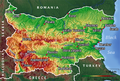
 Topographic Map of Bulgaria English.png 2,200 × 1,500; 4.22 MB
-
 Topographic Map of Bulgaria Francais.jpg 2,200 × 1,500; 778 KB
-
 Topographic Map of Bulgaria German.png 2,200 × 1,500; 4.2 MB
-
 Topographic Map Of Chech.png 1,952 × 1,373; 3.92 MB
-
 Topographic map Stara Zagora 1941.jpg 3,264 × 2,448; 2.8 MB
-
 Zadbalkanski kotlovini.png 1,833 × 735; 2.79 MB
-
 Zentralbulgarien.png 1,349 × 833; 2.14 MB
-
 България333.png 400 × 316; 275 KB


