Category:Topographic maps of Latvia
Jump to navigation
Jump to search
Subcategories
This category has the following 3 subcategories, out of 3 total.
Media in category "Topographic maps of Latvia"
The following 15 files are in this category, out of 15 total.
-
 Baltikum domborzata.png 1,227 × 869; 1.67 MB
-
 Baltikum würm morénavonulatok.png 1,227 × 868; 1.69 MB
-
 Baltikum.png 1,228 × 1,737; 748 KB
-
 Baltikumrelief.png 3,536 × 2,504; 12 MB
-
 Backsteingotik in Estland und Lettland.png 600 × 632; 551 KB
-
 Carte Collines d'Alūksne.png 1,300 × 817; 1.31 MB
-
 Carte Collines de Vidzeme.png 949 × 597; 801 KB
-
 Collines Latgale.png 1,115 × 702; 1.03 MB
-
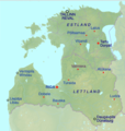
 Latvija fizGeogr.jpg 812 × 472; 58 KB
-
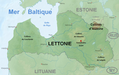
 Lettland physisch relief location map.png 1,305 × 822; 997 KB
-
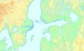 Mittlere Ostsee b3.png 1,194 × 723; 382 KB
-
 Relief Map of Latvia.jpg 1,200 × 756; 309 KB
-
 Scand+Baltic Gothic brick labelled.png 3,028 × 2,309; 8.24 MB
-
 Scand+Baltic+Gothic brick.png 3,028 × 2,310; 8.22 MB
-
 Topographic map of Scandinavia de.png 375 × 548; 240 KB


