Category:Topographic maps of Austria
Jump to navigation
Jump to search
Subcategories
This category has the following 3 subcategories, out of 3 total.
Media in category "Topographic maps of Austria"
The following 85 files are in this category, out of 85 total.
-
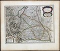 1918 Alemannia sive Svevia Svperior.tif 7,244 × 6,152, 2 pages; 127.57 MB
-
 After Action Report - Krems - NARA - 100384933.jpg 10,800 × 7,750; 9.88 MB
-
 After Action Report - Leoben - NARA - 100384935.jpg 10,800 × 7,774; 10.77 MB
-
 After Action Report - Linz - NARA - 100384937.jpg 10,800 × 7,857; 10.64 MB
-
 After Action Report - Wels - NARA - 100384941.jpg 10,800 × 7,797; 10.31 MB
-

-
 Asendi kaart Austria.png 497 × 250; 114 KB
-
 Austria Burgenland relief location map.jpg 975 × 1,546; 478 KB
-
 Austria extreme points.png 820 × 450; 47 KB
-
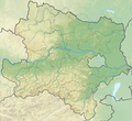 Austria Lower Austria topographic location map.png 1,772 × 1,622; 3.86 MB
-
 Austria Physiography.jpg 2,875 × 1,989; 2.72 MB
-
 Austria relief location map.jpg 1,256 × 700; 677 KB
-
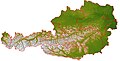
 Austria relief map.jpg 1,256 × 700; 298 KB
-
 Austria topographic map.png 2,000 × 1,053; 641 KB
-
 Austria Upper Austria relief location map.png 2,513 × 2,223; 6.3 MB
-
 Austria Vienna relief location map.jpg 1,669 × 1,312; 411 KB
-
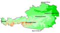
 Austria Vorarlberg relief location map.jpg 965 × 1,338; 468 KB
-
 Austriarelief.jpg 2,500 × 1,281; 354 KB
-
 Austriawithoutcollar.jpg 2,130 × 1,100; 368 KB
-
 Berchtesgadener Alpen.png 3,493 × 3,413; 2.52 MB
-
 Bregenzerwaldgebirge.png 3,366 × 3,238; 2.77 MB
-
 Bregenzerwaldgerbirge topografisch mit Untergruppen.png 1,238 × 1,061; 2.37 MB
-
 Reliefkarte Burgenland.png 3,282 × 4,184; 12.13 MB
-
 Franzisco-Josephinische Landesaufnahme - Berchtesgadener Alpen.jpg 6,757 × 7,777; 23.74 MB
-
 Franziszeische Landesaufnahme - Berchtesgadener Alpen.jpg 13,981 × 17,321; 63.97 MB
-
 Karte Allgäuer Alpen.png 3,488 × 2,013; 2.61 MB
-
 Karte Ammergauer Alpen.png 3,721 × 3,458; 2.54 MB
-
 Karte Ankogelgruppe.png 4,202 × 4,601; 3.48 MB
-
 Karte Bayerische Voralpen2.png 5,632 × 3,096; 3.8 MB
-
 Karte Brandenberger Alpen.png 5,298 × 3,366; 2.89 MB
-
 Karte Dachsteingebirge.png 3,744 × 2,075; 1.64 MB
-
 Karte der Berchtesgadener Alpen Blatt III.jpg 5,287 × 7,392; 15.57 MB
-
 Karte der Gebirgsgruppen in den Alpen.png 9,930 × 5,848; 9.32 MB
-
 Karte des Sonnblick und Umgebung.jpg 8,468 × 7,899; 23.74 MB
-
 Karte Erlspitzgruppe.JPG 3,872 × 2,592; 4.86 MB
-
 Karte Gleiersch.jpg 2,320 × 2,420; 4.09 MB
-
 Karte Glocknergruppe.png 3,311 × 3,011; 1.99 MB
-
 Karte Goldberggruppe.png 4,271 × 5,164; 3.09 MB
-
 Karte Kaisergebirge.png 2,649 × 1,862; 1.22 MB
-
 Karte Kitzbüheler Alpen.png 3,937 × 2,344; 2.34 MB
-
 Karte Kreuzeckgruppe.png 4,348 × 2,426; 1.85 MB
-
 Karte Lechquellengebirge.png 4,167 × 3,372; 2.83 MB
-
 Karte Lechtaler Alpen.png 3,407 × 2,481; 2.59 MB
-
 Karte Loferer und Leoganger Steinberge.png 2,481 × 1,537; 1.11 MB
-
 Karte Rieserfernergruppe.png 3,049 × 2,804; 1.58 MB
-
 Karte Salzburger Schieferalpen.png 3,813 × 1,717; 1.6 MB
-
 Karte Schobergruppe.png 2,983 × 2,675; 1.68 MB
-
 Karte Sesvennagruppe.png 4,644 × 3,800; 2.97 MB
-
 Karte Stubaier Alpen.png 3,354 × 3,366; 3.21 MB
-
 Karte Tennengebirge.png 2,259 × 1,685; 1.04 MB
-
 Karte Venedigergruppe.png 5,130 × 3,976; 3.49 MB
-
 Karte Villgratner Berge.png 5,325 × 2,546; 2.51 MB
-
 Karte vom Kaisergebirge.jpg 6,570 × 4,993; 9.48 MB
-
 Karte Zillertaler Alpen.png 4,014 × 3,603; 3.51 MB
-
 Karwendel map.png 5,425 × 4,541; 3.94 MB
-
 Reliefkarte Kärnten.png 6,087 × 3,409; 17.66 MB
-
 Lagekarte Chiemgauer Alpen.png 7,550 × 4,408; 5.64 MB
-
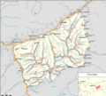
 Lagekarte Granatspitzgruppe.png 2,854 × 4,735; 2.24 MB
-
 Landvogdey in Schwaben.tif 3,434 × 2,344, 2 pages; 23.08 MB
-
 Mieminger Kette map2.png 3,731 × 2,062; 1.34 MB
-
 Reliefkarte Niederösterreich.png 7,287 × 5,975; 37.84 MB
-
 Reliefkarte Oberösterreich.png 6,114 × 5,400; 30.27 MB
-
 Oesterreich topo GranitGneis markerstyle.png 800 × 564; 1.04 MB
-
 Oesterreich topo.png 800 × 564; 1.04 MB
-
 Reliefkarte Slowenien Kärnten.jpg 1,920 × 1,470; 1.46 MB
-
 Reliefkarte Österreich.png 3,464 × 1,928; 9.42 MB
-
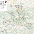 Reliefkarte Salzburg.png 5,080 × 5,069; 20.76 MB
-
 Samnaungruppe.png 4,144 × 3,936; 2.22 MB
-
 Schmittsche Karte von Südwestdeutschland - Berchtesgadener Alpen.jpg 7,059 × 7,170; 14.21 MB
-
 Silvretta map.png 1,925 × 1,378; 851 KB
-
 Slovakia topo.jpg 1,400 × 962; 582 KB
-
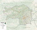 Reliefkarte Steiermark.png 7,265 × 5,863; 36.85 MB
-
 Reliefkarte Tirol.png 7,359 × 5,229; 30.17 MB
-
 Tuxer Alpen Karte.png 4,847 × 4,398; 3.51 MB
-
 Verwall Karte.png 2,863 × 1,387; 1.13 MB
-
 Verwall-Lage.png 683 × 485; 816 KB
-
 Vienna Basin physical.png 926 × 1,066; 1.81 MB
-
 Reliefkarte Vorarlberg.png 1,989 × 2,374; 4.53 MB
-
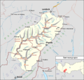
 Wachau.png 715 × 677; 875 KB
-
 Wettersteingebirge map.png 3,731 × 1,630; 1.07 MB
-
 Wettersteingebirge und Mieminger Kette.png 3,731 × 3,009; 1.98 MB
-
 Reliefkarte Wien.png 4,053 × 2,797; 7.74 MB
-
 ÖK50 - Kartographisches Model Ausschnitt aus UTM33 N5250000 E600000 - 1630-0.png 2,868 × 1,658; 7.41 MB
-
 Österreich Übersichtskarte.png 1,766 × 939; 3.5 MB
-
 Ötztaler Alpen Map.png 4,710 × 4,941; 5.42 MB


