Category:Topographic maps of Estonia
Jump to navigation
Jump to search
Countries of Europe: Albania · Andorra · Armenia‡ · Austria · Azerbaijan‡ · Belarus · Belgium · Bosnia and Herzegovina · Bulgaria · Croatia · Cyprus‡ · Czech Republic · Denmark · Estonia · Finland · France‡ · Georgia‡ · Germany · Greece · Hungary · Iceland · Republic of Ireland · Italy · Kazakhstan‡ · Latvia · Liechtenstein · Lithuania · Luxembourg · Malta · Moldova · Monaco · Montenegro · Netherlands‡ · North Macedonia · Norway · Poland · Portugal‡ · Romania · Russia‡ · San Marino · Serbia · Slovakia · Slovenia · Spain‡ · Sweden · Switzerland · Turkey‡ · Ukraine · United Kingdom
Specific status: Faroe Islands · Isle of Man · Svalbard – Limited recognition: Kosovo
‡: partly located in Europe
Specific status: Faroe Islands · Isle of Man · Svalbard – Limited recognition: Kosovo
‡: partly located in Europe
Eesti: Eesti reljeefikaardid
Subcategories
This category has the following 2 subcategories, out of 2 total.
E
- Relief maps of Estonia (4 F)
S
- SVG topographic maps of Estonia (empty)
Media in category "Topographic maps of Estonia"
The following 12 files are in this category, out of 12 total.
-
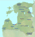
 Baltikum.png 1,228 × 1,737; 748 KB
-
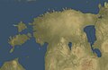
 Baltikumrelief.png 3,536 × 2,504; 12 MB
-
 Backsteingotik in Estland und Lettland.png 600 × 632; 551 KB
-
 Carte Collines de Pandivere.png 920 × 768; 843 KB
-
 Collines de Haanja.png 919 × 767; 838 KB
-
 Estonia relief map (2005-2017).png 833 × 696; 543 KB
-
 Estonian relief map.jpg 961 × 624; 291 KB
-
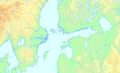 Mittlere Ostsee b3.png 1,194 × 723; 382 KB
-
 Relief map of Estonia.png 800 × 562; 78 KB
-
 Scand+Baltic Gothic brick labelled.png 3,028 × 2,309; 8.24 MB
-
 Scand+Baltic+Gothic brick.png 3,028 × 2,310; 8.22 MB
-
 Topographic map of Scandinavia de.png 375 × 548; 240 KB


.png)


