Category:Maps of rivers in Utah
Jump to navigation
Jump to search
States of the United States: Alabama · Alaska · Arizona · Arkansas · California · Colorado · Connecticut · Delaware · Florida · Georgia · Idaho · Illinois · Indiana · Iowa · Kansas · Kentucky · Louisiana · Maine · Maryland · Massachusetts · Michigan · Minnesota · Mississippi · Missouri · Montana · Nebraska · Nevada · New Hampshire · New Jersey · New Mexico · New York · North Carolina · North Dakota · Ohio · Oklahoma · Oregon · Pennsylvania · Rhode Island · South Carolina · South Dakota · Tennessee · Texas · Utah · Vermont · Virginia · Washington · West Virginia · Wisconsin · Wyoming – Washington, D.C.
Subcategories
This category has the following 3 subcategories, out of 3 total.
Media in category "Maps of rivers in Utah"
The following 18 files are in this category, out of 18 total.
-
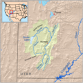
 Bearrivermap.png 500 × 500; 95 KB
-
 Coloradorivermap (Utah detail).jpg 799 × 652; 402 KB
-
 Coloradorivermapnew1.jpg 871 × 1,130; 701 KB
-
 Duchesne river basin map.png 1,206 × 1,046; 2.08 MB
-
 Duchesnerivermap.png 720 × 586; 300 KB
-
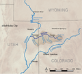
 Great salt lake drainage map.jpg 1,060 × 1,227; 1.13 MB
-
 Greenutrivermap.png 500 × 500; 409 KB
-

-
 Lost Creek Reservoir Watershed.jpg 449 × 636; 96 KB
-
 Owyheerivermap.jpg 937 × 1,109; 1.04 MB
-
 Sanjuanrivermap-new.png 2,030 × 1,749; 3.91 MB
-
 Sanjuanrivermap.jpg 617 × 429; 247 KB
-
 Sevierrivermap.png 500 × 500; 405 KB
-
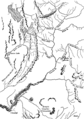 Timpanogos Valley BHoU-p13.png 2,870 × 4,082; 225 KB
-
 Weber River.png 1,231 × 872; 1.29 MB
-
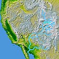
 White River (Colorado and Utah) basin map.png 1,200 × 867; 1.88 MB
-
 Whiteriverutmap.png 1,142 × 1,035; 541 KB
-
 Wpdms nasa topo white river utah.jpg 300 × 300; 60 KB

.jpg)


_(14779344931).jpg)


_basin_map.png)

