Category:Maps of rivers in Louisiana
Jump to navigation
Jump to search
States of the United States: Alabama · Alaska · Arizona · Arkansas · California · Colorado · Connecticut · Delaware · Florida · Georgia · Idaho · Illinois · Indiana · Iowa · Kansas · Kentucky · Louisiana · Maine · Maryland · Massachusetts · Michigan · Minnesota · Mississippi · Missouri · Montana · Nebraska · Nevada · New Hampshire · New Jersey · New Mexico · New York · North Carolina · North Dakota · Ohio · Oklahoma · Oregon · Pennsylvania · Rhode Island · South Carolina · South Dakota · Tennessee · Texas · Utah · Vermont · Virginia · Washington · West Virginia · Wisconsin · Wyoming – Washington, D.C.
Media in category "Maps of rivers in Louisiana"
The following 18 files are in this category, out of 18 total.
-
 1796 blackriverOuachita.jpg 3,120 × 4,160; 2.22 MB
-
 Amiterivermap.png 500 × 500; 176 KB
-
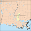
 Atchafalaya Basin Floodway.jpg 800 × 1,200; 111 KB
-
 Boeufrivermap.png 465 × 500; 223 KB
-
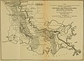 Bulletin of the U.S. Department of Agriculture (1913-1923.) (20474517256).jpg 3,474 × 2,550; 1.47 MB
-
 Calcasieurivermap.png 500 × 500; 172 KB
-
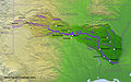
 Geomorphology of Old River.jpg 959 × 847; 153 KB
-
 Littlemorivermap.png 465 × 500; 217 KB
-
 Map of Ouachita River in Louisiana.jpg 2,727 × 3,636; 1.27 MB
-
 Mermentaurivermap.png 500 × 500; 179 KB
-
 MississippiRiverFisk(1952)10a.jpg 2,506 × 3,804; 920 KB
-
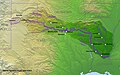
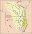
 Ouachita watershed.png 288 × 336; 80 KB
-
 Pearlmsrivermap.png 500 × 500; 152 KB
-
 Red watershed.png 250 × 188; 23 KB
-
 Redrivermap.jpg 856 × 532; 262 KB
-
 Redrivermap1.jpg 837 × 524; 255 KB
-
 Tensasrivermap.png 465 × 500; 221 KB
-
 Vermilionlarivermap.png 400 × 400; 128 KB


_(20474517256).jpg)


10a.jpg)


