Category:Maps of rivers in Iowa
Jump to navigation
Jump to search
States of the United States: Alabama · Alaska · Arizona · Arkansas · California · Colorado · Connecticut · Delaware · Florida · Georgia · Idaho · Illinois · Indiana · Iowa · Kansas · Kentucky · Louisiana · Maine · Maryland · Massachusetts · Michigan · Minnesota · Mississippi · Missouri · Montana · Nebraska · Nevada · New Hampshire · New Jersey · New Mexico · New York · North Carolina · North Dakota · Ohio · Oklahoma · Oregon · Pennsylvania · Rhode Island · South Carolina · South Dakota · Tennessee · Texas · Utah · Vermont · Virginia · Washington · West Virginia · Wisconsin · Wyoming – Washington, D.C.
- English: Maps of the Rivers in Iowa.
Media in category "Maps of rivers in Iowa"
The following 16 files are in this category, out of 16 total.
-
 Blueearthrivermap.png 500 × 500; 101 KB
-
 Booneriveriowamap.png 500 × 500; 109 KB
-
 Competine Creek Iowa.gif 600 × 450; 267 KB
-
 Desmoinesrivermap.png 500 × 500; 116 KB
-
-
-
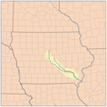
 Iowarivermap.png 500 × 500; 132 KB
-
 Maquoketarivermap.png 500 × 500; 125 KB
-
 Middle ia rivermap.png 500 × 500; 111 KB
-
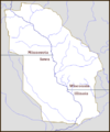
 Raccoonriveriowamap.png 500 × 500; 110 KB
-
 Skunkrivermap.png 500 × 500; 126 KB
-
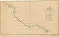
 Turkey river wp.svg 1,019 × 700; 380 KB
-
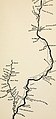
 Turkey river more detailed.svg 760 × 552; 953 KB
-
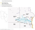
 Upper Mississippi River Valley AVA.png 415 × 500; 100 KB
-
 Wapsirivermap.png 500 × 500; 126 KB
-
 YellowRiver EasternIowa Map.jpg 650 × 565; 48 KB


_(14764167334).jpg)


