Category:Maps of rivers in Georgia (U.S. state)
Jump to navigation
Jump to search
States of the United States: Alabama · Alaska · Arizona · Arkansas · California · Colorado · Connecticut · Delaware · Florida · Georgia · Idaho · Illinois · Indiana · Iowa · Kansas · Kentucky · Louisiana · Maine · Maryland · Massachusetts · Michigan · Minnesota · Mississippi · Missouri · Montana · Nebraska · Nevada · New Hampshire · New Jersey · New Mexico · New York · North Carolina · North Dakota · Ohio · Oklahoma · Oregon · Pennsylvania · Rhode Island · South Carolina · South Dakota · Tennessee · Texas · Utah · Vermont · Virginia · Washington · West Virginia · Wisconsin · Wyoming – Washington, D.C.
Media in category "Maps of rivers in Georgia (U.S. state)"
The following 24 files are in this category, out of 24 total.
-
 Georgia river basins.png 689 × 709; 23 KB
-

-
 A plan of the inlets & rivers of Savannah & Warsaw in the Province of Georgia. LOC 73691821.jpg 9,591 × 10,414; 11.22 MB
-
 Alapaharivermap.png 500 × 500; 165 KB
-
 Altamaha watershed.png 300 × 337; 110 KB
-
 Aucillarivermap.png 500 × 500; 148 KB
-
 Chattahoochee watershed.png 300 × 273; 100 KB
-
 Coosaheadwatersmap.png 467 × 467; 250 KB
-
 FlintRiver watershed.png 300 × 270; 100 KB
-
 Hiwasseerivermap.png 500 × 500; 394 KB
-
 HUC 031300010101 - Headwaters Chattahoochee River.PNG 379 × 472; 417 KB
-
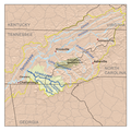
 HUC 031300010705 - Martin Creek-Chestatee River.tiff 736 × 560; 816 KB
-
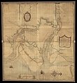
 John Barnwell Altamaha River Map.jpg 1,106 × 765; 531 KB
-
 Littletennesseerivermap.png 500 × 500; 403 KB
-
 Ochlockoneerivermap.png 500 × 500; 159 KB
-
 Ocmulgee watershed.png 300 × 334; 108 KB
-
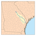
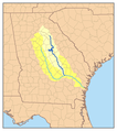 Oconee watershed.png 300 × 338; 111 KB
-
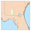
 Ogeecheerivermap.png 300 × 300; 81 KB
-
 Ohoopeerivermap.png 500 × 500; 165 KB
-
 Satillarivermap.png 250 × 250; 54 KB
-
 Savannahrivermap.png 1,938 × 1,935; 138 KB
-
 Stmarysflrivermap.png 500 × 500; 135 KB
-
 Suwanneerivermap.png 500 × 500; 162 KB
-
 Withlacoocheenorthrivermap.png 500 × 500; 167 KB


