Category:Maps of rivers in Missouri
Jump to navigation
Jump to search
States of the United States: Alabama · Alaska · Arizona · Arkansas · California · Colorado · Connecticut · Delaware · Florida · Georgia · Idaho · Illinois · Indiana · Iowa · Kansas · Kentucky · Louisiana · Maine · Maryland · Massachusetts · Michigan · Minnesota · Mississippi · Missouri · Montana · Nebraska · Nevada · New Hampshire · New Jersey · New Mexico · New York · North Carolina · North Dakota · Ohio · Oklahoma · Oregon · Pennsylvania · Rhode Island · South Carolina · South Dakota · Tennessee · Texas · Utah · Vermont · Virginia · Washington · West Virginia · Wisconsin · Wyoming – Washington, D.C.
Subcategories
This category has only the following subcategory.
Media in category "Maps of rivers in Missouri"
The following 24 files are in this category, out of 24 total.
-
Gasconaderivermap.png 500 × 500; 131 KB
-
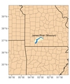
James River MO.png 672 × 806; 117 KB
-
Meramec Lake (cancelled).png 1,206 × 866; 296 KB
-
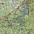
Meramec Lake exent topomap.jpg 640 × 638; 97 KB
-
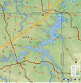
Meramec Lake v3.svg 513 × 525; 604 KB
-
Meramec Park Lake propose v4.svg 1,064 × 1,083; 2.68 MB
-
Mo rivers.jpg 800 × 800; 249 KB
-
Mo rivers.png 1,000 × 1,000; 640 KB
-
Mo-rivers.png 1,200 × 878; 869 KB
-
Navigable rivers near St Louis MO.svg 779 × 832; 116 KB
-
Neoshorivermap.png 500 × 500; 129 KB
-
Osagerivermap.png 750 × 750; 265 KB
-
Papers in Illinois history and transactions (1914) (14758568376).jpg 2,542 × 1,740; 552 KB
-
Papers in Illinois history and transactions (1914) (14781565945).jpg 2,396 × 1,774; 473 KB
-
St Louis Rivers.png 180 × 202; 6 KB
-
Stfrancisrivermap.png 500 × 749; 222 KB
-
STLRivers.PNG 269 × 341; 10 KB
-
White River AR.png 550 × 534; 22 KB

