Category:Maps of rivers of the Western United States
Jump to navigation
Jump to search
Subcategories
This category has the following 14 subcategories, out of 14 total.
A
C
- Maps of the Colorado River (37 F)
G
M
- Maps of rivers in Montana (23 F)
N
- Maps of rivers in New Mexico (16 F)
O
S
- Maps of the Snake River (10 F)
T
- Maps of rivers in Texas (43 F)
U
V
- Maps of the Virgin River (6 F)
Media in category "Maps of rivers of the Western United States"
The following 30 files are in this category, out of 30 total.
-
 Mt-rivers.gif 1,325 × 829; 269 KB
-
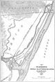 Alamo Canal 1908.png 896 × 1,344; 1.14 MB
-
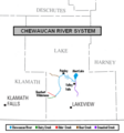 Chewaucan River map.PNG 572 × 613; 30 KB
-
 Clark Fork Map.png 900 × 727; 135 KB
-
 Hover Dam.png 1,000 × 1,004; 356 KB
-
 Columbia basin project.JPG 520 × 823; 92 KB
-
 Columbia drainage basin blank map.png 808 × 790; 712 KB
-
 Flathead River Map.png 813 × 628; 100 KB
-
 GooseneckMeandersUtahTopo1.jpg 3,757 × 2,876; 7.09 MB
-
 Gore Creek, Colorado.png 3,266 × 2,572; 58 KB
-
 Wpdms nasa topo green river utah.jpg 300 × 300; 60 KB
-
 Hover Dam 2.png 1,000 × 1,004; 369 KB
-
 Karte colorado river topografisch.jpg 300 × 300; 60 KB
-
 Kootenay River map with states and provinces.png 794 × 683; 89 KB
-
 Kootenay River map.png 794 × 683; 85 KB
-
 Okanogan River.png 626 × 683; 59 KB
-
 Pend Oreille River Map.png 899 × 727; 123 KB
-
 Pend Oreille-Clark Fork dams.jpg 689 × 605; 151 KB
-
 PSM V72 D480 Delta of the colorado river with salton and pattie basins.png 1,643 × 2,245; 392 KB
-
 Salmon River Idaho Map.png 879 × 695; 119 KB
-
 The story of Montana (1916) (14771716244).jpg 3,152 × 2,276; 878 KB
-
 Umpqua River basin area.jpg 300 × 200; 35 KB
-
 USA Region West landcover location map.jpg 933 × 1,045; 534 KB
-
 Wpdms nasa topo wind-bighorn river.jpg 300 × 250; 45 KB
-
 Wpdms nasa topo clarks fork of the yellowstone river.jpg 300 × 250; 45 KB
-
 Wpdms nasa topo gila river.jpg 300 × 300; 60 KB
-
 Wpdms nasa topo gunnison river.jpg 300 × 300; 60 KB
-
 Wpdms nasa topo little colorado river.jpg 300 × 300; 60 KB
-
 Wpdms nasa topo outline virgin river.jpg 300 × 260; 41 KB
-
 Wpdms nasa topo yellowstone river.jpg 300 × 250; 45 KB


_(14771716244).jpg)


