Category:Maps of rivers in Illinois
Jump to navigation
Jump to search
States of the United States: Alabama · Alaska · Arizona · Arkansas · California · Colorado · Connecticut · Delaware · Florida · Georgia · Idaho · Illinois · Indiana · Iowa · Kansas · Kentucky · Louisiana · Maine · Maryland · Massachusetts · Michigan · Minnesota · Mississippi · Missouri · Montana · Nebraska · Nevada · New Hampshire · New Jersey · New Mexico · New York · North Carolina · North Dakota · Ohio · Oklahoma · Oregon · Pennsylvania · Rhode Island · South Carolina · South Dakota · Tennessee · Texas · Utah · Vermont · Virginia · Washington · West Virginia · Wisconsin · Wyoming – Washington, D.C.
Media in category "Maps of rivers in Illinois"
The following 32 files are in this category, out of 32 total.
-
1674 Jaillot Map with Chucagua.png 327 × 351; 246 KB
-
27-Plat 1.jpg 896 × 917; 240 KB
-
A plan of the several villages in the illinois country (cropped).png 512 × 332; 31 KB
-
A plan of the several villages in the illinois country.png 1,196 × 1,996; 174 KB
-
Bulletin (1908) (20239508220).jpg 3,110 × 2,061; 1.19 MB
-
Bulletin (1961) (19806945943).jpg 1,666 × 2,966; 772 KB
-
Bulletin of the Illinois State Laboratory of Natural History (1908) (20457175795).jpg 3,433 × 2,347; 805 KB
-
ChicagoRiver.svg 1,023 × 1,421; 218 KB
-
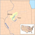
Des Plaines River.png 1,000 × 1,555; 692 KB
-
Embarrasrivermap.png 1,000 × 1,000; 563 KB
-
Fox River Map.png 518 × 828; 118 KB
-
HunterLakeMap.pdf 5,400 × 7,212; 15.37 MB
-
Kaskaskiarivermap.png 498 × 500; 164 KB
-
Littleegyptmap.PNG 227 × 342; 26 KB
-
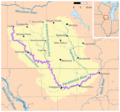
Littlewabashrivermap.png 1,000 × 1,000; 565 KB
-
Navigable rivers near St Louis MO.svg 779 × 832; 116 KB
-
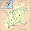
Ohiorivermap.png 467 × 469; 76 KB
-
Papers in Illinois history and transactions (1914) (14758568376).jpg 2,542 × 1,740; 552 KB
-
Papers in Illinois history and transactions (1914) (14781565945).jpg 2,396 × 1,774; 473 KB
-
Patokarivermap.png 1,000 × 1,000; 548 KB
-
Pecatonica River Map.png 999 × 934; 376 KB
-
Physical features of the Des Plaines Valley (1909) (14595635419).jpg 1,766 × 2,360; 392 KB
-
Rockilrivermap.png 500 × 500; 108 KB
-
Spoonrivermap.png 500 × 500; 125 KB
-
Sugar River Map.png 1,919 × 2,335; 675 KB
-
Upper Mississippi River Valley AVA.png 415 × 500; 100 KB
-
Vermilion (Wabash).jpg 1,109 × 909; 308 KB
-
Vermilion wabashrivermap.png 1,000 × 1,000; 554 KB
-
Wabash-River-Watershed.jpg 506 × 504; 32 KB
-
Wabashrivermap.png 1,000 × 1,000; 581 KB


